Today's commentary
Submitted by Vince (USA), Kurt (Greenland), Sylvia (Greenland), Christine(Denmark)
We went biking up to the Tacan radar station and hiked down to Salt Lake, there we collected some samples and 5 different plants for each group, after that some of them went to Mount Garnet and some of them went home. We had a quick meeting for quick presentations about what we got from the Salt Lake and Mount Garnet. Then a new guest was presented to us whose name is Kasper, he is going to observe what we are doing until Monday.
Group 1: Atmospheric They where around the lake taking some water, flowers and atmospheric samples. “The carbon dioxide levels fell into the middle of the range that we’ve tested so far. We have had some trouble measuring UV with the cloudy weather. We are also still working on our albedo data.”
Group 2: Environmental science They were at the Salt Lake “We biked to the top of the Tacan radar station, then hiked down into the valley where the Salt Lake is located. While there our group collected some musk ox fur. A musk ox was sighted while we were there, however none of our members of the group were fortunate enough to see it. We found out that the Salt Lake also is populated by musk ox. The main reason for population is probably because of the lake and the mossy vegetation. Yesterday we learned that the musk oxen like to eat the moss, most likely for the amount of water they contain.”
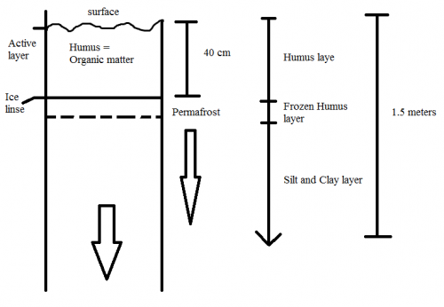
Group 3: Geological science They were near the Salt Lake, like the others. And some of us followed some musk ox towards Mount Garnet. “Near the Salt Lake we found a permafrost area, and we look at it, and look at the layers. And we also took a sample of it. We also took five different kinds of flowers to identify them. We took pictures of them also.”

Group 4: Health They were at the Salt Lake and in the Salt Lake. N: 66o59´33.6´´ W: 50o35´35.2´´ “We stood in the water (knee-high) and took our temperature. We lost our data, but the watches showed us that when your temperature is low you use a lot of energy. And when you are biking your temperature drops and then you use a lot of energy.”
Group 5: Sea Tomato They were at the shoreline of the Salt Lake “Gathered a water sample from the Salt Lake to compare to the water sample from Sea Tomato Lake. We’ve found out that the Salt Lake varies so much from all other fresh lakes in the area in terms of chemistry / geology. It could be hard to compare to the other lakes.”
Group 6: Chemistry They were at Salt Lake and the lake near by - Took some water & soil samples - Temperature - GPSA Global Positioning System (GPS) is a satellite-based navigation system used to track the location or position of objects on the Earth’s surface. coordinates “The life the pond few meters from Salt Lake was very different. There were hundreds of dafnies and other small animals which we are analyzing now.”
Agenda highlights
Bike to Salt Lake to collect samples
Hike to Garnet Ridge
Vocabulary
mamuq (Greenlandic) - tasty


Comments