100 Percent!

    Saturday we flew a mission called Southwest Coastal B. This mission was yet another baseline (priority) flight, which took us on several glacier runs on the west coast. It was another beautiful clear day, great for our instruments and for our moods. This was our 6th day flying consecutively, and for a season that was tough weather-wise, it was well-deserved treat.
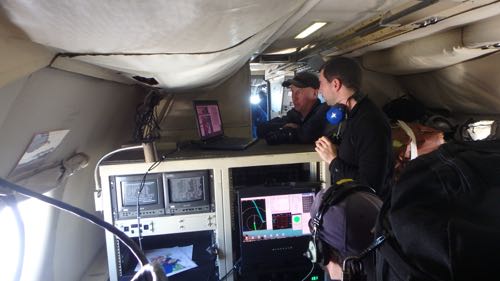
    John Sonntag and Joseph MacGregor at work on P-3
    Mission Scientist John Sonntag and Deputy Project Scientists Joe MacGregor at work during a priority mission over the Greenland Ice Sheet

    From my perspective, having the chance to experience the long days and fast pace of an airborne science deployment this week was exactly what I was waiting for. A flight can be 8 hours of focused work for both science teams and flight crew, in addition to up to two hours before and after flights for briefings and to turn on instruments. By the end of the week it was clear that the pilots, crew, and science team were ready for a well-deserved rest day, but it was gratifying to know that we collected 6 days of priority land ice data to help tell the story of the changing Greenland Ice Sheet. At the end of this last flight, which included tight turns, diverse terrain, and bouts of high winds and turbulence the announcement from John Sonntag that we collected 100% of our planned data (this means no clouds or other outside factors affected any instrument's data today) was exactly what the entire operation needed to hear. With a planeside debrief by pilot in command Chris Kerns and an hour of running data, the team was free to relax, explore, and revel in a week of science missions gone right.

    A Sunday Visit to the Ice Sheet

    After a week of successful priority flights flying over the Greenland Ice Sheet, some of us decided to go visit the ice sheet on foot. The longest road in Greenland takes you from Kangerlussuaq, past the most interesting golf course you'll ever see, herds of caribou, a waterfall, a calving front, and eventually to a terminal moraine left by Russell GlacierA mass of ice that persists for many years and notably deforms and flows under the influence of gravity.. We took a caravan of three vehicles to the Ice Sheet itself and to set foot on one of only two ice sheets in the world and hike a moraine was another experience I have yet to find words for. I'll leave you with a few photos from the day's trip and hope you'll look forward to some of our video footage from the day.
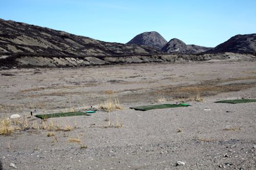
    Golf Course
    Kanger Golf Course

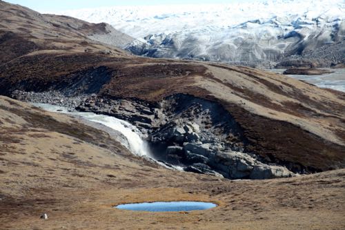
    Greenland En Route to Ice Sheet
    Greenland Views en route to Ice Sheet

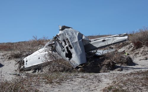
    Crashed fighter jet/prop
    Crashed fighter jet/prop left behind on the longest road in Greenland

    Tomorrow begins my last week with the Operation IceBridge Team here in Greenland and I am truly grateful for this entire experience. Stay tuned for updates and educational materials in the weeks following these last few flights.
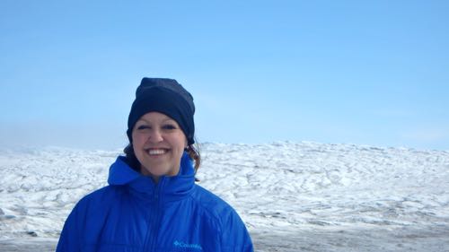
    Kelly McCarthy on Greenland Ice Sheet
    PolarTREC teacher Kelly McCarthy at the clearly retreated terminus of the Russell Glacier in Greenland

    Date
    Weather Summary
    Very warm, with sunny clear skies.
    Temperature
    53°

    Comments

    Elliott Dobson

    For better understanding, have you taken any samples of ice from the sheets you have seen?

    Mackenzie Catino

    Do you like Thule or Kangerlussuaq better and is it easy to keep track of all of your data you have collected?

    Caitlin Shulski

    Was your team the same on every flight or were you with different pilots, etc. every time?

    Kelly McCarthy

    Hi Elliot! That's an excellent question! We personally did not take samples of ice, but several of our flight paths were designed to fly over core sites. That means our data can be correlated to core samples taken by other groups--the collaborations among all of the scientists working on the ice sheet is impressive!!

    Kelly McCarthy

    Hi Mackenzie!
    I think both parts of Greenland were beautiful and exciting in their own way. I loved the science flights that we got when we were based out of Kangerlussuaq, and I thought it was very interesting to get to know the culture of Greenland a little better through our time in Kanger. But I think nothing compares to the beauty of Thule. All of the data collected on the ice sheet and the sea ice is stored electronically--there is A LOT to keep track of, but luckily each set is organized digitally and goes through some processing to eventually be stored at the National Snow and Ice Data Center online.

    Kelly McCarthy

    Hi Caitlin!The team was the same on every flight. The NOAA crew had a swap when they were in Alaska and I was in Thule, but for my end of the expedition we were the same group in the air every day. Sometimes we would have different guests come on (like a documentary crew or photographers). We also had some of our scientists leave half way through and new scientists come on board around the time we moved to Kanger.