
McMurdo Station, Antarctica11:00amHigh: +18F wind chill: +5FLow: +19F wind chill -3FWinds: E 8 knts;Station Pressure: 28.755"Present Conditions: mostly cloudy and overcast; light flurries picking up to gusty and more snowfall
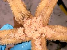
Our testing is dependent on when the divers were available so on Saturday we collected the last of the marine samples at Transect 4, the control site. This site was to the west of Hut Point on the sea ice maybe 300 yards off the coast. The core samples were gravely but didn't have the sponge spicules aka as furr balls from underwater sea cats that have been grooming themselves profusely. Seriously, that is what it looks like. So I imagine there are these seal size furry cats that's live underwater. (JUST KIDDING!!) The marine critters were a bit different then the others that we have collected as well. The sea stars were a lot larger and one of them was actually eating baby sea stars that another one was protecting. Well, now they are all dead- wrapped up tight in aluminum foil and two plastic bags with their names on the outside soon to become liquid mush in Steve's lab to see what their chemistry looks like.
Isopod
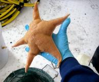
Acodontaster conspicuus
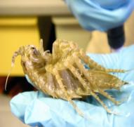
Diplasterias brucei sea star
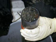
Core sample from Transect 4
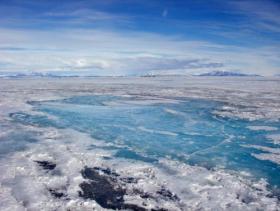
The terrain of the sea ice- probably not what one would imagine
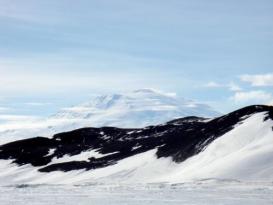
Another spectacular view of Mt. Erebus from the ice
In between finishing the last dive we started on the terrestrial sampling as I already explained. Here are some more pictures of that process. Unfortunately, I will not be photographing every bottle to post on this site- they all look alike! And Steve has already done that for his data records. However, below are pictures of what the whole process looks like.

Andrew using the GPSA Global Positioning System (GPS) is a satellite-based navigation system used to track the location or position of objects on the Earth’s surface. to find the exact location for a sample with in the area of the site
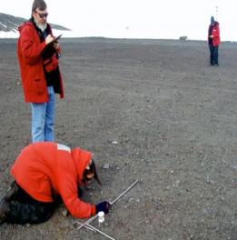
Steve taking notes and photographing the meter sample; April determining the declination
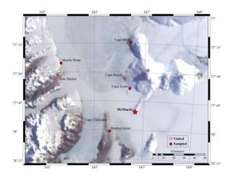
Below are site maps produced from GPSA Global Positioning System (GPS) is a satellite-based navigation system used to track the location or position of objects on the Earth’s surface. points and mapped into GIS. This provides a visual representation of statistical information. From these maps and points we go out and collect the sediment samples at each specific point. That could mean crawling around pipelines, hills and ridges, snow fields, ice, in the middle of roads. Today I managed to slide and fall in the ice more times then I needed to, which just made it more then troublesome to keep up. Maybe if Houston had more ice and snow I would have a better idea how to walk through it. I did succeed at being behind all afternoon and get my hiking shoes thoroughly soaked.
First lets start with where we are in Antarctica.......
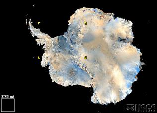
Antarctica
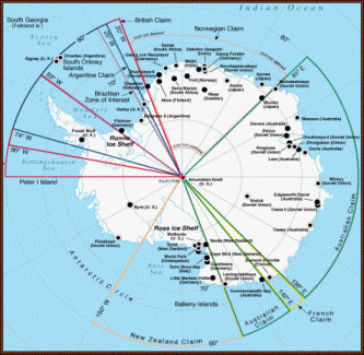
Find McMurdo- in the New Zealand claim on the Ross Ice Shelf
McMurdo sits at the edge of Ross Island, on the ice shelf and the sea ice,
directly across from the mainland
McMurdo Station
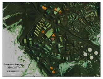
Areas in yellow are the intensive sampling sites at McMurdo Station.
These sites have 16 samples taken from 16 specific spots in each site.
Map produced by Andrew Klein
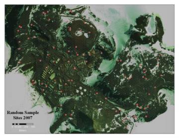
The sites in purple are the random sample sites as selected by the statistical random selection program.
Map produced by Andrew Klein
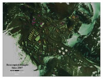
The sites in purple are areas randomly selected in areas that are reoccupied from previous activity.
Map produced by Andrew Klein
Comments