We finally made it out onto the fjord today, which I guess is the official start of our field work!

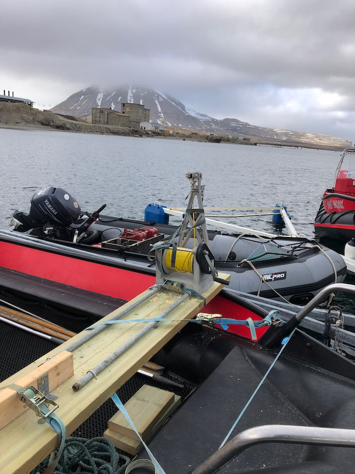
    This morning I worked with Svein Oland from the Norwegian Polar Institute, to get our boat ready. He was incredibly helpful in creating a mounting platform for the winch (to use to lower and raise the CTDA research tool that is submerged in the water to measure conductivity (salinity), temperature, and depth.) and the bathymetry setup. I was really impressed at his resourcefulness in gathering up the hardware we needed - after all, it’s not like you can go to Home Depot up here! After a couple of hours of work, we got it all mounted.
    Setting up the boat
    The mount Svein and I designed and built.
    Setting up the boat
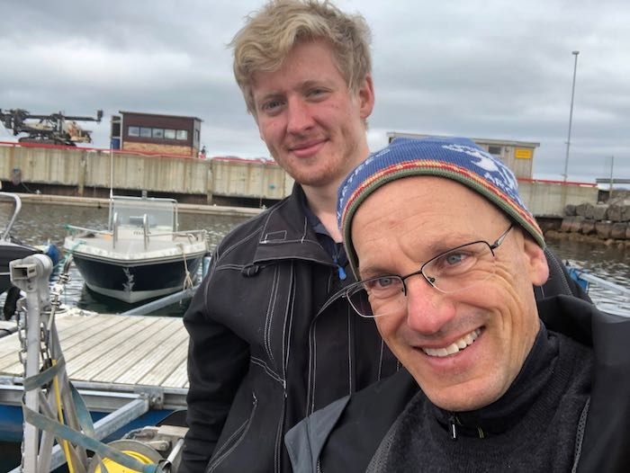
    Svein and I pose for a selfie after our work on the boat is complete!

    After lunch, I found out that my gun permit came through from the Norwegian government. This means that we are able to leave Ny Ålesund and go out on the boat!

    We gathered up our stuff and walked down to the boat dock. Shout out to Jan Pettersen for giving us a very thorough orientation. Although Julie and I have driven these boats before, it’s been many years for both of us, so it was super helpful. Then we were off!
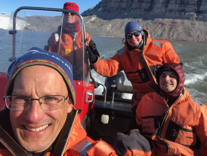
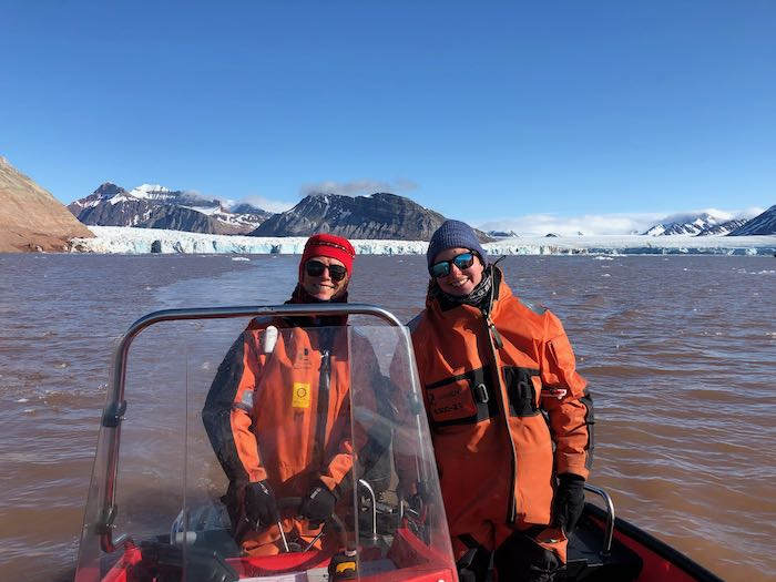
    The team on the boat
    Our obligatory selfie out on the fjord!
    Our main goal today was to get the lay of the land - to scope out what the fjord looks like after so many years to help us plan out the next few weeks. It was shocking to see up close how much ice has disappeared. (In a later post I’ll show in more detail where the glacier front used to be and how far it has moved back in the past 10 years.)

    Driving the boat
    Julie and Kelly in the boat on our first trip out on the fjord.
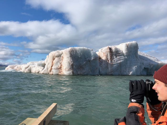
    Iceberg
    One of the many icebergs we saw on our way out to the glacier face.
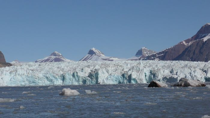
    Kronebreen glacier
    The face of Kronebreen glacier where we will be collecting our data.

    Check out this video with some clips of our first trip out on the fjord.

    Another goal was to test out the drone. I got a chance to fly the drone back in the US, but this was my first time flying from a moving boat! It was a little nerve-wracking at first to try to land the drone on a moving target! But with Xander’s expert drone-catching skills we were in business!
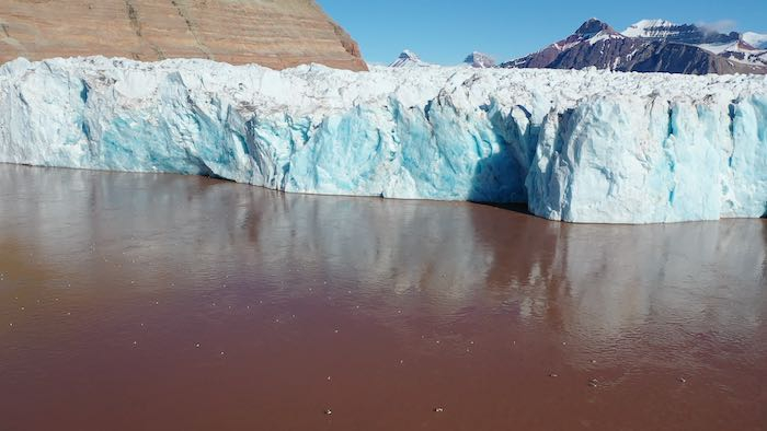
    Glacier face from drone
    One of the shots I was able to take using my drone.
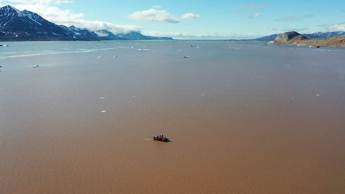
    Boat from drone
    This is the view looking out from the glacier face. Since this was taken with the drone, you can see our boat in the foreground.

    Check out this video shot using my drone. I need to work on my technique, but I think it was a good start!

    We came back today incredibly happy to finally be starting our field work and getting a chance to see the glacier up close.
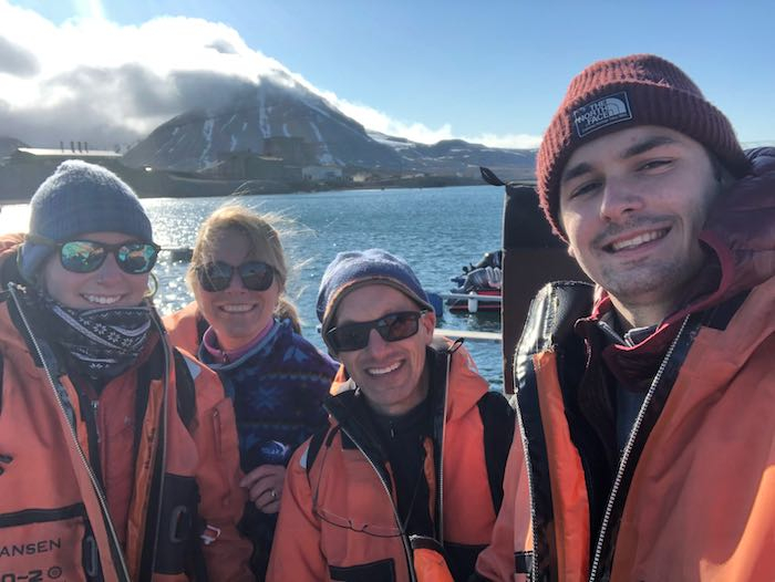
    The team after our first ride on the fjord
    The team poses for a selfie after our first ride.

    Author
    Date
    Location
    Ny Ålesund, Svalbard
    Weather Summary
    Partly sunny
    Temperature
    6°C (43°F)
    Wind Speed
    5 m/s

    Comments

    Judy Fahnestock

    Woo Hoo! I'm so happy that you have made it out in the field at last! Thank you for posting beautiful photos and videos of your time on the water. And nice drone navigating! I can only imagine how tricky (and nerve-wracking) it must be to land it so precisely while you are surrounded by water! Maybe you should go work for SpaceX after your field work - they need people like you to return large items from space. ;) Now, a few questions. Did your team borrow the boat from a research station in Svalbard or did you bring it from the U.S.? And why is the water so muddy looking there?

    Mark Goldner

    Hi Judy! Yes, it feels great to be back out on the fjord immersed in science. I have really enjoyed flying the drone. Once I get over the nerve wracking part that it could land in the water and be lost forever, it's super fun! I'm gettin a chance to experience places along the glacier that would be impossible - or at least unbelievably dangerous - to go in person.

    We rented a boat from the Norwegian Polar Institute, which is the main organization here. We're also renting our survival suits and office space from them.

    The water is so muddy because of all the sediment carried by the glaciers. These are very fast moving glaciers, so they are dumping a huge amount of sediment into the fjord. I'll be talking a lot more about that in a future post :)

    William Hanaghan

    it is cool that you were able to get out into the fjord and take pictures. What is the drone for? Also, why is the water color brown?

    Mark Goldner

    Hi Will! Great to hear from you. We are hoping to use the drone to help see what is happening right at the edge of the glacier, especially at the "upwelling plumes" - the places where water is flowing out from under the glacier. Dr. Brigham-Grette is particularly interested in understanding how sub-glacial streams change over time. There are lots of things we can measure out in front of the glacier, but we can't get right up to the glacier face because of the risk of icebergs falling out (this is known as "iceberg calving"). Today we witnessed many icebergs calving, and it was a good thing we weren't right there! The other reason is that the drone gives people (like you!) who can't get up here a really good visual of what a glacier really looks like and how it can change over time. This will hopefully help people develop a clear and concrete sense of how climate change is happening.

    William Hanaghan

    I noticed that you mentioned getting a gun permit and that you could go on the boat now, Is that because there are some dangerous sea animals in the water? Do you need a gun permit to use the boat? I was wondering where you are going to put the CTD, in the fjord or somewhere else?

    Mark Goldner

    Hi Will, the gun is for protection against Polar Bears. In a previous post I wrote about our rifle training, but in a nutshell polar bears are quite dangerous. They will actually hunt humans occasionally! We would always try to avoid having to shoot a bear by moving away from the bear, or using a flare gun to scare the bear away. Shooting with a rifle would be the absolute last resort. But the bears are out there! A couple of days ago we saw a mother and cub - from the safety of one of the buildings here (check out this video) and today while we were out on the fjord we heard over the radio that a polar bear had been sighted on one of the islands nearby!

    As to your question about the CTD, we are using the device in front of the glacier front, in the fjord, to try to understand more about the water coming off the glacier. You'll see a little about this in yesterday's post.

    Becky scheff

    Are the crevices in the glaciers normal or are they caused by melting/global warming?

    Mark Goldner

    Hi Becky! Great to hear from you. Your question is a really good one, and I neglected to explain that. Crevasses in glaciers are a normal part of the process of the glacier flow. You have to realize that the ice can be hundreds of meters thick and thousands of meters wide. Because the ice is a solid, as it flows, it gets deformed and cracked. So that's normal and not related to climate change.

    However, as glaciers get thinner and as the amount of melting under, on and around them increases, the amount and character of the crevasses can change. For example, we have noticed that one of the two glaciers we're studying (Kronebreen) has may more jagged and deep crevasses than one right next to it (Kongsvegen). Kongsvegen's crevasses are much narrower and have a more regular pattern. We're wondering if Kronebreen is experiencing a greater degree of melting and thinning than Kongsvegen. You can see that in this photo from today's blog post. It's taken from above Kongsvegen looking out towards Kronebreen. You can see how Kronebreen looks like it's falling apart where Kongsvegen seems more intact.

    Charlotte Pappas

    Hello Mr. Goldner,

    Foremostly, I found this post interesting, especially the pictures you included of the Kronebreen Glacier.
    For instance, in the pictures of the Kronebreen Glacier, I noticed that the face of the Kronebreen Glacier looked like it had many crevasses and cracks on it, which is a sign that huge pieces of glacial ice that used to be part of it melted, and fell of the glacier. Moreover, I think that the reason why large pieces of glacial ice fall of glaciers when they start to melt is because when a glacier melts, some of its glacier ice turns to water, which makes the glacier loose some of its density, and results in the glacier not being able to support as much glacier ice as it used to hold.
    In addition, I also noticed in your pictures that parts of the face of the Kronebreen Glacier looked like it had a gray color, which is likely caused by the sediment that the glacier was carrying slowly getting deposited as more of the glacier melts. Furthermore, I think that the reason why sediment gets deposited when a glacier thaws is because when a glacier melts, it loses some of its density and size, so it no longer can hold all of the sediment that it used to pick up.

    Overall, my main takeaway from this post is that due to the rising temperatures of climate change, it has resulted in glaciers to start to melt and recede more rapidly then before, and these melting signs are now easily noticeable when we look at the Earth's glaciers today.
    One final question that I have is are there any other signs that a glacier is melting that you can see without doing tests on the glacier and its surroundings?

    That is all of my thoughts for now.
    Charlotte

    Mark Goldner

    Hi Charlotte, one of the main tools that scientists use to monitor the retreat of glaciers is photography. Two ways this can be done effectively are timelapse photography and also doing aerial flights over glaciers. For timelapse photography, there are some scientists who have installed cameras on nearby mountains. Here's a link to a site with timelapse videos of Svalbard glaciers that was put together about 10 years ago. Although it's out of date it shows you what's possible.

    NASA has a really interesting project called IceBridge where they fly airplanes over the Greenland ice sheet to monitor the stability of the ice and many characteristics of the glaciers. This data will help us understand how the ice on Greenland is changing due to climate change, in very high resolution.

    Ben Rhyne

    Hi Mr. Goldner,
    This whole trip looks so interesting, and I'm enjoying reading through your journals! My question is what is the most surprising difference about the area from this trip compared to your last one?

    Mark Goldner

    Hi Ben, sorry for the delay in responding to your comment. The most surprising difference was clearly the amount that the glaciers have retreated since ten years ago. When we were flying over the glaciers on our descent into Ny Ålesund, I had a hard time recognizing exactly where the three glaciers were because they look so much different from the way they looked in 2011!

    Cha Cha Cohen

    Hi Mr Goldner!

    It looks like you had a very eventful and exciting trip! I am wondering if you think these glaciers would have moved more if it weren't for the impacts of global warming slowing them down.

    Mark Goldner

    Hi Cha Cha, sorry for the delay in replying to your comment. It's clear that the only reason the glaciers are retreating so quickly is because of global warming. In fact, if humans weren't pumping so much carbon dioxide into the atmosphere, we would probably be slowly moving into another Ice Age!! This means we might have seen the glaciers slowly advancing instead of retreating.

    Andrew Flint

    Hi Mr. Goldner,

    What is the brown colored stuff in the ice (from the 5th picture from the top)?

    Mark Goldner

    Hi Andrew, the brown stuff is sediment - this is bits of rock that is ground up by the glacier as it flows across the bedrock beneath it. As glaciers flow across the land, they break up the rock; most of that rock gets totally pulverized into sand, silt and clay. The ice then picks up that sediment. Depending on where in the glacier the iceberg was from, you can see thick layers of sediment. Sometimes the sediment includes large rocks and even huge boulders!

    Teo Montiel Ko…

    Hi again Mr. Goldner, It was cool seeing the video shot by the drone. Why is the texture of the glacier so bumpy, and why does part of it look so blue? And why is the water so brown? Also, did you ever have to use the gun? Did you see a lot of wildlife? Thanks, Teo

    Mark Goldner

    Great questions, Teo! The glacier looks "bumpy" because of the crevasses. These are cracks that form as the glacier moves across the landscape. You have to realize that although the glacier is flowing, it's also a solid. In order for a solid that large to flow, it needs to deform and break up into chunks that can move separately. Those cracks are the crevasses. As the glacier gets closer to the water, it tends to stretch out, which is what causes the crevasses to get so large and deep. The Kronebreen Glacier is particularly stretched out because it is thinning and retreating so quickly.

    The ice looks blue because when it forms it gets compressed. As the ice gets compressed, its crystalline structure changes such that colors of low energy (like red and orange) have a harder time passing through the ice. So the blue, which can easily pass through, becomes more dominant.

    The brown comes from all the pulverized rock (called sediment) that the glacier picks up as it grinds across the landscape. Much of that sediment flows out under the glacier in sub-glacial streams, which exit the glacier in what are called sediment plumes.

    We never had to use the gun (outside of our initial training.) We saw lots of wildlife - mostly birds, Arctic foxes, Reindeer and Seals.

    Jackson Musto

    Dear Mr. Goldner,

    The shots you took of the glaciers are incredible! It's so amazing to see the variety of colors and designs in the ice face. One question I wanted to check in on was about the effect global warming has on the whole fjord. From your journal I can tell that because of global warming the glaciers where pushed back mush farther than they were last time you where there, but are there any other obvious changes in the area around you such as water temperature, or more icebergs?

    Sincerely,
    Jackson

    Mark Goldner

    Hi Jackson, two changes I noticed that were quite different from last time I was there: first, it seems like the Kronebreen Glacier is much more stretched out than it was before. As a result, there are many more large crevasses and the glacier seems more unstable. There also seemed to be more iceberg calving events than I remember from last time. Now, we didn't really measure the number of icebergs so I can't tell for certain - but it certainly seemed that way.

    Eric Bardon

    Hi Mr.Goldner,

    The photos you took with the drone are incredible. There are so many different colors on the glaciers. You said that you were amazed by how much ice had melted, one question I have for you is if the ice continued melting at this pace, how long till the animals cannot survive there?

    Thanks Eric

    Mark Goldner

    Hi Eric, that's a really interesting question, but one that is very hard to answer. The problem with trying to come up with a simple answer is that the whole system is so interconnected that it's hard to know how each piece of the system will affect the whole. I think of a game of Jenga as an analogy. You keep pulling out blocks one at a time and the whole tower stays together. But there's the one block - and you can't easily predict which one - that will topple the whole thing. So think of all the factors that affect the survival of the animals - air temperature, water temperature, water acidity (pH), water salinity, amount of ice, the survival of other animals, etc. etc...

    Eulalia De Oliveira

    Hi Mr. Goldner,

    I found this journal entry very enlightening. The photos you took were incredible! Is the dark brown color under the water sediment? Why did you need the gun permit to go out on the boat? Was that the only thing that was holding up your trip? It was so inspiring to see these photos.

    Thanks, Eulalia

    Mark Goldner

    Hi Lalia, thanks for your comment! Yes, the brown color in the water is the sediment. By the way, it's in the water, not under the water. In fact, most of the sediment is found in the top layers because it is fresh water flowing off the glacier that is filled with sediment (sand, silt, clay, rocks). The freshwater is less dense than the salty ocean water, so it rises to the surface, carrying up its sediment. Eventually the sediment will fall down to the bottom of the ocean, but for a while it stays suspended at the top.

    We needed a gun permit because in order to leave the research base you must carry a rifle and flare gun. This is for protection against possible polar bear attacks. They are exceedingly rare, especially in a boat, but it can happen, and you need to be able to defend yourself.

    Actually we were only delayed a couple of days because of the gun permit issue. Other delays were caused by quarantine rules getting up to Svalbard, and one day of bad weather in which we couldn't fly to the research station.