Today the groups split up with Sara and the UNIS AG212 students headed out to the coastal lakes near Isfjord Radio and the REU students, Mike, Steve, and I were to hit Lake Linne in an attempt to recover instrumentation that has been in the lake since either last year, this spring, or in the case of a sediment trap monstrosity, a few years back (just means more data).
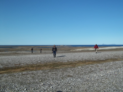
Following our typical breakfast of as much coffee and eggs that I can handle, we gathered as our smaller group of 8 and began our daily hiking ritual of around an hour to the lake. Like an ad for Muckboots we trudge daily through recently thawed permafrost muds, streams, and jagged rock feeling sufficiently hardcore to get things started for a day of science (some like pilates, we like…).
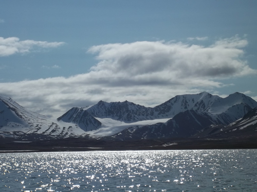
As a smaller group we were able to shuttle everyone to the north end of the lake and thanks to a stiff east wind the ice was virtually gone. The sun was shining and it afforded us an incredible view of Linnebreen, the glacier that sits in the northern reaches of the Linne valley.
The instrumentation present in the lake consisted of the following tied at various locations between large rock anchors and a buoy placed 1.5 meters below the water level (as to not be influenced by winter ice):
A. temperature probes: These measure just that and are useful in understanding how the lake distributes energy. Different temperatures at different depths will influence water densities and control how sediment and water influxes enter the system as overflows, interflows, or underflows within the water column. This has bearing upon the sedimentary record we hope to pull from the bottom of the lake and how to interpret the layers we find.
B. trolls: Not ogre-like beings or your favorite little dolls adorning the dash board of your ford fiesta. Rather, trolls are live-time data gathering devices which can measure anything from again temperature to dissolved oxygen, pH, and turbidity of the water.
C. Water wings: Geez we re-use terms don't we. These are actually wing-shaped devices (look like bats!) that hang in the water and record weather they are lifted due to flow velocities occurring within the lake.
D. Sediment traps: These are funnels with small tubes attached below them that gather sediment that is falling to the lake floor at different depths within the lake's water column. Using these, we can be sure to calibrate how much sediment is being spread both laterally but also vertically within Lake Linne. These are placed and pulled each year and compared to the annual layers we use to reconstruct older climates in the cores we take from the lake bottom.
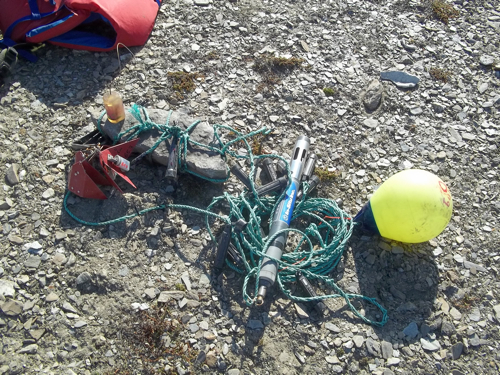
To find such gear requires patience, exploratory gear, and a degree of limnological luck. We constantly remind ourselves we're never guaranteed to find everything that is under the surface. Sometimes gear is washed away, buoys break, or unknowing folks think they are doing a litter removal service by carrying it off (I'd like to think their heart is in the right place). As for us, we had detailed notes from when the instrumentation was installed, GPSA Global Positioning System (GPS) is a satellite-based navigation system used to track the location or position of objects on the Earth’s surface. waypoints for each site, a radio antennae for certain sites with beacons, and bound and determined undergraduates.
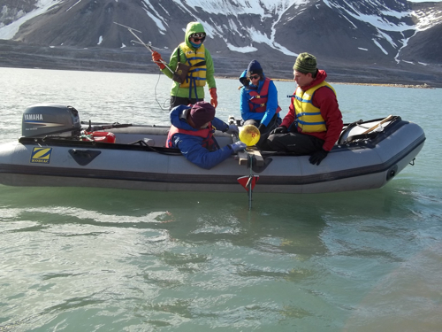
The morning started off slow because the water was rather turbid due to sediment laden meltwater entering the lake. Accordingly, one could only see maybe a meter into the water and remember that the buoys were conveniently places at 1.5 meters below the surface, ugh. While one boat tried to visually find the buoys in the GPSA Global Positioning System (GPS) is a satellite-based navigation system used to track the location or position of objects on the Earth’s surface. determined vicinity the other trolled a large chain under the boat in hopes to snag the buoy and retrieve the payload. 1.5 hours later nothing…we agreed it was time for lunch.
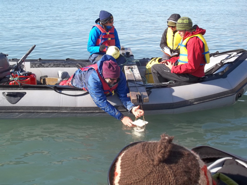
With each of us 3 sandwiches heavier we again hit the water and found luck! By simply trolling the waypoint areas we were able to locate blindly 5 of the moorings with the sixth being spotted visually by sheer luck that I turned my head from the GPSA Global Positioning System (GPS) is a satellite-based navigation system used to track the location or position of objects on the Earth’s surface. at an opportune time (I thought I saw a duck). With each string of instruments, the REU students would lasso the buoy, transfer the line to a boom strapped to the boat and reel in the gear, snipping each zip-tie that held the equipment on with frigid fingers as they came up the water column. We had mud and data! Rejoice!
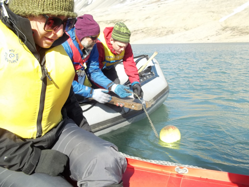
We took care not to jostle the sediment traps as they're cargo was still fragile and we wanted to make sure the fine particles still clinging to the funnel sides made their way into the records we'd later catalogue.
The final piece of equipment we brought in was a special sediment archiving device, an intervalometer, that not only produces the mud gathered over its time in the water but also records when sediment entered its holding area. This is done by funneling all of the sediment through a glass vial as it enters and it recording the scattering of light due to the particle's dispersing effects. Timing is everything for understanding how watershed processes are interpreted in the final sediment record!
With 5:10 rolling around and us still needing to make it back to the boat launch, pack, and hike we called it a day.
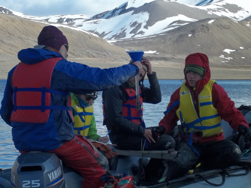
Around 6:30 we strolled into camp with some real results to download off probes and the first major scientific reconnaissance of the trip under our belts. Tomorrow is laundry day and I think we are happy about that…

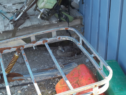
Random Svalbard Picture of the Day: There are hundreds of Eider ducks in this area and they really like to inhabit areas built up by humans, taking advantage of our structures as good cover for nests etc.. The duck below decided to build a nest directly next to our garage entrance and we are doing everything we can not to disturb her. So far we have a good working relationship.
- next >
- 1 of 40


Comments