
Once back at the base camp, we started to try and obtain some Twin OtterA highly maneuverable utility aircraft developed by de Havilland Canada. It can be flown slowly and in tight circles, and is designed for 20 passengers, short takeoffs and landings, and often used for cargo, passengers, and as a science platform. air time to take us on a reconnaissance flight over to Shackleton GlacierA mass of ice that persists for many years and notably deforms and flows under the influence of gravity., John's field location for next season's work. After a day and a half of manipulating flight schedules, we were granted a few hours of air time. We flew over the neighboring mountain range and headed toward the head of the glacier where it comes off the polar plateau. From there, we flew down glacier along the mountains that create the eastern boundary and turned over the toe as the glacier merges with the Ross Ice Shelf to head back up the western edge. After several touch and go landings, the pilots safely landed south of the Gemini Nunataks (rocky points that are completely surrounded by a glacier) and John and Perry set out to collect samples.
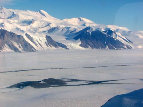
The next day we were to return to McMurdo. Once again, I was privileged to have another rare opportunity; our LC-130 had been equipped with a seismology project that was going to fly slowly (instead of a two hour flight it took almost four hours) and low (about 4,000 feet) over the glaciers to try and detect crevasses. The added bonus to this experiment was that the paratrooper's door was outfitted with a bubble window of Plexiglas that allowed one to lean out beyond the side of the plane by about two and a half feet! Many of us took turns leaning into the window viewing the amazingly rugged beauty of the Transantarctics.


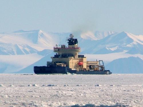
When we returned to McMurdo in mid-January, the sea ice was beginning to break up and everyone was anticipating the arrival of the Oden, the Swedish icebreaker. With the loss of sea ice, the penguins began to appear close to town. My very first sighting of an Adélie penguin was so exciting! It was a lone penguin, traveling across the ice near shore. The following day, there was a small flock of them further from shore, sharing a chunk of ice with some Weddell seals. Our departure was drawing near, and I was desperately hoping to see some Emperor penguins. Fortunately, on our Delta ride out to Pegasus Airfield for our return flight, I saw three Emperors standing near the warming hut. My list of Antarctic animals to see before I returned was complete!

For me, the majority of the expedition was like one big camping trip into the rugged backcountry of the "real" Antarctica. The science while there was relatively simple; we did a lot of hiking and picked up some really fascinating rocks. I didn't have to worry about using and repairing complex equipment or learning scientific protocols.
Throughout the expedition, I had difficulty in determining if a rock sample was of the correct type to provide quality information. There seemed to be so many parameters that had to be just right in order for a rock to be deemed an acceptable sample. Some of the criteria included: the right assemblage of minerals - primarily a sufficient quantity of quartz, the right amount of exposure to the atmosphere (not too buried by surrounding rocks or sediment), the right amount of weathering (mostly on the top and sides), evidence of being transported by the glacier and not some other means (striations or grooves on the bottom), and close enough to the accepted edge of the LGM. It seemed as if every time I thought I had found a good sample, that it was lacking in one of these criteria.

I'm hoping to be able to experience some of the "real" science as it happens back in the United States. The majority of the science that was the focus of our expedition happens back at the University of Washington, in Seattle. The goal of the team's trip to the various camps along the Beardmore GlacierA mass of ice that persists for many years and notably deforms and flows under the influence of gravity. was to both collect rock samples from the edge (limits) of the LGM. These samples will later be tested for the ratio of Be-10:Be-9 isotopes, along with other potential elemental isotopes (John Stone's project), and to map older moraines created by the Beardmore GlacierA mass of ice that persists for many years and notably deforms and flows under the influence of gravity. during earlier ice ages (Brenda Hall's project). The science that we conducted was basic geologic fieldwork. Prior to much of the current geoscience technology, most geologists gained their knowledge of the physical world by walking the land, creating maps, and collecting samples. For our work, we selected samples, marked them with an identifying number, bagged them, and took various photos. These pictures included general views of the surrounding landscape, images of the sample itself and its orientation within the landscape, and a fish-eye view of the sky and surrounding horizon from the rock's perspective. This last type of documentation will be very important for John when he determines the validity of the sample's derived date. Using these photos, he can calculate the concentration of incoming cosmic rays be seeing if portions of the sample were in the shade due to high points on the horizon and figuring, in general, the amount of atmospheric exposure the rock has seen since being uncovered from the ice.
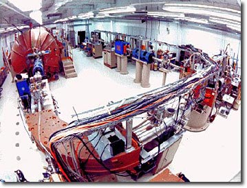
In John Stone's case, the "modern" science is completed back home in the lab. There, he will process the rock samples we collected. This entails crushing the rocks into very fine pieces, isolating the different minerals, and then dissolving the desired mineral type in order to isolate specific elements. These specific elements will then be taken to a facility that hosts an accelerated mass spectrometer (AMS). As samples are run through this complex machine, the concentrations of the different isotopes of each element are determined. The ratios of the various isotopes can then be used to determine the length of time these rock samples have been exposed to the atmosphere, and thus exposed to cosmic rays.
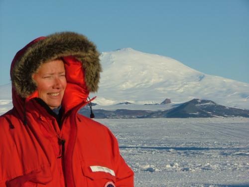
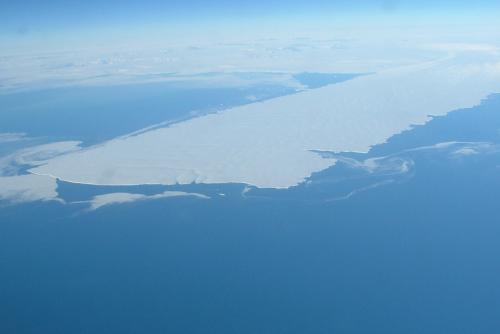
Our expedition, "Glacial History in Antarctica", was so special in that our team was able to go to places where very few people in the world have ever been. I feel incredibly privileged to be one of the those who have ever been to such remote places on the world's seventh and most inaccessible continent. The return flight aboard the C-17 to Christchurch, New Zealand was full of emotions. Toward the back of the plane there are two small, round windows, one on either side of the plane. I sat on a pallet and watched the Drygalski Ice Tongue pass beneath us. I was allowed to climb into the cockpit and see Antarctica slipping away from me. As I returned to my seat, I looked one last time out the rear window and saw my last glimpse of the continent. Tears rolled silently down my cheeks as I made a promise to myself to one day return.
- < prev
- 55 of 55


Comments