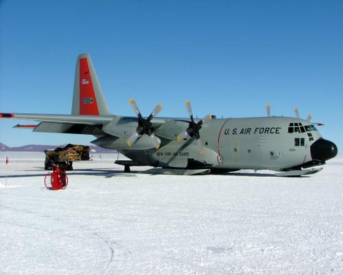
Finally, after eleven days in McMurdo, the weather cleared and we were off to CTAM. The flight was aboard a LC-130 Hercules which is quite a bit smaller than the C-17 we arrived on in McMurdo. It is special because it is on skis instead of wheels. After approximately a two hour flight, we landed at CTAM. The first difference I noted when disembarking the plane was that the temperature was much colder than in McMurdo because we were at a significantly higher elevation and were camped on top of a glacier instead of on exposed rock at sea level. While CTAM was a very comfortable camp with very interesting science going on, we were anxious to finally get into the field and begin our research. On our second day there, we were able to obtain some helicopter time to take us to our first camp at Cloudmaker Peak on the Beardmore GlacierA mass of ice that persists for many years and notably deforms and flows under the influence of gravity..
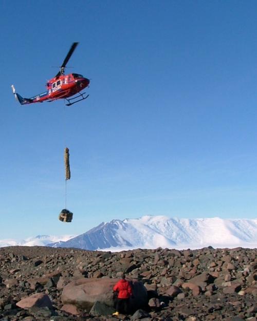
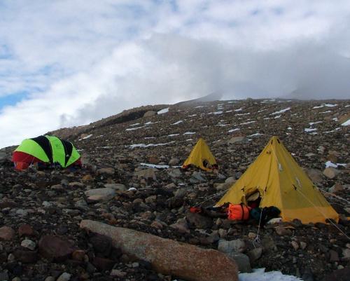
Now we could begin the science we came to Antarctica to do. Generally, we spent 9-10 hours per day in the field. A typical day went like this: waking up around 6:30-7:00 a.m., breakfast, packing lunches, discussing plans for the day, contacting MacOps (McMurdo communications) at 8:00 a.m. to let them know we were okay, off into the field hiking around eight miles daily, and collecting 20-30 pounds of rock samples. We generally returned to camp around 6:00-7:00 p.m. where we ate dinner, discussed what we'd found in the field, talked about plans for the next day, and related it to other research that had been conducted in the region. I found the fieldwork on Cloudmaker the most challenging of the three camps. It was while on Cloudmaker Peak, we experienced our "worst" weather. Although it was sunny, we had about three days of 35+ mph winds. This made the temperature feel as if it were in the single digits. The terrain was the most rugged, with very steeply hummocked piles of rocks that had been pushed up by the Beardmore during its maximum height during the last ice age. The rocks making up the moraines was widely varied in composition. There was a wide array of types from a variety of metasediments, schists (the most hazardous to step on because of their tendency to break under your weight), granites, and limestones. I quickly found that I was very out of shape and had difficulties keeping up with John and Perry. Fortunately, while our walking was up and down over relatively small hills, our daily treks were generally parallel to the glacier along the side of Cloudmaker. Usually by the time I caught up with them, they were discussing the quality of a potential sample. If they decided it would potentially provide good information and determined they'd collect it, I was in charge of taking the fish-eye photo that showed the sky and surrounding horizon fromt the rock's perspective. I also had a chance to rest up before our quest for the next sample.
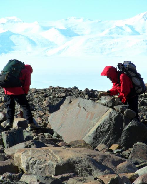
Toward the end of our stay on Cloudmaker, we had a helicopter supported day trip to an unnamed plateau farther up the Beardmore. John was hoping that here he'd find evidence of moraines from the last glacial maximum (LGM). Brenda was hoping she'd be able to map moraines from earlier glacial periods. Unfortunately, this wouldn't be the case for either expectations. Instead, we ended up with a pseudo "sight-seeing" tour of the plateau while searching for suitable evidence.

As our time closed in on Christmas, and our work of collecting samples along the LGM on Cloudmaker Peak was about completed, we began planning for our work on Mt. Kyffin. Mt. Kyffin is on the other side of the glacier about 28 miles downstream. Twit and Maurice had joined our camp and since there were now seven of us, it took four helicopter flights to ferry passengers and the gear over to Mt. Kyffin. In order to do this, a twin otter placed a cache of fuel on the glacier about half way between the two mountains. The flight that Brenda, Perry, and I were on, had to land to refuel and this was the first time I'd placed foot on the enormous glacier. It was so exciting to know that I was standing on one of the world's ten largest glaciers! From the upstream side, Mt. Kyffin is very imposing, with a large granite spire and nearly vertical face.
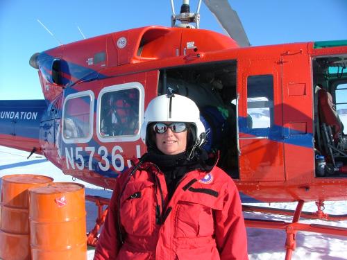
Our camp, was on the northern slope which was quite gentle. I was surprised to discover that the rocks making up the moraines were completely different in composition than those on Cloudmaker Peak. I was very happy to discover that they were much more stable to walk on and surprisingly level. However, this exchange was offset by the fact that the estimated LGM was up the mountain from our camp. So, every day, we set off up the mountain to search for and collect our samples. This was as strenuous as Cloudmaker, but in a different way. There were several ice fields that I preferred to skirt instead of cross because they were just steep and slippery enough to be intimitading but too widely scattered to justify bringing crampons along for the day. Generally, by the time I'd caught up with John and Perry, they had much of the sample selection and preparation completed. By now, much of my role was helping carry samples back to camp.
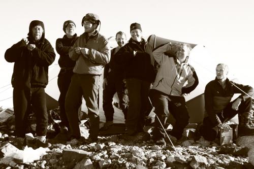
Christmas Eve and day were very special experiences that I'll never forget. On Christmas Eve, it is a tradition to sing Christmas carols over the radio system to everyone at the various research stations and field camps. We heard several songs from the McMurdo choir, which was very organized compared to the other groups. Next, the residents of the South Pole Station sang some very discordant songs, but they made up for it in their enthusiasm. A couple of other remote field camps then chimed in with a few songs before MacOps signed out wishing everyone a Merry Christmas. While I found myself missing the holiday celebrations with family and friends at home, I was in the most majestic cathedral anyone could ask for and celebrating with new found friends.
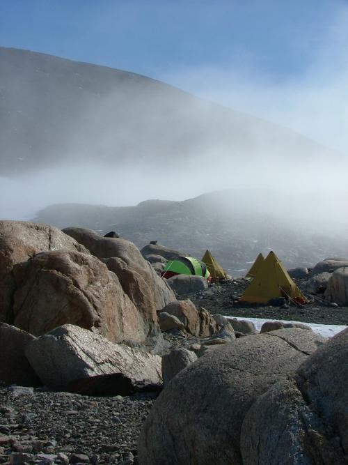
Our work on Mt. Kyffin was briefer than expected because the LGM was rather faint in most places. We were ready to head down glacier to our final camp, Mt. Hope. Then, the fog set in. It was a day or two before the fog cleared sufficiently for the helicopter to be able to move us to our next camp. At this time, Twit, Brenda, and Gordon left us for other projects, and John, Maurice, Perry, and myself completed the move. Once again, we found our camp to be lower on the mountain than John would have liked, so we had to hike up the side of the mountain each day to reach the LGM. Here, the rock was much more homogeneous in composition and it was easier to identify acceptable samples, even though they were much more widely separated.
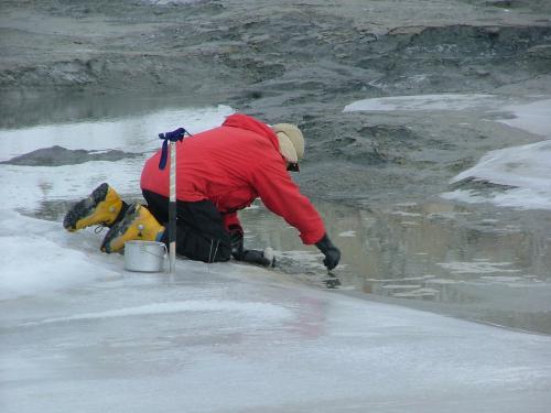
In addition to the collection of rock samples, John had another investigation that he had planned back when he had come to Mt. Hope on a reconnaissance day trip. Mt. Hope is the end of the Queen Alexandra Range and at the foot of it lies the Ross Ice Shelf that extends as far as the eye can see. At the point where Mt. Hope meets the ice shelf, there is a small lake. Since John first laid eyes on it, he suspected that it was tidally influenced. To prove this, he set up a time-lapse camera programmed to take photos every few minutes and allowed it to record the lake for 26 hours. When placed together, these photos document the lake level rising as the tide comes in and falling when the tide goes out. This was an exciting confirmation of John's idea about the lake. We also spent one day at the lake collecting sediment samples from the floor of the lake and algae that was floating on the lake's surface. John and Perry explored the slopes above the lake and found ancient algae specimens. The algae samples will be given to other scientists to increase their knowledge about algae (past and present) in Antarctica.
New Year's Day 2011 was part of an amazing time on Mt. Hope. Maurice and I hiked to the top of Mt. Hope. About 1/2 of the hike was across an ice field, while the top portion was scrambling up a talus slope. From the summit, to the south, you could just make out the headwalls of glaciers spilling off the polar plateau through passes in the Transantarctic Mountains. As far as you could see from east to west, stretched the multitude of mountain ranges that make up the Transantarctic Mountains, and to the north, the Ross Ice Shelf blended into the pale blue sky of the horizon. To know that we were standing on ground occupied by Ernest Shackleton and his men as they sought a safe passage off the ice shelf and onto the continent, thereby discovering the Gateway (a shortcut between the Beardmore GlacierA mass of ice that persists for many years and notably deforms and flows under the influence of gravity. and the Ross Ice Shelf), was awe inspiring.

That evening, after descending Mt. Hope, a thick fog rolled into camp. Most of the fieldwork was completed, although John and Perry did venture out to collect a couple more. Now, began our waiting period. Due to the fog and very limited sight, the helicopters from CTAM could not come pick us up. Every time we thought the fog was clearing, we would see the dense clouds creep lower down Mt. Hope. At one point, the fog cleared at our camp, but CTAM was fogged in; by the time their weather cleared, our camp was once again in fog. Finally, after several days, the weather partially cooperated and we were picked up to return to CTAM.


Comments