Cruise Day 48
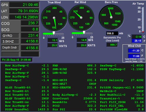
Speed 7 knots (kts)
Course 237° (WSW)
Location Canada Basin, ~495 nm north of Barrow, Alaska
Depth 4157 m
GO DEEPER DISCUSSION: (see previous journal for the questions.)
Seawater has a lower freezing point than fresh water. The surface temperature of water we're in now is -1.4°C (29.5°F), so snow flakes, made of frozen fresh water, won't melt when they land in open leads under our current conditions.
TODAY'S JOURNAL:
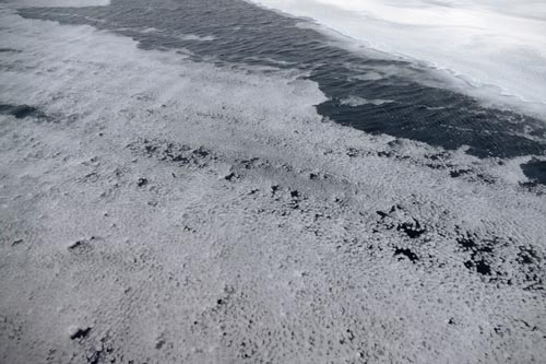
The wind strengthened last night, making for some truly harsh conditions outside as the snow was flying horizontally across the ice and water and swirling around the structures on boar Healy. The wind caused the slush in some of the strips made by Langmuir cells to ball up, giving them the appearance of a big slick of spilled Ping-Pong balls (see yesterday's journal for a discussion of this phenomenon.) We tried once again this morning to establish an ice station, circling back to a large stable-looking floe. The strong wind and snow persisted, though, so we couldn't get sufficient visibility for a polar bear guard to be established. Once it was apparent that the ice station was a bust, we turned south again to make more progress towards our next full GEOTRACES station at approx. 77.5° N. By this afternoon we were seeing some very large openings in the ice but the ice coverage is still sufficient to keep the waves down. We are anticipating this freedom from rough seas to come to an end eventually as we work our way out of the ice but I'll enjoy every hour of stability in the time being!
This morning I caught up with Johna Winters, a STARC technician from Oregon State University. STARC stands for Ship-based Technical support in the ARCtic, and is jointly administered by Oregon State University and the Scripps Institution of Oceanography. STARC provides marine technicians on Healy science cruises, as well as many other oceanographic research cruises on other ships. Our STARC techs offer a connection between the science party and the ship, maintaining and monitoring ship-based underway instrument systems and our data acquisition system, which archives the information coming from these instruments.
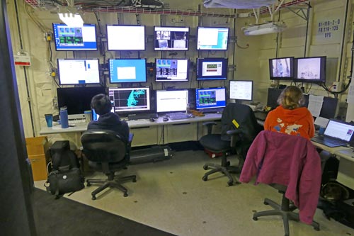
Johna represents a third of our STARC team, with Croy Carlin and Brett Hembrough rounding out the STARC crew. Each has a daily 8-hour shift, 7 days a week, to keep the ship-based systems running. They also are on hand to help with instruments on our sampling rosettes and to lend their expertise with various sampling operations being conducted by researchers on Healy. On some cruises STARC techs run sampling casts with their own gear and so their experience is a valuable addition to the whole science team.

The primary underway science systems that STARC is currently overseeing includes two types of sonar: A Knudsen echo sounder that is primarily used to find depth along with a multibeam sonar that maps bathymetry as we proceed through the Arctic. There is also an Acoustic Doppler Current Profiler (ADCP) system that works in a similar way to sonar, but uses higher frequency sound energy. It isn't "looking" for the bottom; instead recording reflected energy from particles in the water column. By comparing the depths and Doppler shifts of the returns, it can interpret how water masses are moving deep below the surface. From time to time, the STARC team oversees an XBT cast. This stands for expendable bathythermograph, a device that quickly measures depth and temperature to offer a snapshot of water column temperature structure and to help calculate underwater sound speeds to fine-tune sonar systems. Expendable means that the instruments are cast overboard but not recovered – once their desired depth has been reached the thin copper wire connecting them back to the surface is snapped, with the XBT sinking to the sea floor.
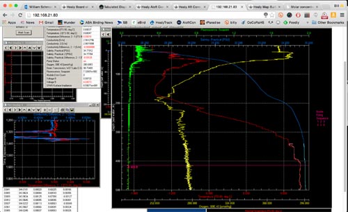
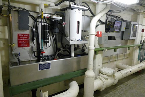
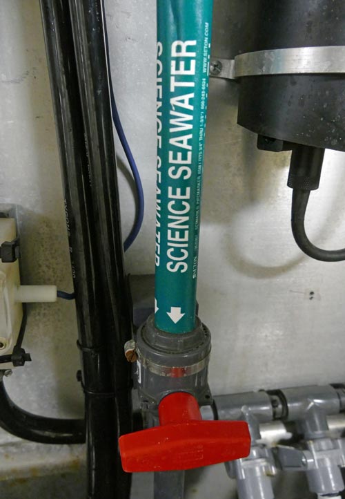
Healy also has a sophisticated array of meteorological instruments that are monitored and recorded by the STARC team. They configure custom summary pages that we can access on the ship's network to see what outside conditions are like. I look at the so-called tabulated display all the time, and use it to get the summary weather, position, speed, and course data at the top of every journal post. Healy also has a seawater flow-through system that continually supplies surface water to scientists and measures variables including surface water temperature and salinity. It has a fluorograph to detect chloropyll, a transmissometer to measure particles in the water, and dissolved oxygen and carbon dioxide measuring systems. In this regard, the underway seawater system is kind of like a CTDA research tool that is submerged in the water to measure conductivity (salinity), temperature, and depth. instrument package that stays put, with the ship delivering surface water to it as we transit the Arctic ocean.
Thanks for walking me through the basics on all of this, Johna!
GO DEEPER!
Why is the ship's course different from the ship's bearing? (The direction we are going, 236.7°, is a little different than the direction we are pointing, 231.4°.)
Aloft Con web cam updated every hour
That's all for now. Best- Bill


Comments