The Day I Redeemed Myself
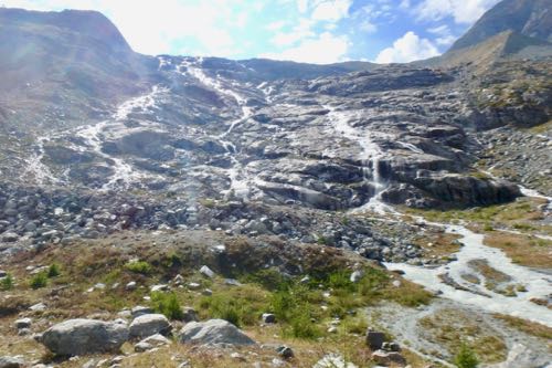
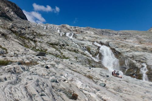
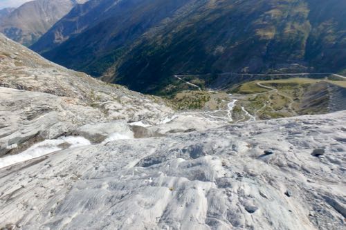
The target for the day was the forefield of the Allalin GlacierA mass of ice that persists for many years and notably deforms and flows under the influence of gravity.. We were all pretty happy to be heading to this one because we knew that the glacier and forefield were right next to the parking lot. This meant no long and grueling hike just to get to the forefield! I naively entertained thoughts that it would be an easier day and that we might finish up really early since we were cutting several hours of hiking off of the day.
I immediately started to doubt my earlier sentiments when I saw how steep the forefield was.
Achievement Unlocked
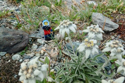
Nevertheless, I knew it was going to be a good day when I crossed one of the streams and looked down at my feet and spotted a patch of Edelweiss.
I have been searching for this gem of the Alps since I got here and I immediately yelled out, “I finally found it!” Jake, Luke, and Christian were not nearly as enthused about this as I was, but they humored me by stopping and taking some pictures too.
I meanwhile paused for an entire photo shoot next to the elusive flowers.
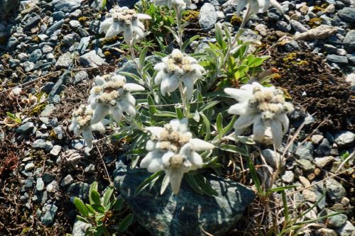
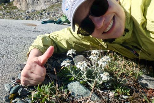
This “Star of the Alps” is in serious decline due to over collection, so if you are lucky enough to find it too, remember, pictures only. It is against the law to remove this flower, and many other alpine wildflowers. Don’t worry; all the tourist shops sell a myriad of collectibles covered with depictions of this delicate flower. I may or may not have bought a ridiculous amount of these to bring home to family and friends.
Promotion to Survey Team
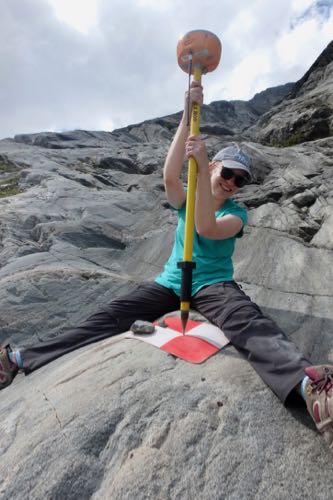
No it really isn’t a promotion, but I did get a change of assignments in the field. Two of our team members had to leave a few days ago due to the start of the semester, so we are down to only four team members. I was paired up with Luke today to conduct the GPSA Global Positioning System (GPS) is a satellite-based navigation system used to track the location or position of objects on the Earth’s surface. survey of the targets. Ideally the survey team is composed of two people, and since I am the most inexperienced hiker/climber in the group, it made the most sense for me to do this task.
Remember when I said I thought it might be an easier day, well I was quickly eating those words as Luke and I set out to survey the targets. I found myself channeling my inner mountain goat as I scrabbled up the side of rock walls and shimmied down slopes.
I was still upset for not being able to finish the hike at Usser Tal, but I felt like I redeemed myself on this day. It was hard work scurrying all over the mountainside through the guidance of the handheld GPSA Global Positioning System (GPS) is a satellite-based navigation system used to track the location or position of objects on the Earth’s surface. unit to find all the targets hidden amongst the crags. It felt a little like an Easter egg hunt, if the Easter egg hunt was designed for ex-Navy seals and extreme mountaineers.
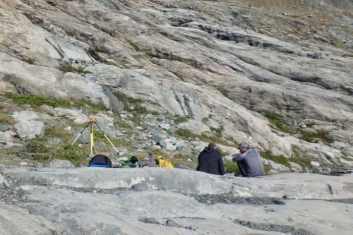
I spent the day helping Luke take the GPSA Global Positioning System (GPS) is a satellite-based navigation system used to track the location or position of objects on the Earth’s surface. measurements on the RTK sensor and taking striations measurements at each location.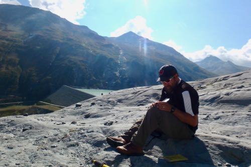
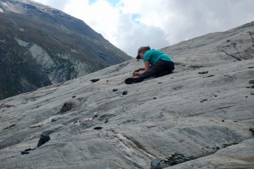
As the day wore on, every muscle in my body started to protest and only sheer mental willpower was keeping me going. In my mind I was thinking that it was getting harder and harder to crisscross our way across the mountain side. We had to look longer for safe passages to cross the various streams to make our way to the next waypoint. This often meant traveling far downslope only to have to slog our way back up again.
I eventually found out that this was not my imagination. As the day wore on and the sun warmed the glacier high above, more melting was occurring causing the streams to increase in speed and volume. We actually had to abandon some of the targets at the end of the day because there was simply no way to access them that late in the day anymore. We often had to find new paths down and in some parts the only way to descend was to sit on the rock and do a controlled slide (or as controlled as it could be) down to the next ledge.
Many of the cracks and creases in the rock were filled with moss and wildflowers. One would think these would be the best places to gain some footing. I found that it was pretty much the opposite. The moss was very spongy, and you never knew how far your foot would sink when you placed your weight on these parts. I lost count of amount of times I stumbled or lost my footing on the mossy areas.
Anyway, I got to a particularly difficult descent and determined that the only way down was through the moss. So I sat myself down and let myself slide down the green, mushy moss. Did I mention the moss is also very wet and muddy? I emerged from this rather sticky slip n’ slide with a dirty backside, but otherwise unscathed.
By the end of the day, we were all hot, smelly, sore, and very much looking forward to a hot meal.
Hike Stats
Steps: 13,702
Distance Traveled: 6.2 miles
Flights Climbed: 105 floors
PolarTREC Poppy
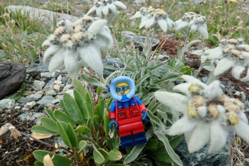
Poppy had to get on the action of taking pictures of the Edelweiss. After we got our fill of taking pictures of the fragile flower, we both posed next to it while singing “Edelweiss” and the rest of “The Sound of Music” soundtrack in our head.
Daily Haiku
Small and white, I look
happy to meet you, don’t pick,
please grow forever


Comments