April 9, 2007
Wind 11.2 mph
Air Temperature -19.5C -3.1 F
Wind Chill -19.6 F
Latitude 73 11.56 N
Longitude 146 42.29 W **
Yesterday morning I helped Andrew Roberts set up several photo stations along an ice ridge. The flags are set 10 meters apart and a photo is taken with a reference pole. The photo stations are visited periodically and photos taken with the pole to see how the ridge has grown or decreased. We used the EM-31 an instrument that uses a magnetic field, like sonar, to measure the ice thickness at several of the stations. Part of the morning was also involved in surveying the ridge for new stations and revisiting old stations. This involved a long snowmobile ride on a pleasant day.

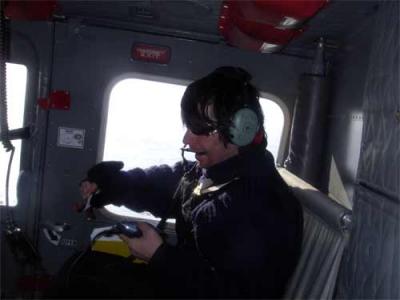
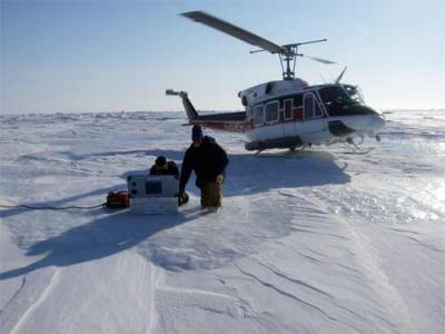
In the afternoon Jeremy Wilkinson from the Scottish Association of Marine Science was deploying a GPSA Global Positioning System (GPS) is a satellite-based navigation system used to track the location or position of objects on the Earth’s surface. (Global Positioning System) buoy 90 miles north of the Ice Camp. He invited me to join him in the helicopter, and help set up the buoy.

This GPSA Global Positioning System (GPS) is a satellite-based navigation system used to track the location or position of objects on the Earth’s surface. buoy has a solar panel and will send latitude and longitude information back to Scotland via satellite. The solar panel charges the batteries and the box is sealed. The idea is to put the buoy on a piece of multiyear ice and follow the position of the ice as it moves around. With some luck this data will be collected over a period of one or two years.

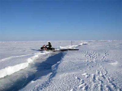
This morning Cathy Geiger and I set off to retrieve 4 short term GPSA Global Positioning System (GPS) is a satellite-based navigation system used to track the location or position of objects on the Earth’s surface. buoys on a snowmobile. The ice moves and the buoys had been set on the first year ice in order to record small scale movements. The buoys had been marked by green garbage bags, filled with snow. We went out line 5 and then began to search. We located the first buoy and crossed a newly refrozen lead with the snowmobile and then had to drag the sled across a fresh pressure ridge. We located the first three buoys and loaded them on the sled and returned across the lead with the snowmobile.

But we couldn¹t find the fourth buoy. We took compass bearings and lined up our search pattern, walked back and forth, searched with the snowmobile and then finally returned to the spot where we thought it should be. The buoy wasn¹t there. We finally gave up and radioed in that we were returning to camp for lunch. A few minutes after we started back we came over a hummock and almost ran over the GPSA Global Positioning System (GPS) is a satellite-based navigation system used to track the location or position of objects on the Earth’s surface. buoy! Instead of being a kilometer and a half out it was only one kilometer! So we successfully retrieved the buoy, and finished our task!
In the afternoon I spent the time in the communications hut, talking with the scientists working on their data analysis and repairing instruments, while I journal. There is a lot of humor and joking going on as the scientists solve problems with their data and instruments. If you want to know what is going on in camp the communications hut is the place to be. Josh Bernstein and the Discovery Film crew called in on the radio several times to record checking out of camp for their film. Then Art Howard, from Polar-Palooza, came in with his movie camera and asked a few questions. There have been a couple of filmmakers here recording the events and science done at the ice camp.


Comments