Today dawned with gray skies, drizzle and marine fog. It was a perfect day to be a geologist. So, with that in mind, I spent the day with Jody Bourgeois and SeanPaul La Selle our geology specialists.
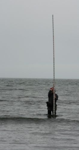
We started our day on the beach where SeanPaul set up the surveyor's tripod to mark the change in elevation from the surf up over a ridge or two and across a low terrace. Jody, his professor, was very patient holding the surveying rod. The job of a surveyor, if you have ever passed a survey team on the side of the road, is to determine the elevation of a piece of land and show the relative changes in elevation in a topographic profile of an area. SeanPaul was in charge of surveying from the shoreline to behind the terrace. I tagged along and generally distracted Jody with questions and conversation so that SeanPaul had to remind her to hold the rod straight.
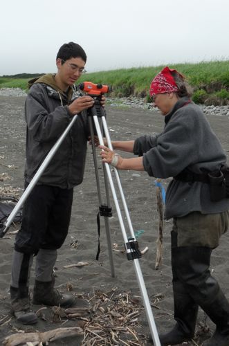
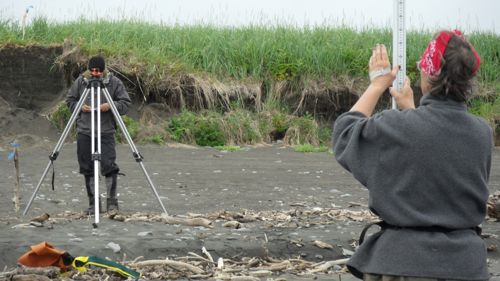
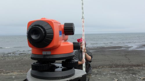
Jody walked the stick to various points along a generally straight line and stopped at points where there was the start of an elevation change. SeanPaul used the transit level to mark the points. The transit level is a lens that has three horizontal lines across it. He records the top, middle and bottom measurements and then uses a simple math formula to calculate the distance and elevation changes. Once again, this is an opportunity to use the skills you learned in math class.
This took the entire morning, but since we were within sight of camp we walked back for a quick lunch. As we were eating, the survey team showed up with Greg in the lead. Since they usually roll into camp around 6 PM and it was about 1:30, this was not a good sign. The group of three had come across a bear that was at the bottom of a hill they had come to the crest of. When they made a lot of noise and stood together in an effort to redirect the animal, the bear made no change in course and continued to walk in their direction. Wisely, they backed off and made their way back to camp to do work closer to home base. Although it was an uneventful encounter, the bear's path was between the survey team and the site they were on their way to look at. Habitually bears take the same route to an area and back so there was no need to stay in the vicinity and good common sense was the best defense.
My afternoon was spent on the same terrace as camp digging a geological excavation. These are the opposite of archeological excavations. Archeologists dig carefully through soil and thoroughly screen all the soil to look for artifacts. Geologists on the other hand dig a big pit with no regard for the contents of the pit itself whatsoever. They then climb down into the pit and look at the walls. The walls tell you what happened in the area over a period of time. Because we were near the beach, Jody and SeanPaul were looking for deposits left from tsunamis. So besides looking at the volcanic ash layers, tephra, they were also checking to see if there was any sign of layers of soil or sand left from giant waves caused by earthquakes. Essentially, they are looking for the history of what happened to Earth in a place, where archeologists are looking for what happened to people in a certain place.
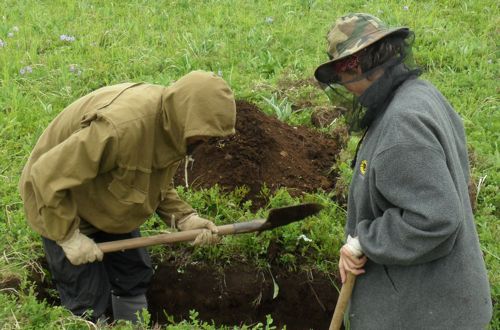
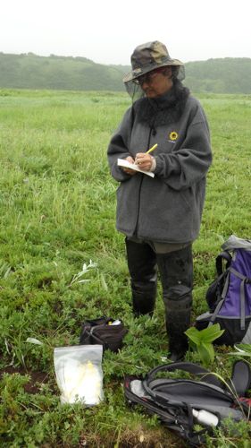
Jody often teases that people are just there to make a mess of the beautiful layers of nicely layered soil. Archeologists think that when the soil layers are messed up it is good news because it is a sign that people were there. Ironically, the two sciences are somewhat symbiotic and the scientists here are very happy to help each other whenever possible.
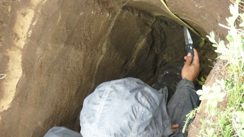
So with my geology lesson for the day complete, I watched the geologists map all the work they did today to make a topographic profile of the area. It is a picture of the elevation and how it changes based on their measurements. They also make a picture of the layers of tephra and potential tsunami deposits.
Feeling that I have a better understanding of what geologists do, I plan to take a closer look at the next survey team I pass on the road. I might also use the opportunity to ask them how their topographic profile is coming out – just to show off a bit. However, since I live in an area far from the beach, I think I will just skip asking them if there are any tsunami deposits.


Comments