IceBridge P-130 Orion Kangerlussuaq Airport
    Project IceBridge's P-3 Orion sitting on the tarmac at Kangerlussuaq Airport.
    Last night at our normal nightly meeting we were told to make sure we bring our passports. We are supposed to bring our passports with us on every flight in case we have to divert. A plane will divert when it can't land at the intended airport. This does not mean there is a problem with the plane. It could just be that the airport the plane originally had intended to fly to has poor weather conditions so the plane can't land. That is the scenario we might face on our return trip today. We were reminded of our passports because we were going to be flying to Canada. Normally this mission would be flown out of Thule because Thule has the closer airport. The crew chose to do this mission because it was the best option available.
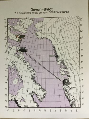
    Devon-Bylot Flight Plan
    A flight plan put together by John Sonntag combining two different missions, which focused on Devon Island and Bylot Island off the coast of Canada.

    Before we take off in the morning the pilots look at the weather for where we are going, and for our return trip, to make sure we can actually return back to Kangerlussuaq. Going from Greenland to Northeast Canada is not a very far flight, but it is not what would normally be planned as a flight out of Kangerlussuaq. Greenland is still a windy and cloudy mess so clearer skies must be sought out for the missions to continue. This is a medium priority mission and it is really two different missions spliced together. This allows Operation IceBridge to collect data on a day when most missions are not feasible. John Sonntag (NASA engineer and scientist) is constantly looking at the weather. He knows all of the 63 flight plans that IceBridge wants to fly. From the beginning of the expedition the crew knows that they will not fly all of the 63 flights. The flights are arranged in priority order. Baseline flights, the highest priorities, are the flights that Operation IceBridge have flown before and/or that show the most change. There are also some baseline flights that are in areas that show little change. These areas are used to show unbiased data collection. John says he looks at the flights like a quiver of arrows. Each one just waiting to be pulled out. This analogy is perfect because in my mind John is a hunter seeking out a flight line that will give the crew the best results. Most times he catches his prey but there are days like yesterday where no missions can be flown. Today, John catches his prey, our flight plan is to combine parts of two missions. John created a new mission calling it Devin-Bylot. Devin and Bylot are both islands in Northeastern Canada.
    Devyn Icecap
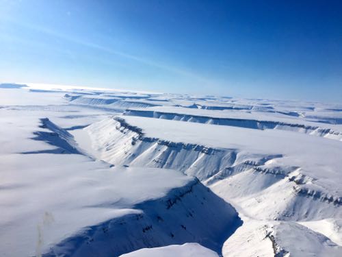
    The edge of Devyn Icecap.
    Bylot Island
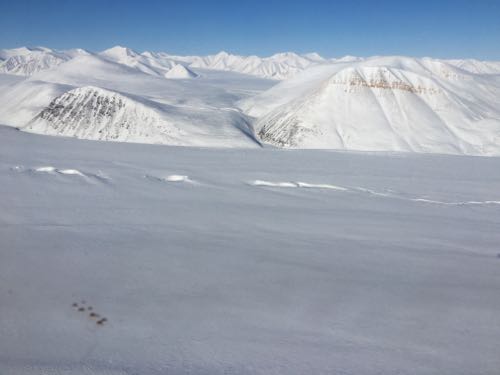
    Mountains on Bylot Island. One can see last year's melt channel.

    The flight had a long transit, in other words it took a while to get to our desired location. The flight was just over seven hours there and back and we had about three hours of active data collection. Those three hours were worth it. I was looking at snow covered mountains, perfectly white. It was amazing. We saw tons of polar bear tracks, and one of the pilots actually saw a bear, but as soon as it heard the plane it took off and disappeared into the white mountains. The plane flies low, about 1500 feet, and I was told the bears can hear and see the plane. The scientists don't want to disturb the bears, but flying a noisy plane over a usually quiet piece of land would scare me too.

    The flight was smooth and easy. It was nice to be back in the plane after a day on the ground. Tomorrow there is a less than 50% chance that there will be somewhere clear to fly to but both Friday and Saturday look promising. It even snowed last night. All the mush from Tuesday is now ice again with fresh powdery snow over top. Lovely and scary all at the same time. It's so pretty to see the fresh snow and it is slightly dangerous to walk on with the ice underneath. At least for me who is not used to it and forgets how slippery ice can be especially when it is hidden by the fresh undisturbed snow.
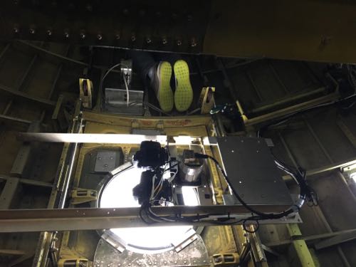
    DMS on P-3 Orion
    A picture of the DMS on IceBridge's P-3 Orion. It is located under the floor of the plane.
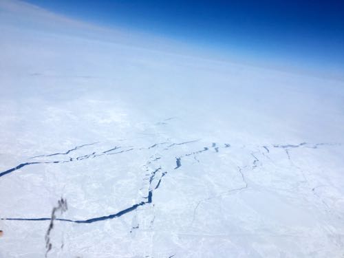
    Breaks in the Sea Ice
    Natural breaks in the Sea Ice.

    Author
    Date
    Weather Summary
    Cloudy over Greenland clear over Canada
    Temperature
    18 F

    Comments

    Guest

    What happens to the data in those areas where the team can't fly because of the weather? How can they compare it to previous years? I remember you mentioned there was another satellite apart from IceSat. Would scientists maybe rely on what they can get from this satellite for information on those regions?

    Max Wolfman

    Other than the weather, has there been any other factors that have hindered your trip and or the researching process. What caused them? If there has been factors that have hindered your trip, what can be done to ensure that it is prevented for the rest of this year's trip and future trips in years to come?

    Adeena Teres

    There are no other factors that have hindered our trip so far. Every once in a while one of the systems on the plane will have a glitch that has to be fixed. While I have been here, all of the problems have been minor and easily fixed. The plane can be very bumpy and none of the equipment in the plane is permanent, it is all removed at the end of each campaign. This non-permanence isn't a problem but it is one of the reasons the systems malfunction from time to time. The systems on the plane are put under a lot of stress. The will shake and the usual problem is that connectors will become loose.

    Adeena Teres

    In an ideal situation the team would get all of the baseline missions done because those are the most important. If a mission is missed then that flight would be a higher priority the following year. Missing one year isn't going to ruin the data and the team makes sure to get the areas it missed in the following years to ensure that they have a complete picture of what is occurring in the Arctic.