GPSA Global Positioning System (GPS) is a satellite-based navigation system used to track the location or position of objects on the Earth’s surface. Survey
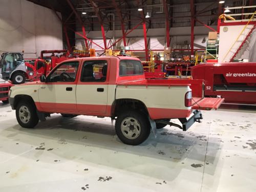
Sunday morning I had to wake up early and help with the GPSA Global Positioning System (GPS) is a satellite-based navigation system used to track the location or position of objects on the Earth’s surface. survey of the Kangerlussuaq Airport ramp. Ok, so I will admit that there was no 'had to', I wanted to go and see what a GPSA Global Positioning System (GPS) is a satellite-based navigation system used to track the location or position of objects on the Earth’s surface. survey was and see what it involves. The purpose of the survey is to validate the instrumentation of the P-3 Orion. The data has to be accurate or there is no point in collecting it. The GPSA Global Positioning System (GPS) is a satellite-based navigation system used to track the location or position of objects on the Earth’s surface. survey of the ramp measures the surface elevation of the ramp which is the flat area of an airport where the planes are parked. When the plane flies over the ramp, it will use the Airborne Topographic Mapper (ATM) on the ramp and compare the data collected from the ATM to the data from the ramp survey. This will ensure that the plane's data is accurate and has validity. Without accuracy and validation, the data is useless. To do the survey a GPSA Global Positioning System (GPS) is a satellite-based navigation system used to track the location or position of objects on the Earth’s surface. equipped truck is used. The truck is driven in a grid pattern over the entire ramp. After the survey is conducted the GPSA Global Positioning System (GPS) is a satellite-based navigation system used to track the location or position of objects on the Earth’s surface. data is analyzed and the exact elevation of the entire ramp can be determined.
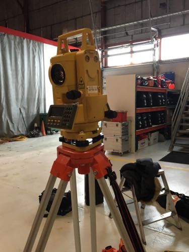
Before the survey can be done a total station was used to get the height of the truck. The point of the survey is to measure the height of the ramp. The device is on the truck so the height of the truck has to be taken into account when doing the survey. Each wheel of the truck may be at a different height, so each one is measured. By knowing the height of the truck it can be taken out of the equation when the data is being analyzed so the survey measures the true height of the ramp and the uneven height of the truck is discounted.


After the ramp survey was completed most of the IceBridge crew went to Russell GlacierA mass of ice that persists for many years and notably deforms and flows under the influence of gravity. to walk around. The hike to the glacier was about a mile and it was an easy walk. Driving to the glacier was a different story. On the way to the glacier the truck I was in got stuck in the snow. It was the first time I have ever been in a vehicle that was stuck in snow. I got out and helped by standing out of the way. The truck was pulled out of the snow drift and we were off to the glacier.
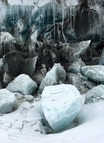
I was warned not to get too close to the glacier because it can be dangerous. When I was there I saw a piece of ice fall off the glacier. It was a small piece but it was amazing to see. I could hear the glacier making cracking noises and I could hear it dripping. The ice in the glacier was blue. This is due to the layers of ice within the glacier. On the way to the glacier we passed large formations of metamorphic and igneous rocks. IgneousRocks or rock processes produced under conditions involving intense heat, such as rocks of volcanic origin or rocks crystallized from molten magma. rocks are formed from lava or magma. Metamorphic rocks are formed from heat, pressure, or fluids and they change from their original composition. Kelly, a glaciologist, took a piece of the glacier. She didn't do this just because glaciers are cool. She put the ice into a glass, there are large bubbles in the ice and as the ice starts to melt the bubbles are released and you can hear it popping.


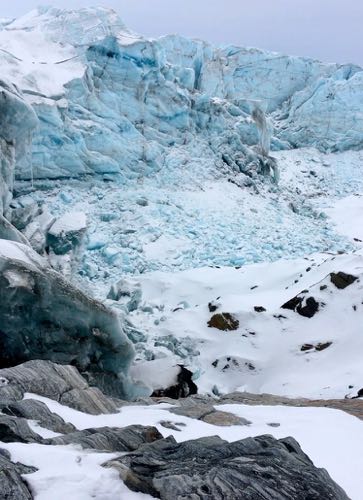
After walking up to one part of the glacier, we continued on to see it from another area. We climbed up a large hill to look down onto the glacier. It was a hard climb and I thought at some points I was going to fall off the side of the mountain. It was steep and between the ice and the loose rocks it was a challenge to traverse. When we got to the top of the mountain it was around 4pm. It was very cold and I could feel the chill. When I was right up next to the glacier I was warmer than I was on top of the mountain.
Here is a video of Russell GlacierA mass of ice that persists for many years and notably deforms and flows under the influence of gravity.. Make sure you listen to the sound of the glacier up close. You can hear it cracking and you can hear water dripping and running. It is amazing how much sound comes from a glacier.


Comments