Data Collection Continues

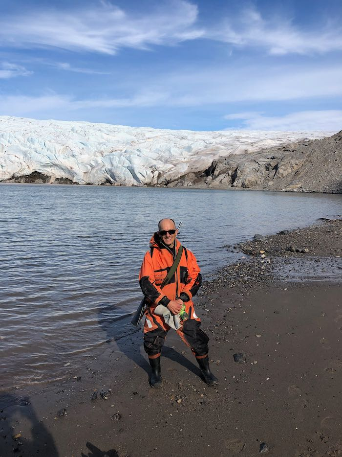
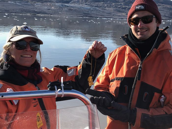
    Both yesterday and today we spent long and productive days on the fjord. The weather was gorgeous today! It was around 8°C (46°F) with very little wind and bright sunshine. We spent most of the day doing bathymetry (mapping the seafloor) which is very slow work, but with weather like this it was so pleasant to just be out on the water.
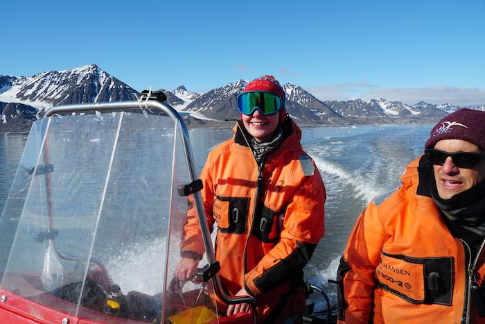
    Kelly drives the boat
    Kelly is becoming an expert boat driver for us all.
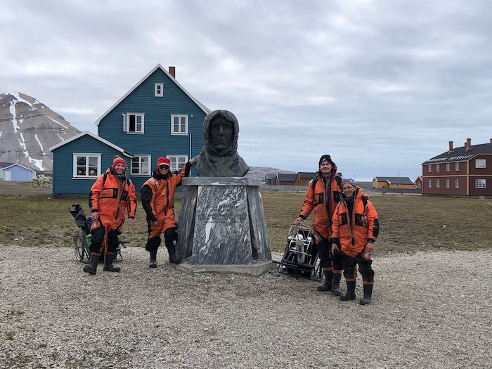
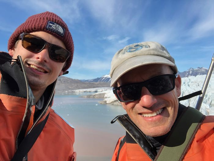
    posing in front of Amundsen statue
    We pose in front of the statue of Norwegian polar explorer Roald Amundsen. We pay homage to him every day, and this seems to be bringing us good fortune so far!
    We spent yesterday in front of Kongsvegen GlacierA mass of ice that persists for many years and notably deforms and flows under the influence of gravity. doing more bathymetry, CTDA research tool that is submerged in the water to measure conductivity (salinity), temperature, and depth. work, water sampling, and drogue launching (to get a sense of the water velocity in front of the upwelling plumes), and drone flying. I got a chance to fly along the edge of Kongsvegen, and up along its lateral moraine (the long pile of debris along the side of the glacier. (More edited drone videos coming in the next day or so!)

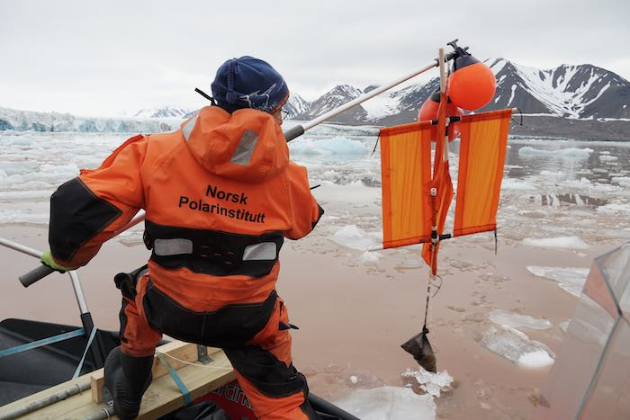
    launching the drogue
    I’m launching a drogue in the water which we’ll pick up again in a little while to measure the speed of the water coming off the glacier face (photo courtesy of Xander Kirshen).
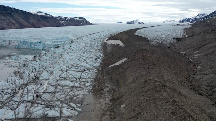
    Kongsvegen lateral moraine
    A drone shot looking up the lateral moraine on the side of Kongsvegen Glacier.
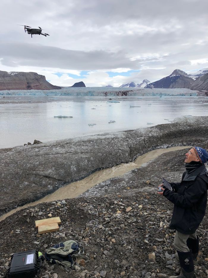
    flying the drone
    Me flying the drone while standing on Kongsvegen Glacier lateral moraine.

    The seafloor is taking shape

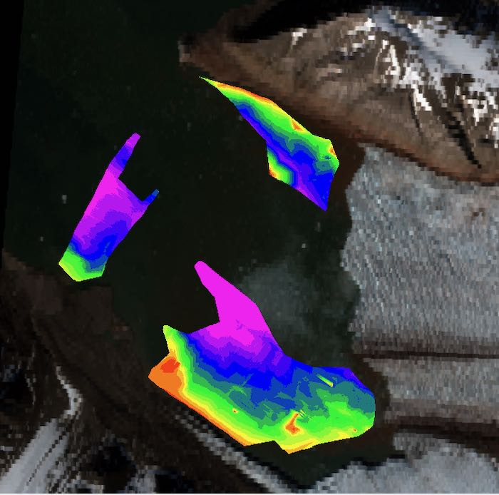
    The bathymetry work is really coming together. As of yesterday we had mapped three pretty large sections in front of Kronebreen and Kongsvegen Glaciers. Here’s a preliminary image of the data so far. You’ll notice a large section in the middle that we haven’t been able to map yet - that’s because it’s almost always chock full of icebergs that we can’t drive through!
    bathymetric map of Kongsfjord
    Preliminary bathymetric map in front of Kongsvegen and Kronebreen Glaciers (image courtesy of Kelly McKeon).

    Seeing the map emerge is really amazing. Although it’s depressing to realize that this area is newly exposed because of the rapid retreat of the glaciers (because of climate change), it’s interesting to realize that we may potentially be the first people to map some of this part of the ocean floor.

    Awaiting the surge

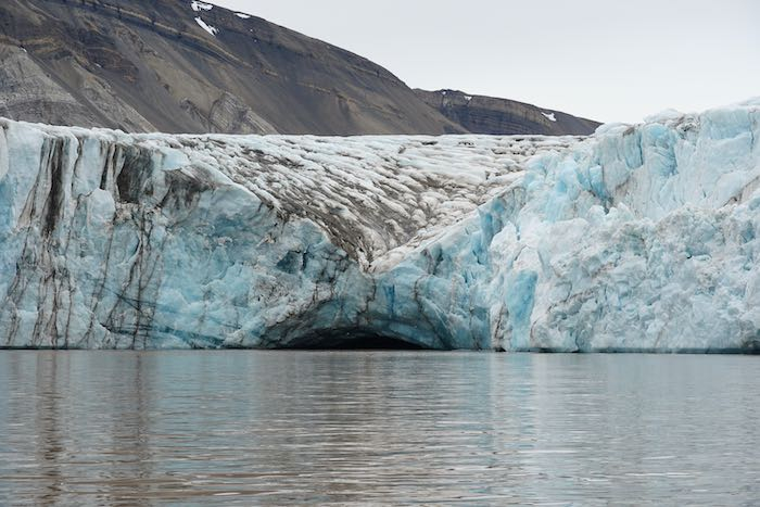
    We’ve been monitoring a large upwelling plume in front of Kongsvegen, that another research group here has also been watching carefully. They are interested in how glacial lakes drain, and there is a huge lake forming way up on the glacier which has not yet drained. If it does so in the next week, we’ll be watching that plume to see if that’s where the water will flow out. Where that spot is, looks like a cave that seems ready to collapse!
    Kongsvegen upwelling plume
    An upwelling plume area at the face of Kongsvegen Glacier (photo courtesy of Xander Kirshen).

    On to Kongsbreen

    Our work today was in front of the third glacier in our study area, called Kongsbreen GlacierA mass of ice that persists for many years and notably deforms and flows under the influence of gravity.. This glacier is smaller, and not as active as the other two, and much of the glacier is now grounded on bedrock above the water level. But it is still flowing forward, releasing plenty of sediment from a few different plume areas, and calving off icebergs. In fact, while we were there we witnessed a pretty spectacular calving event, which I was super lucky to capture on video!

    Just like the other two glaciers, it’s quite notable how much the glacier has receded since I was here ten years ago. I don’t have great photos from this area from 2011, but I’ll work on trying to illustrate this in a future post.

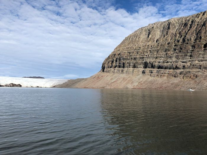
    I had some time to do a little drone flying today, which allowed us to view in more detail how water is flowing under Kongsbreen GlacierA mass of ice that persists for many years and notably deforms and flows under the influence of gravity. to create the sediment plumes. You can see how the sediment comes way out into the fjord in the picture below. To get the vantage point I wanted, Xander and I got out on the amazingly beautiful island of Colletthøgda between Kronebreen and Kongsbreen Glaciers, and then hiked up about 100 meters up to look over the glacier. (If you’ve been following my blog, last week when I had to do an emergency landing, it was on the other side of this island.
    Colletthøgda Island next to Kronebreen Glacier.
    The beautiful Colletthøgda Island next to Kronebreen Glacier. Xander and I hiked up the low part in the back, next to the glacier. The whole island is about 600meters (1800 feet) high.
    On Colletthøgda Island
    Xander and I on the island of Colletthøgda looking over Kronebreen Glacier.
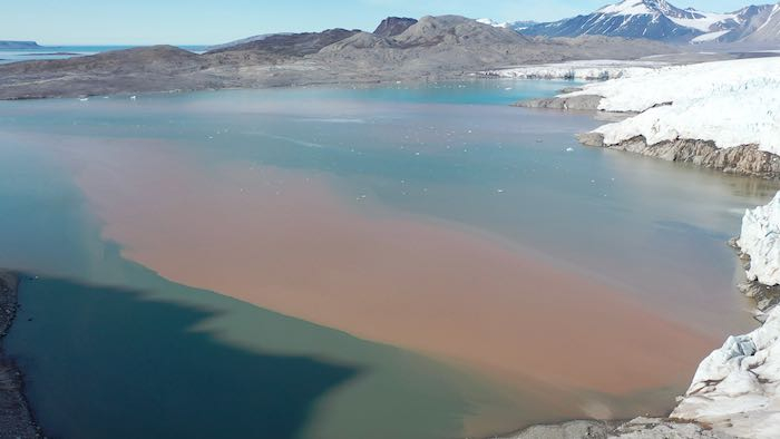
     Sediment plumes in front of Kronebreen Glacier
    The sediment plumes in front of Kronebreen Glacier are clearly visible as brown water.
    .
    Xander studying rocks
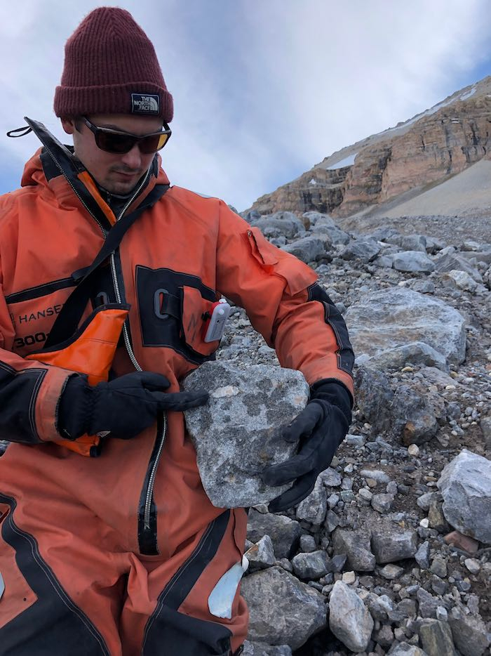
    Xander is really into rocks and rock formation, so we had a great discussion about geology on the way down from the drone flying!
    on the shore of Colletthøgda Island
    On the shore of Colletthøgda Island

    Looking back in time

    I was also able to do some flying on an island across from Kongsbreen GlacierA mass of ice that persists for many years and notably deforms and flows under the influence of gravity. that has only recently covered in glacial ice (less than 20 years ago). Although it’s depressing to realize how much ice has been lost, it’s another opportunity to visualize features that glaciers leave behind. Again it makes me think of what the Boston area probably looked like at the end of the last ice age, around 15,000 years ago!

    Check out this video I made from the drone footage I took today. My 7th graders might recognize the terms glacial erratics, glacial scarring and kettle ponds, all of which are visible in this video. Also visible are really interesting features called thrust ridges, which are deposits of sediment left behind when different sections of the glacier push up against one another and concentrate the deposits. You can see a cross-section from Kongsvegen GlacierA mass of ice that persists for many years and notably deforms and flows under the influence of gravity. here, and then you can see the deposits left behind in this photo.
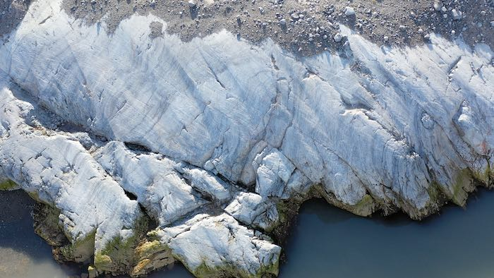
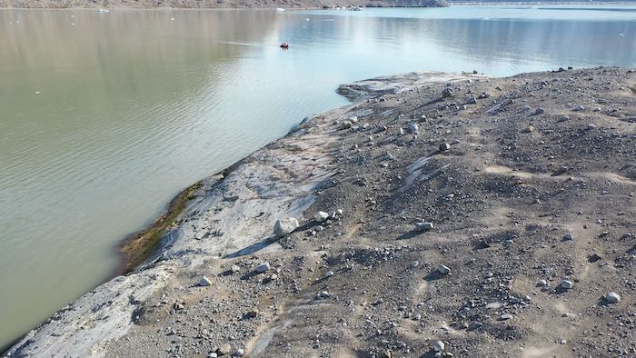
    glacial scarring
    Glacial scarring on recently deglaciated bedrock.
    glacial erratics
    Glacial erratics on recently deglaciated bedrock.

    Wildlife Sightings

    Yesterday as we were winding our way through the icebergs we saw several large bearded seals! Here is a video compilation that I made of several of our seal sightings.
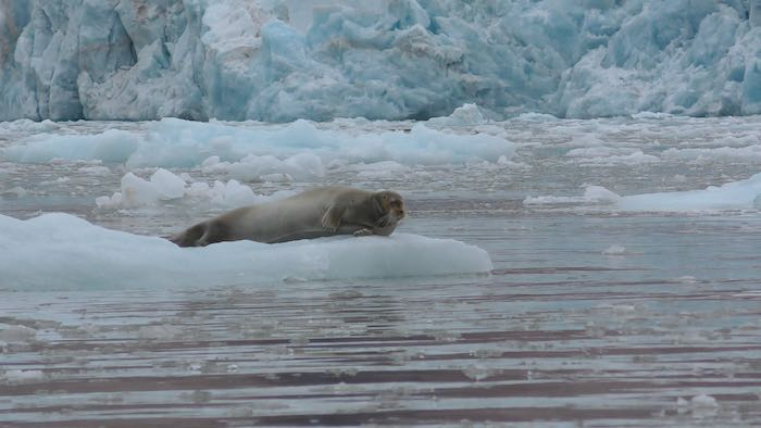
    bearded seal
    One of the many bearded seals we saw yesterday.
    While we’re on the topic of wildlife sightings, Kelly found some krill swimming around in our water samples as she was filtering them out! Here’s a fun little video I was able to take of a cute little krill swimming.

    krill from Kongsfjord
    A krill that was captured in our water sampler yesterday!
    I thought I’d add this nice image of a tiny piece of kelp that we found. There is a group here studying kelp and they don’t think the region in front of these glaciers is conducive to kelp growth because of the lack of large rocks on which they can attach. So we were surprised to find this! We’ll have to report it to that group to see if they want to study this further.

    kelp in Kongsfjord
    A kelp sighting in front of Kongsbreen Glacier!
    And one final funny wildlife story from this morning. There are several Arctic Terns who have been nesting in the ground in and around Ny Ålesund. They are super protective of their nests, and the males will come and attack people (or other animals) if they get too close. This is inconvenient for those of us in our dorm, because we have to walk right by one of the nests. As I was taking a video this morning of one of the birds, and got attacked! It’s a goofy video which resulted in my falling down and getting pooped on! But aside from a bruised ego I am no worse for wear. (Pro tip: don’t try to video terns while they are attacking you...) Anyway, here’s the video!

    Author
    Date
    Location
    Ny Ålesund, Svalbard
    Weather Summary
    Sunny and warm
    Temperature
    8°C (46°F)
    Wind Speed
    1 m/s

    Comments

    John S.

    Hello Mr. Goldner,

    I think you mentioned the terns when you told us about the trip in school. I also saw a seal on Nantucket a few weeks ago. Also, how wide is the beam from the bathymetry? If you angled it could you effectively "see" under the icebergs? Do you know the average height of the glacier?

    Mark Goldner

    Hi John, these are good questions! The beam from our sonar isn't that wide, so we can't map very large regions, and the process ends up being quite slow. However, there is another scientist up here who has what is called a multibeam sonar device that can measure depths over a wider area. And, in fact, he has done exactly what you suggested - to angle the device sideways to look at the face of the glacier underwater! I'm hoping to get permission to share some of his photos, because they are very cool! We can actually see where the subglacial streams exit the glacier in some places!

    The average height of the glacier is around 50-70 meters high (which I'm getting from the altitude reading from the drone). That's around 150-210 feet.

    Charlotte Pappas

    Hello Mr. Goldner,

    Foremostly, it was interesting reading your post, and I was especially surprised when I read about the island across from Kongsbreen Glacier you were studying, and how that island used to be covered in glacial ice less then 20 years ago, which is not a long time, when you think about that glaciers used to cover the Boston area around 15,000 years ago. Therefore, I am inferring that the glacial ice melting on that island must have occurred very rapidly, as it took less than 20 years to be completely gone. I also think that the reason why the glacial ice melted was because of climate change, and its affect of rising the temperatures the Arctic. Also, I am now wondering if other areas in the Arctic that recently used to be covered in glacial ice have melted and now have no glacial ice on them?

    Additionally, I also watched your video of the bearded seals that you saw, and I noticed that the bearded seals spent a lot of time on the ice, but also some time in the ocean swimming, and they appeared interesting. Hence, I did some additional research about bearded seals, and I found that they live in relatively shallow parts of the ocean that are less than about 1,600 feet deep, and eat a variety of invertebrates, including shrimps, crabs, clams, and whelks. I also learned that male bearded seals vocalize during the spring breeding season using four types of calls, which are trills, ascents, sweeps, and moans.
    Moreover, I am now further wondering if bearded seals, or any other animals, live on glaciers, or have any relationship with glaciers?

    That is all of my thoughts for now.
    Charlotte

    Mark Goldner

    Hi Charlotte! As usual I am really impressed at your thoughtful comments! I'm glad you are enjoying the blog and that you are taking the opportunity to go out on your own to learn more.
    I agree with your wondering about how different organisms depend on glaciers and icebergs for their survival. Your question makes me think a lot about how interconnected our world is. The geology (ice, rocks, sediment, water) are important for organisms (like seals, polar bears, marine organisms, different bird species, etc.). What happens to those organisms when the ice disappears...? (And we haven't even mentioned the microbial life that must exist at the bottom of the food chain.)
    This is definitely important for scientists to look into, and I don't know what research done about these connections. So thank you for raising the topic!

    Nathaniel Kelly

    Hi i was wondering how bathymetry works, what tools you need to do bathymetry and how long it takes to do? Thank you, Nathaniel

    Mark Goldner

    Hi Nathaniel, The way the bathymetry equipment works is through sonar. A beam of sound (you can hear it!) is sent towards the seafloor every second, and when it reflects back, the echo is recorded. Based on the time it takes for the sound to return (and knowing the speed of sound in water) the device calculates the distance the sound travels. It's the same principle by which bats and dolphins navigate through echolocation. Our bathymetry device is also connected to a GPS unit, so the GPS location is then tagged with a depth. The work is pretty slow going, because we can't drive very fast through the water or the device won't record data correctly. So it's taken us about 10 days of measurements to get a sense of the seafloor depth in front of the glaciers. And we weren't able to completely finish, because the past few days the fjord was so full of ice that we couldn't navigate through the ice without damaging the equipment. And we are leaving here tomorrow:(

    Erin Towns

    I appreciate the way you are illustrating what you are talking about in varied ways. The photographs and drone imagery and video are fascinating. And to be attacked first thing in the morning by Terns. Nice that you had the camera with for that action. Thanks for the laughs.

    Sofia Ugalde

    Hello Mr. Goldner as you already know I was at your zoom/live meeting and I’m glad you're enjoying your time as well as all the other scientists over there.
    As well, an idea I got from reading this journal is that it must be amazing to travel and study animals you don’t get to normally see on a normal day. I envy you for getting to see so many animals but I’m happy here back in Boston. Also not so long ago I went to a beach in Main called “York Beach” and I got to see and study some crabs, snails, skrill, and lobster.

    A ‘THICK’ question I have for you is where is a good place close to Brookline for me to go to study some biology (for myself). As for my second and last ‘THICK’ question, what is the most amazing and rarest animal you got to see?

    -Good Day Sofi Ugalde
    P.S. Could you share some of your studies from everything going on there?
    P.P.S. Tell the scientists over there hello for me please

    Mark Goldner

    Hi Sofia, thanks for your comment. It was great to see you at the Zoom presentation on Monday! I agree that one of the very special things that I'm able to do is to see wildlife that I don't get a chance to see in my everyday life. I think seeing a mother polar bear and her cub was definitely a highlight, as well as seeing a fox trying to prey on geese. These are certainly animals that you never would see in New England, and I was lucky enough to capture both of those events on video.

    There are lots of camps and programs where young people can study biology in the summertime, so let's talk as next summer approaches and I can help you find an interesting program. The New England Aquarium also has some volunteer programs for teenagers that you might want to look into. (You might need to be 14 to do that.)

    I will definitely share what we find with my classes next school year (and Mr. Miller's)!

    Cedar Alcott

    Hi Mr. Goldner,

    Reading about the bright sun made me think: are the animals affected by the never-ending days of sunlight? I know all animals have a circadian clock that could be disrupted. Specifically, the nocturnal animals who also hibernate. They are awake during the warmer seasons, but the warmer seasons have 24 hours of sunlight. I'm curious if the nocturnal rhythms of these animals get disrupted by the never-ending sunlight.

    Mark Goldner

    Hi Cedar, your question about how different animals are adapted to different amounts of daylight is really interesting. I don't know much about this topic specifically, but many animals are well adapted to the extreme changes in light as the year progresses. Some animals, such as some bird species, may sleep very little as they take advantage of the 24-daylight to forage for food, build nests, etc. Other animals, such as reindeer, apparently show little or no difference in their sleep habits as the light conditions change throughout the year.

    Asher

    I noticed that you saw a few animals, and I was wondering if you had a favorite (probably not the birds lol). Was there even a natural sight that caught your eye? tell me about what you liked most about your trip so far.

    Mark Goldner

    Hi Asher, I think my favorite wildlife sighting was watching an Arctic Fox try to prey on some Barnacle Geese, while being harassed by some Arctic Terns. It was a dramatic moment of interaction between different species and really made me think about how difficult it is for animals to make their living up here because the conditions are so harsh. If you missed that blog post, here's a link to the YouTube video where I filmed the whole encounter.

    Abigail Jackson

    I think it's cool to see the map of the sea floor with so much of it done and how all the effort that you and your teem put into it really made it come together nicely. When the air was 8 degrees c how cold was the water? Also, I was wondering if when the sonar goes down and you get the echo how do you know how deep it is?

    Mark Goldner

    Hi Abigail, thanks for your thoughtful questions. It's interesting that the water temperature stayed quite cold - between 3°C and 5°C the whole time we were there. The temperature of the water stays cold even as the air temperature rises in the summer. This is mainly due to the effect of the very cold water flowing off the glacier. We thought we would see the temperature rising a little as water from the Atlantic Ocean moves in - which it does every year - but we didn't see any evidence of that happening.

    The way the echo sounder works is that the speed of sound is known - about 1500 meters per second in seawater. Since the speed is calculated by the distance divided by the time, you can calculate the distance that the sound travelled if you know the time by using the formula Distance = Speed X Time. In this case, distance is the depth. The software on the computer connected to the echo sounder does the calculation for us. There is some variation in the speed of sound based on salinity or temperature, so there is probably some uncertainty in the data because of that.

    Andrew Liu

    Hi Mr.Goldner,

    I was wondering, what are some of the other animals that live in the arctic, and how do they interact?

    Andrew

    Mark Goldner

    Hi Andrew, while we weren't there to study wildlife, there was plenty of wildlife to observe! The main animals that we saw frequently were Arctic foxes, bearded seals, polar bears, reindeer and barnacle geese. Also many other species of birds - fulmars, kittiwakes, puffins, skuas (just to name a few!). Further out in the fjord, closer to the open ocean it is not uncommon to see whales and walruses. As you might know, the polar bears are at the top of the food web. Although they prefer marine mammals (seals, mainly), they will also eat other animals if they have the opportunity. The foxes tend to prey on birds and their eggs. Most of the birds feast on tiny animals like krill.

    Daniel Rosen

    Hi Mr. Goldner, why do you think the different layers of the bedrock are different colors? Also, were there any animals you saw there that are similar to ones here?

    Daniel

    Mark Goldner

    Hi Daniel, great observation! The bedrock is different colors because there are different layers that formed - over hundreds of millions of years under very different conditions. For example, there are many layers of sedimentary rock which formed under an ancient ocean. On top of those are some igneous rocks which formed when a volcano erupted and the magma cooled. Then, all those layers were lifted up by what are called tectonic forces onto the land as you see them now. It's crazy to think that the Earth has changed so much over hundreds of millions of years - that there were once volcanoes in this region, and even forests at one point. Last time I was here (in 2011) I found a fossil of a broad-leafed tree! It's amazing to think that the region has changed so much that there were once broad leafed trees growing here!

    The animals we saw up in Svalbard were quite different from anything we'd see here, because they are adapted to a much colder and drier climate than we have here in New England.

    Paige Hammond

    Hi Mr. Goldner,
    I was looking at the photo of the cave you saw. I was wondering if it was possible to fly a drone to see inside it. I know this is probably a bad a idea because the cave will collapse on it but is there anything to see inside the cave? Like any wildlife? or is it just ice.
    I was also wondering if the seal you saw had predators like they do here. I know that seals here get eaten by sharks, so I was wondering what predators seals had there.
    -Paige

    Mark Goldner

    Hi Paige, I have to tell you, I was very tempted to fly the drone inside the cave to satisfy the same curiosity you have! But since the drone costs about $2000, I decided it wasn't worth the risk of collapse. I would have been very interested in seeing how the water flows into to cave from below.

    The seals' main predators up there are Polar Bears. We never saw any Polar Bear attacks, but they do happen frequently.

    Ytien Liu

    Hey Mr. Goldner,

    Sorry for getting to you so late, but I had a few questions and wonderings after reading your journal entry. First off, about the bathymetry, what information does the bathymetry include, like are there other purposes for the bathymetry? In addition, I would like to include another question about the bathymetry, how is bathymetry data collected?

    Furthermore, I would like to know what is the impact glaciers have on the plant life around? Also, how does clear blue ice form on glaciers?

    Mark Goldner

    Hi Ytien, thanks for your questions! The main way that the bathymetry works is that a sound wave is send from a device called a transducer, and then that sound bounces off the seafloor and the echo is recorded. Then, the device determines the time it took for the sound to travel to the seafloor and back. Knowing that the speed of anything is determined by Speed = Distance ÷ Time, then Distance = Speed x Time. Since we know the speed of sound in water, the device then calculates the distance. Also, the device is connected to a GPS unit (to record the exact location) and a computer. When we got back to the research base, Kelly would upload the data into mapping software, which creates a map using the GPS coordinates and the depth. Since we aren't measuring every single point, the software does something called extrapolation where it fills in the missing points. (Sort of like a connect-the-dots game!) This, of course, means that there are points where we aren't exactly positive what the seafloor depth is, but the more data you have the more reliable the map is.

    The glaciers have a huge impact on life in the ocean, because it is bringing lots and lots of sediment into the fjord, which serves as nutrients for some plants, animals, and micro-organisms. Also the sediment can prevent some plants from growing because the murky water prevents light from penetrating into the fjord. We are curious what will happen in the future as glaciers retreat and less sediment comes into the fjord - how will that affect the growth of plants?

    The blue ice is an interesting phenomenon that occurs when the ice forms. Glacier ice forms when snowfall accumulates over many years and compresses into ice. The reason snow is white is because almost all the colors of the spectrum are reflected. Normal ice (like what might form on a lake) is generally pretty clear, because most colors of light can pass through it. When the ice gets super compressed over hundreds or thousands of years, this changes the structure of the molecules in the ice, so they no longer let all those colors through. The color that makes it through most easily is blue, so that's why glacier ice appears blue! As the ice is exposed to air (such as at the front or top of the glacier, or on icebergs), the ice begins to expand and it reverts back to its white color.

    Mae

    Hi! I hope you have had a great summer! I was just wondering a few things. What kind of birds are there and what makes them so Aggressive? I was thinking that they could be some kind of Siegel, but then I realized that it would be to cold. Thank you so much! I have learned some much from your blog!

    Mark Goldner

    Hi Mae, thanks for your question. I guess you're referring to my encounter with the terns the morning that I wrote this post. The Arctic Terns are heavily preyed upon by Arctic Foxes. Because there are no trees or much protected places to nest, they must nest in the ground. That leaves their eggs and chicks very exposed to being hunted by the foxes. One researcher I spoke to said there were around 50 eggs laid this year in Ny Ålesund, of which only 2 survived! With those kind of odds, you can imagine that they will try to protect themselves in any way they can! Therefore they are very aggressive towards any animal that comes close to their nests. (Fortunately Terns can lay eggs several times throughout the summer, so that helps keep their numbers up.)

    Emery La

    Hi Mr. Goldner, What type of wildlife did you find in the arctic? I saw that you saw some seals and arctic turns, but was there any microscopic creatures? Did you make any new wildlife discoveries? I think that it would be really cool to have made a new discovery, because we have only discovered 5% of the ocean.

    Mark Goldner

    Hi Emery, you're right that there's so much undiscovered in the ocean. However, we weren't studying wildlife, so that wasn't part of what we were looking for. We did see some krill swimming around when we were filtering the water (not really microscopic, but close!) Check out this little video I took of krill swimming around in the filtering apparatus.