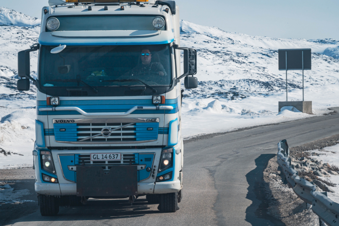
In Greenland there are no railroads or inland waterways and very few roads. There are 90 miles worth of roads in total, only 40 miles of them paved. There are 75 cities and settlements that are spread out mostly along coastal areas that are only accessible by boat, dog sled, or helicopter. According to Greenland's official tourism site, Greenland is the world's biggest island with a total land area of 2.16 million square kilometers or 836,330 square miles. Maine in comparison, according to it's government website, has 90,000 square kilometers or 33,215 square miles and 488 cities and towns. According to the Maine Department of Transportation, today there are over 21,000 miles of roads in the state, most of them paved. The Maine Forest Service reports that the state has an estimated 17.52 million acres of forest land covering 89 percent of the land area. The Qinngua Valley, located in southern Greenland, is home to the only natural forest here.


The Western Greenland Ice Sheet covers 80% of this island country and as such, it determines everything about settlement, employment, life, and travel. Today Dr. Das, PASSCAL polar engineer Kirsten Arnell, and I worked on the ice sheet placing seismic tremor array stations according to specific GPSA Global Positioning System (GPS) is a satellite-based navigation system used to track the location or position of objects on the Earth’s surface. coordinates.

Have Some Wind

There are two specific things that stand out in my mind when I think of the first time traveling to and landing on the ice sheet. The first was the sound of my heartbeat sitting in the front seat of the A-Star helicopter as it was about to take off down the short runway of the Ilulissat Airport. In all of my travels around this globe I have never had the opportunity and although I have experienced plenty of nerve wrenching experiences abroad, it never goes away when faced with something new. I was struck by the smoothness of the ascent and in awe when I saw the first glimpses of the environment from above. It was jaw dropping to say the least and a wave of gratitude for life and this program washed over me in that moment for sure. The second thing that stood out in my mind was the moment we were touching down and seeing the wind and sun blowing snow and reflecting light everywhere. My eyes quickly landed on the cache of boxes left from the other team's previous session (our team has been split into two shifts on alternating days due to limited helicopter space), complete with large snowdrifts covering everything. What I heard first upon landing came through the headset from our researcher Dr. Das stating matter of factly, "Get out the goggles. It's going to be that kind of day." She was not kidding. The wind was the first obstacle to get the mind around.
We had been trained that the first order of business upon landing was to cover every part of skin showing to avoid frostbite. Moving around posed difficult with the weight of base layers, fleece, outer shell, heavy parka, thick socks, snow pants, work gloves inside of heavier gloves, climbing harness (crevasse safety protocol), one hat, three hoods, annnd the goggles. It definitely took some time in the first hour to get used to it and was a total workout in itself. Kirsten and Dr. Das, both seasoned professionals, modeled how the day would go immediately, getting down to business and giving me the first of the tasks that I would be part of for the entire day.
Installing Stations

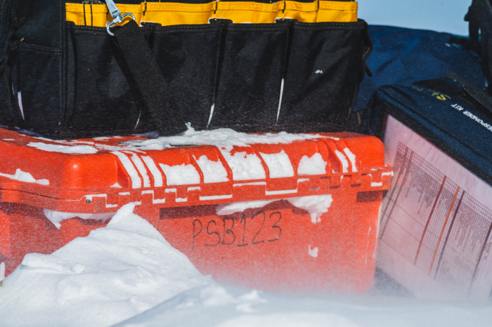
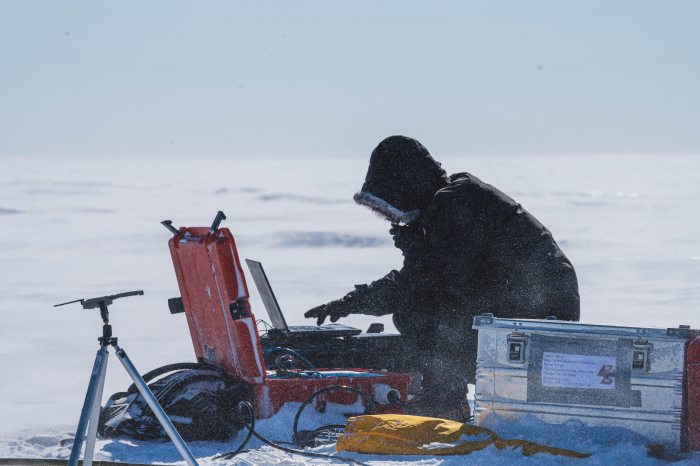
Seismic tremor array systems have individual stations that are set up according to carefully spaced GPSA Global Positioning System (GPS) is a satellite-based navigation system used to track the location or position of objects on the Earth’s surface. positions. Each station includes an orange MEVO box, seismic sensor, and solar panel attached to a GPSA Global Positioning System (GPS) is a satellite-based navigation system used to track the location or position of objects on the Earth’s surface. antenna. Our goal was to install four stations in one day. That goal was somewhat constrained by what we could take with us flying around the array area. The distance between stations were roughly a quarter mile. Each array includes nine stations. My job was to assist in the drilling of jiffy holes into the ice sheet about four feet, and next kovacs holes another four or five more feet to stabilize the sensor that needed to be buried. The sensor collects the actual data and the kovacs hole and pole the sensor is connected to roots it into the ice sheet. The Jiffy Drill is familiar to me thanks to numerous days I have spent ice fishing with friends on Maine lakes in the winter. Drilling with wind and the five million pounds of clothing on made for a great workout and feeling the burn of it as I sit here this morning typing this journal. Digging snow out of the hole by laying on the ice and reaching arm down as far as possible achieved this with average results at times making it necessary to re-drill. Lowering the sensor carefully in the hole and orientating it towards true north because when the scientists retrieve data from sensor, they need to know direction in order to analyze the data well. At the same time as the drilling and ice and snow removal was going on, our engineering friend Kirsten was busy attaching cables, hooking up the solar panels, GPSA Global Positioning System (GPS) is a satellite-based navigation system used to track the location or position of objects on the Earth’s surface., and making sure data was coming through. I watched her calmly taking notes on a piece of paper while the wind blew around her mercilessly like it was nothing. She typed the data into her laptop with gloves on. This is what she is used to working in as someone who has a dedicated career that puts her in polar regions. Meanwhile my job included using a screwdriver to bang against cold metal to get it unstuck while changing out drills a few thousand times and then filling the hole up with finely powdered snow on top of the placed sensor. Next came repacking everything up, carrying drills and Kirsten's boxes (containing tools, etc) back to helicopter, and jumping to the next station. Our best time of the day on an install was under an hour, which given the wind, wasn't too shabby.
For The Visually Minded
If you had issues following anything above, or if you are a student and stopped paying attention after the first line of the section above, here is a photographic guide to installing a seismic array station on an ice sheet.


Lessons
The physicality of working in the field in polar science is tremendous. Being smart and alright in cold and harsh conditions are requirements for this career for sure. Being able to lift and carry heavy things over distance and dealing with a variety of uncomfortable things like jammed fingers that come along working with cold equipment, drills, and assembly of all kinds are non-negotiable. It's a long way to the top if you wanna rock n' roll in polar science folks.
Student Corner

What questions do you have for engineer and scientist Kirsten Arnell about working on an ice sheet whether in the Arctic or Antarctic?


Comments