PermafrostPermanently frozen ground.: What Is It and Where Do We Find It?
PermafrostPermanently frozen ground. is soil that is frozen (below 0 degrees Celsius) for two years or more; much of the northern hemisphere permafrost has been frozen for tens of thousands of years. Almost 25% of the land mass of the northern hemisphere consists of permafrost (8.8 million square miles). It comprises vast areas of Siberia (Russia), Greenland, and Canada as well as large portions of Alaska and Norway. There are mountainous areas in Asia that have extensive permafrost as well. You can see a map of this information at http://gtnp.arcticportal.org/resources/maps/12-resources/39-other-maps.
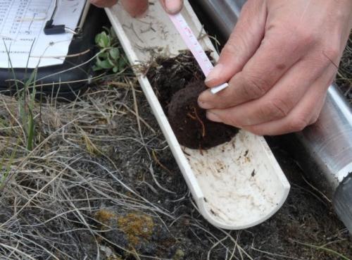
Soil can always be characterized by layers. In the case of permafrost, there is an active layer of thawed soil in the summer. This is made up of minerals and organic material including roots, microbes, insects, and decomposing material. This layer varies in thickness, depending on the type of soil. Sandy soils here can have an active layer that is meters deep, while peaty soils (those that contain more organic matter) may be as little as 20cm (8 inches) deep. That means there is little room for roots to grow. It also means that dead plants and animals take a very long time to decompose.
Signs of PermafrostPermanently frozen ground. from Above the Ground: Polygons
One interesting effect of having frozen subsoil is Arctic or tundra polygons.
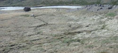
These shapes can be 3-20 meters (10-70 feet) across. They form when the soil dries in the summer, and cracks form. When water drips into these cracks and then freezes, it forces the cracks to widen. (This is because when water freezes, the molecules form rings which take up more space than the molecules do as liquid water.) As the ice melts and water accumulates and refreezes year after year, the columns of ice, called ice wedges become wider and longer. Up on the tundra you can see the outlines of the wedges that have formed below, and these are the polygons.
What Can PermafrostPermanently frozen ground. Tell Us?
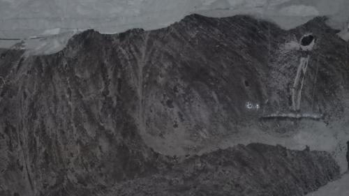
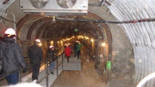
At the U.S. Army Corps of Engineers PermafrostPermanently frozen ground. Tunnel near Fairbanks, Alaska a tunnel was driven into a hillside more than fifty years ago. Walking through the tunnel is like walking through a time capsule that lets us see 20,000-year-old frozen plants and extinct animals, ice wedges, and frozen microbial life (with a microscope); it helps us to understand permafrost and the secrets it holds.
What Happens When PermafrostPermanently frozen ground. Melts?
Buildings, roads, and pipelines fall down when permafrost melts because their foundations are suddenly on soft soil instead of a hard, frozen surface. Sink holes form too. The organic matter (material that is or was once alive) that is frozen in the soil is storing the carbon that the organisms were made of. When the permafrost melts, the organic materials will begin to decompose and release carbon dioxide. Much of this carbon dioxide will be released into the atmosphere where it is likely to increase global warming. On the other hand, some may also increase the the number and size of photosynthesizing plants who will use up some of the newly released carbon dioxide rather than releasing it into the atmosphere. This is an important area of research throughout the Arctic.
Another gas that is released when permafrost melts is methane; the bubbles are trapped and observed when a temporary layer of water ice forms over a layer of melting permafrost. Since methane is 25 times as potent a greenhouse gas as carbon dioxide is, this is something that is of great concern and is also the subject of Arctic research.
Some of the other PolarTREC teachers are working on permafrost research and the effects of permafrost thaw. Take a look at the journals being posted from Alaska and Siberia!
Acknowledgement: Thank you to Rebecca Finger for references, websites, and graphics!
Flag of the Day


Comments