Welcome to the Virtual Base Camp, the starting point for your exploration of the polar regions with PolarTREC teachers and researchers!
2016 Expedition Timeline
Expeditions
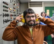
CosRay Neutron Monitors
What Are They Doing?

We will be performing maintenance on the neutron monitors. The neutron monitors are used to study the sun, which occasionally undergoes solar storms that produce bursts of energetic particles. We are interested in learning more about the energy range and abundance of the particles produced in these events, which is important for understanding how to protect electronics and the electrical grid from extreme space weather events.
¿Qué están haciendo?
CosRay: Monitoreo de Neutrones
Nuestro trabajo consistirá en dar mantenimiento a los monitores de neutrones. Estos sensores son utilizados para estudiar al sol, el cual produce ocasionalmente tormentas solares en las que emite partículas de gran energía. Nos interesa aprender más sobre el rango energético de éstas partículas, asi como sobre su abundancia, ya que esto nos permitirá predecir mejor las tormentas solares y así podr proteger equipos electrónicos y las redes eléctricas acá en la tierra.
Monona, WI
United States
Expedition Map
Weddell Seals in the Ross Sea 2016
What Are They Doing?
")
The team will travel daily to Weddell seal haul out sites on the sea ice near McMurdo Station. While on location, the team will find female seals that they had handled approximately two months earlier, and recapture the females to assess changes in their health, condition and behavior over the summer months. To do so, the seals will be captured and sedated. Once sedated, the seals will be weighed and measured (length and girth), have blood and tissue samples collected, and their molt status assessed. In addition, imaging ultrasound will be used to determine if the females are pregnant, and -0 if so - the size of the fetus will be measured. They will also take thermal images of the seals to see how much heat the seal is losing to the environment. Time-depth recorders that had been deployed earlier in the summer will be recovered, and the diving and foraging behavior of the seals during the past two months examined. The team will return the next season in an attempt to relocate the seals and determine if the seals have pupped.
In addition, the team is doing range-wide surveys of all the seals in the area to determine the timing and progression of the molt (when it starts, how long it lasts). During each survey the molt status of all seals seen is recorded, and the status referenced back to the timing of pupping and reproductive activities to determine if females that finish lactation earlier start molting earlier.
The project's overall goals are to learn more about what drives the timing of a seal’s critical life history events – such as breeding and molting – and how disruptions in that natural cycle by changes in climate and environment might affect the world’s southernmost mammal.

Memphis, TN
United States
Expedition Map
Operation IceBridge Arctic
What Are They Doing?


Coal Township, PA
United States
Expedition Map
Climate Change and Pollinators in the Arctic 2016
What Are They Doing?

This work can have important pan-Arctic and global implications. The majority of flowering plants in nature and one third of our crop plants depend on pollinators to produce fruits and seeds. As temperatures rise in the Arctic, successful adaptation and range expansion of many plants, including plants migrating into the Arctic, will depend on pollinators. This study will help us determine which mechanisms may most strongly drive changes in plant-pollinator interactions and plant reproduction.

Hudson, OH
United States
Expedition Map
Microbial Changes in Arctic Freshwater 2016
What Are They Doing?


Los Angeles, CA
United States
Expedition Map
Vegetation Impacts on Permafrost
What Are They Doing?


Cheektowaga, NY
United States
Expedition Map
Chukchi Sea Borderland
What Are They Doing?


Exmore, VA
United States
Expedition Map
Arctic Sunlight and Microbial Interactions 2016
What Are They Doing?

Team Announcement: Due to unexpected circumstances, Ivy McDaniel will not be going to the field this season with the research team.
Tremendous stores of organic carbon frozen in permafrost soils have the potential to greatly increase the amount of carbon in the atmosphere. Permafrost soils may thaw sporadically and melting ground ice can cause land-surface sinking called "thermokarst failures". These failures change the rate and amount of carbon released with the unanticipated outcome being that soil carbon can be mixed-up from a depth and exposed to sunlight as the land surface is altered. Sunlight can photo-degrade or break-down organic carbon and alter the carbon's ability to support bacterial respiration to produce carbon dioxide. Whether sunlight and UV exposure will enhance or retard the conversion of newly exposed carbon to carbon dioxide is currently unknown—this study is providing the first evidence that this alteration will be amplified by photochemical processes and their effects on microbes.
The research team is trying to understand exactly how sunlight and bacteria degrade dissolved organic matter by determining how fast these processes convert newly released dissolved organic matter to carbon dioxide, compared to dissolved organic matter already in surface waters. The team is accomplishing their research objectives with a series of laboratory experiments to determine rates of photodegradation and microbial processing of dissolved organic matter from different sources, and a series of landscape comparisons and sampling transects to characterize dissolved organic matter degradation in small basins and large rivers extending from the headwaters to the Arctic Ocean. Ultimately, this research will attempt to answer questions such as whether carbon export from tundra to oceans will rise or fall and how reactive the exported carbon will be. The team hopes to be able to measure the ultimate impact of impending disturbances, including climate change, on the net carbon balance of the Arctic and its interaction with the global carbon cycle.

Chicago, IL
United States
Expedition Map
Carbon Balance in Warming and Drying Tundra 2016
What Are They Doing?

More information about the project can be found here: https://www2.nau.edu/schuurlab-p/index.html

Albuquerque, NM
United States
Expedition Map
Deep Roots
What Are They Doing?


Chicago, IL
United States
Expedition Map
Southern Ocean Diatoms
What Are They Doing?


Quincy, MA
United States
Expedition Map
Ice Shelf Flow and Fracture Dynamics
What Are They Doing?

The SZ provides a critical amount of lateral support for the RIS. A potential weakening of this area could reduce the amount of backstress provided by the RIS on inland ice which would increase the flux of ice across the grounding line and thereby accelerate the ice sheet’s contribution to sea level rise. Logistic support of the US Antarctic Program’s South Pole station also relies on an overland traverse from McMurdo which must cross the SZ. Our work will provide a means of predicting future SZ behavior and provide a timeframe to plan alternative routes if necessary.

Longmont, CO
United States
Expedition Map
Polar Gigantism in Antarctica
What Are They Doing?


Friday Harbor, WA
United States
Expedition Map
Operation IceBridge Antarctica
What Are They Doing?

Denver, CO
United States
Expedition Map
Ice Cube Neutrino Observatory 2016
What Are They Doing?

All neutrino detectors rely on observing the extremely rare instances when a neutrino does interact with a proton or neutron. This transforms the neutrino into a charged particle of the same type as the neutrino flavor (electron, muon, or tau). Muons are charged particles that can travel for 5-10 miles (8-16 kilometres) through matter depending on their energy, and generate detectable light in translucent media.
IceCube is made up of thousands of sensitive light detectors embedded in a cubic kilometre of ice between 1450 m and 2450 m below surface. The sensors are deployed on strings in the ice holes that were made using a hot water drill. IceCube detects about 100,000 neutrinos a year, and has a projected life time of two decades. The data collected will be used to make a "neutrino map" of the universe and to learn more about astronomical phenomena, like gamma ray bursts, black holes, exploding stars, and other aspects of nuclear and particle physics. However, the true potential of IceCube is discovery; the opening of each new astronomical window leads to unexpected discoveries.

Arlington, VA
United States
Expedition Map
Tough Tardigrades
What Are They Doing?


Orem, UT
United States
Expedition Map
Antarctic Neutron Monitors For Solar Study
What Are They Doing?


Rochester Hills, MI
United States