Welcome to the Virtual Base Camp, the starting point for your exploration of the polar regions with PolarTREC teachers and researchers!
2007 Expedition Timeline
Expeditions
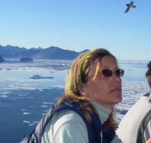
Oden Antarctic Expedition 06
What Are They Doing?
The scientific objectives of the cruise were to collect a range of data in rarely traveled areas of the Antarctic seas and coastline, including the Bellingshausen, Amundsen, and eastern Ross Seas. International science teams worked alongside teachers and other personnel monitoring wildlife, including pinnipeds, cetaceans, seabirds, and penguins; surveying sea ice and meteorological conditions; mapping the chemical, thermal and bathymetric properties of the ocean; and measuring the abundance of plankton and nutrients in the ocean. These studies helped add to our limited knowledge of these remote corners of the Antarctic and allow future researchers to expand their monitoring efforts in these regions.

Brownsville, TX
United States
Expedition Map
SEDNA Beaufort Sea Ice
What Are They Doing?
Mr. Harris and Dr. Geiger joined an international team of scientists on the SEDNA project, working north of Alaska on the drifting pack ice of the Beaufort Sea. SEDNA was an International Polar Year (IPY) project; the goal of the project was to develop a deeper understanding of how the atmosphere, ocean, and sea ice interact and influence the mass balance of sea ice cover. The results of this study helped researchers better understand the effects of climate change on sea ice cover, leading to better predictions of future changes and assessments of the impacts of these changes on regions and global communities. While in the field, the team took measurements on, above, and under the ice, and compared the ice thickness and distribution with data provided by satellites. Instruments placed on the ice collected and transmitted data via satellite, in order to track the ice conditions even after the science team had left the ice.

White River Junction, VT
United States
Expedition Map
Bering Ecosystem Study
What Are They Doing?
A diverse research team aboard the U.S. Coast Guard Cutter (USCGS) Healy conducted sampling along a series of transects over the eastern Bering Sea. Research on the ship was multidisciplinary, as part of the Bering Ecosystem Study, with scientists using a variety of techniques to measure the productivity of the Bering Sea ecosystem. Research teams measured the temperature, salinity and nutrient content of the sea water, changes in sea ice cover, and the concentration of nutrients used and released by phytoplankton. They also conducted surveys of zooplankton, fish, seabirds, and marine mammals such as walruses and seals, to assess the health of these populations. These measurements helped give scientists an indication of the status of the Bering Sea ecosystem and any potential changes occurring in the marine environment that might change the continued use of its resources, and the economic, social and cultural sustainability of the people who depend on it. Click here to go to the Bering Sea Ice Expedition webpage.

Makawao, HI
United States
Expedition Map
Greenland Snow Studies
What Are They Doing?
This research project on the Greenland ice cap examined the air trapped in firn (old snow that has recrystallized into a more dense substance through the weight of the overlying snowpack) for clues to past climates. The unique characteristics of firn allow the sampling of large quantities of pre-industrial air to explore anthropogenic effects on the atmosphere. While in the field, the team conducted a variety of snow measurements; post-field analysis of the data enabled a better understanding of past climates and the impact of human activity on the Earth's atmosphere.

Twin Falls, ID
United States
Expedition Map
Bering Sea Predators
What Are They Doing?
The research team studied the impacts of predators on the main benthic prey species in the Northern Bering Sea. Main predators of benthic organisms include spectacled eiders, groundfish, snow crabs, sea stars, and gastropods. As ice cover declines and groundwater temperatures increase in the Bering Sea, the ranges of mobile benthic predators such as crabs and groundfish may increase and thus affect food availability for other predators such as the spectacled eider. The team used trawls, corers and nets to extract sediment and water samples from the sea floor in order to inventory the benthic population and document any changes occurring within the marine food web.
Expedition Map
Arctic Tundra Dynamics
What Are They Doing?
The team investigated the role of carbon in arctic tundra ecosystems. Approximately one quarter of the world's soil organic carbon is stored at high northern latitudes in permafrost and soils. As the arctic environment warms, this carbon may be released to the atmosphere in the form of greenhouse gases such as carbon dioxide (CO2) and methane (CH4). The goal of this project was to understand how changes in a warming and drying arctic environment might affect the balance and stability of the arctic soil carbon. The team measured soil moisture, permafrost depth, carbon dioxide and methane gas in the soil and atmosphere, and surveyed plant composition, function and primary productivity. They also used remote sensing as part of a larger project to investigate patterns of change across the tundra at various scales, from small local changes to landscape level changes.
Before Mr. Wilder joined Dr. Obermeier’s team, he had the opportunity to work on an archaeological project outside of Barrow with Anne Jensen. Ms. Jensen has been excavating remains in Nuvuk, the northernmost village in Alaska, in order to learn more about the history of the region over the past 1200 years. Click here to learn more about the project.

Spartanburg, SC
United States
Expedition Map
Greenland Education Tour
What Are They Doing?
The expedition members spent five days learning about the research conducted in Greenland, the logistics involved in supporting the research, and had first-hand experience conducting experiments and developing inquiry-based educational activities. The project tied in with the international network Global Learning and Observations to Benefit the Environment (GLOBE), supported by the National Science Foundation, NASA, and GLOBE sponsors around the world.
The group arrived in the coastal town of Kangerlussuaq, Greenland on June 18th, where they toured the research infrastructure that supports Danish, U.S., and other international research projects. Tuesday, On June 19th the group flew to Summit Camp at the top of the Greenland Ice Sheet to learn about the research conducted at the Greenland Environmental Observatory at Summit (GEOSummit).
Teachers and students participated in data collection for some of the large and ongoing projects, measuring the sun reflectance off the snow and the interaction between the snow and the atmosphere. The team experimented with pieces of ice cores to examine the layers and gasses trapped as bubbles in the ice, preserved as atmospheric time capsules representing the year they were trapped. They examined snow-pits and used instruments that collect environmental measurements year-round. After their overnight stay at Summit Camp, the group returned to Kangerlussuaq where they took a closer look at water run-off from the ice sheet and the corresponding stream ecology.
Expedition Map
Kuril Islands Biocomplexity
What Are They Doing?
An international team of American, Japanese, and Russian researchers and students examined the 5,000-year history of human-environmental interactions in the Kuril Island chain of Russia. The team combined studies of archaeology, geology, paleoecology, oceanography, and climatology to investigate the records of human settlement and abandonment on the Islands. They also surveyed the geologic evidence of volcanic eruptions, earthquakes, tsunamis, past vegetation and marine conditions, and climatological evidence of past temperature, sea ice, and storminess. The research team traveled by boat to a number of islands to dig archaeological pits, sample soils, and search for buried artifacts and clues to past activity on the islands. The objectives of the project include understanding the environmental conditions of the past and estimating the degree of human vulnerability and resilience to both sudden and gradual environmental changes.

Bellingham, WA
United States
Expedition Map
Greenland Seabird Ecology
What Are They Doing?
The research team studied little auks (Alle alle), small seabirds also known as dovekies that migrate to the High Arctic to breed in large colonies in Greenland and Spitsbergen. Little auks eat zooplankton, and parents feed their chick almost entirely on copepods (Calanus species). Different zooplankton communities are associated with the different water masses in the Greenland Sea. More importantly, the energy content of individual zooplankton differs among species, with larger species generally providing more energy to predators than smaller ones. Changes in the species composition of zooplankton communities associated with changes in oceanographic conditions in the Greenland Sea therefore directly affects the quality of prey available to Little Auks. The East Greenland population of little auks forages in water that originates from the Arctic and they are able to eat large, energy-rich Calanus hyperboreus and Calanus glacialis, whereas little Auks breeding in areas influenced by warmer water on the west coast of Spitsbergen may be forced to forage on smaller, less energy-rich Calanus finmarchicus. The team compared the breeding and feeding ecology of populations of Little Auks breeding in East Greenland with populations in West Spitsbergen. They examined the feeding and breeding behavior of the birds and collected information about their overall health and physiology such as size, chick growth, food type and quality, and the quantity of stress hormones in their blood.
Chico, CA
United States
Expedition Map
Climate Change Svalbard
What Are They Doing?
The team traveled to Svalbard, Norway, located in the High Arctic to investigate how high latitude glaciers, melt-water streams, and sedimentation in lakes and fjords respond to climate change. The Svalbard region has been marked by the retreat of glaciers, reductions in sea ice, and measurable warming throughout the Holocene period, and more specifically during the last 90 years. The Svalbard archipelago has preserved geologic records of climate change since the last ice age and into the 20th century, which makes it an ideal location for this study.

Kents Hill, ME
United States
Expedition Map
Alaska Climate Variation
What Are They Doing?
The research team investigated climate variation over the past 10,000 years in southern Alaska based on information stored in lake sediments. The team monitored limnological conditions and analyzed recent lake sediment in order to reconstruct the paleoclimate of the region. The research attempts to understand modern warming in the context of long-term climate variability. The data was compared with records across the Arctic and sub-Arctic to better understand climate variation.

Kingsburg, CA
United States
Expedition Map
SIMBA Antarctic Sea Ice
What Are They Doing?
The research team traveled by icebreaker to the Bellingshausen-Amundsen Sea in western Antarctica. During their two months at sea they sampled sea-ice properties such as temperature, snow depth, ice thickness, meteorological conditions, ice biogeochemistry, and biology in order to investigate sea-ice processes. The researchers deployed an array of 12-14 drifting buoys that continued to measure these processes for an additional year. The research cruise was part of a larger coordinated program designed to estimate the exchange of salt, fresh water, and heat between the atmosphere and ocean, characterize the thickness and extent of sea ice, and determine if the sea ice is shrinking in this region. A cruise into the East Antarctic pack ice which took place at the same time collected similar samples, and remote sensing studies contributed additional observations before, during, and after the cruises.

Boerne, TX
United States
Expedition Map
Antarctic Undersea ROV
What Are They Doing?
The research team explored remote regions of the seafloor around McMurdo Station, Antarctica with a specially developed remotely operated vehicle (ROV) for underwater research. The ROV could be deployed through a small (15 cm) hole in the sea ice, enabling access to regions beyond scuba diving depths (at 40-170 m). The researchers located historical experimental structures on the sea floor around McMurdo Station and investigated the colonization of these structures by species of sessile invertebrates. This provided an unprecedented opportunity to explore and document the rates and patterns of ecological succession from one of the most extreme habitats in the world. The team also tested protocols for conducting sonar mapping with the new ROV as a first step towards creating high-resolution, bathymetric maps of the entire seafloor around McMurdo Station.

Flagstaff, AZ
United States
Expedition Map
Oden Antarctic Expedition 07
What Are They Doing?
Lollie Garay journeyed across the world to participate in a unique co-operative endeavor between the Swedish Polar Research Secretariat and the U.S. National Science Foundation (NSF). Along with researchers, teachers, and other personnel from Sweden, and the United States, Ms. Garay boarded the Swedish icebreaker Oden in Punta Arenas, Chile and traveled to McMurdo Base in Antarctica, finally returning home via Christchurch, New Zealand.
The scientific objectives of the cruise were to collect a range of data in rarely traveled areas of the Antarctic seas and coastline, including the Bellingshausen, Amundsen, and eastern Ross Seas. An international research team studied the oceanography and biogeochemistry of the region while in transit to Antarctica, with a particular emphasis on the processes that control the growth and fate of phytoplankton in the ocean. These studies added to our limited knowledge of these remote corners of the Antarctic Seas and allowed future researchers to expand their monitoring efforts in these regions.

Houston, TX
United States