The PolarTREC Field Experience
A Month, On a Boat, In the Arctic
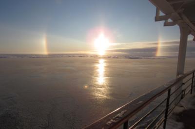
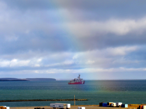
I spent a month on a boat in the Arctic as part of the 28 member Science Team that lived and worked alongside the 53 member Crew of the Canadian Coast Guard Ship Louis S. St. Laurent, a 392 foot icebreaker out of St. John's, Newfoundland, Canada. When the Science Team boarded the ship on September 6, 2017, from Cambridge Bay, a small settlement located on Victoria Island in the Kitikmeot Region of Nunavut, Canada, the ship's crew had already been aboard for two weeks. From Cambridge Bay we sailed west through Prince Albert Sound, through the inlet of Amundsen Gulf, and to the Beaufort Sea. We would spend the next four weeks doing a counter clockwise trip that would take us through ice covered seas, calm water, and large swells to as far north as 81 N in the Canada Basin, and as far south as Barrow, Alaska. This trip was the 15th annual Joint Ocean Ice Studies (JOIS) cruise with the stated focus:
"Research questions seek to understand the impacts of global change on the physical and geochemical environment of the Canada Basin of the Arctic Ocean and the corresponding biological response. We thus collect data to link decadal-scale perturbations in the Arctic atmosphere to inter-annual basin-scale changes in the freshwater content of the Beaufort Gyre, freshwater sources, ice properties and distribution, water mass properties and distribution, ocean circulation, ocean acidification and biota distribution." (Taken from Science Plan for the Oceanographic Research aboard the CCGS Louis S. St-Laurent September 7 to October 2, 2017.)
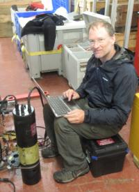
My role as part of the science team was to write daily dispatches from the ship describing the daily activities of the journey with a focus on the science and research being done. Those were published on 2 websites: the PolarTREC website: https://www.polartrec.com/expeditions/co2-and-ph-studies-of-the-arctic-ocean, and the Woods Hole Oceanographic Institute website: http://www.whoi.edu/page.do?pid=159656
Summary of the Science
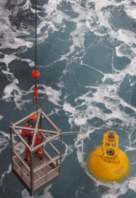
Primarily JOIS is a collaboration between Fisheries and Oceans Canada researchers and researchers from Woods Hole Oceanographic Institution (WHOI) in the United States. Secondarily, there are numerous piggyback research projects from various institutions (US, Canada, Japan) being done alongside ranging from satellite ice thickness ground-truthing studies to research into the ecology of methylotrophic bacteria in the Western Arctic Ocean to monitoring the Arctic for radiation from the 2011 Fukushima Daiichi nuclear disaster. 
Importance of Teacher/Researcher Collaboration

Linking PolarTREC to my Classroom and Community
My trip to the Arctic will serve as a springboard for conversation and learning through the stories, pictures, and videos that I was able to capture. Additionally, my enhanced understanding of the intricacies and importance of Arctic research will allow me to better channel the importance of real-life science. For instance, solution chemistry and acid base chemistry are no longer something that just takes place in a test tube. The Beaufort Sea and the Arctic are places on the planet (that I have been to) where that same chemistry takes place with some rather important ramifications. I can also talk to parents, administrators, fellow teachers, and the community at large about the importance and ramifications of this endeavor with a genuine bank of experience to draw upon. More importantly, I have some new-found connections with researchers and scientists (besides my collaborating researcher) that I can draw upon for input in areas I am not certain about. This never would have existed if I had not spent a month on a boat in the Arctic with them.
Student and Public Impact
I believe that the students in particular that I work with in the coming years will gain a better understanding for why the Arctic and Antarctic matter. From a science perspective there is a whole lot happening in the Polar regions that aspiring scientists (some of my students) can work on IF they are exposed to it early in their careers. They will then be the ones to have the impact on the public at large. I teach 100+ students a year who will become the voices talking about what we learn and come to understand about in the Arctic and Antarctic really matters. Their voices will be the ones that will drive the discussions and formations of science based policies regarding climate change in the coming years. I hope to plant the seeds.
Expectations and Outcomes
I went into my PolarTREC experience with an open mind to the possibilities of learning some new things and meeting some new people. I had expectations of pulling together a better understanding of carbon dioxide solution chemistry and its relationship to pH of aquatic systems and hence its relationship to Ocean Acidification. 
I recall pondering whether or not all the money, time, and energy being put into this research cruise and others like it are really worth it. Given that we have instant access to unlimited information from Google, Google Earth, etc., I wondered whether limited resources are best utilized in this manner. I realized that the answer is in two words: direct observation. All science is based on asking questions and using experimentation and data to come up with the best explanation we can. Models of systems like the Arctic Ocean or the Beaufort Sea can be generated with our incredibly powerful computers, but the data sets for those models needs to be collected through direct observation. Once we have a model we need to know if it actually works so again we rely on direct observation. That realization was an unexpected outcome for me.
I am also left with a much better sense of how a research cruise operates. As I got to know the ins and outs of the science being done, I realized just how interdisciplinary it all was. All the measurements being done were important to every group's research. The ice measurement research was important to the carbon dioxide research, the Colored Dissolved Organic Matter and nutrient work was used by the physical oceanographers in determining the structure of the Beaufort Gyre, the CTD rosette casts were used by virtually everybody in one way or another. All very intertwined and interdependent.
I was also struck by how intertwined the ship's crew and the science crew was. 
Post-Expedition Plans
My immediate post expedition plans are to focus on incorporating the experiences, photographs, and videos into the daily lessons. I will start each day with something related to the month I spent in the Arctic. For instance, I played my students a 5 minute audio clip of the icebreaker going through the ice. We talked about the various sounds in the clip, what made them, and why. Then the next class session I showed them some footage of the ship moving through ice so they could get an appreciation for the origins of the sounds.
In the not-so-distant future I will be putting together a sequence of lessons which tie the chemistry (specifically the carbon dioxide and pH) of the Arctic into lessons about solution chemistry and acid-base chemistry so that hopefully those topics will have a bit more real-world science feel to them.
My Plans for the Future
In the long term, I have a couple of projects dreamed up. First I would like to learn to use the Ocean Data Viewer software and eventually incorporate it into some lessons or research projects that focus on geochemistry in the Arctic including changes in carbon dioxide as it relates to ice coverage. One way I might pull this off is to have a student learn the software as part of a senior project then work with them to develop doable high school level activities.
My second project idea is to incorporate aquatic carbon dioxide monitoring into my advanced chemistry courses. I would like to get some funding to purchase some carbon dioxide monitors (SAMI's or otherwise) and have students deploy them in local water bodies and then look at changes in carbon dioxide and pH over the course of the school year and possibly beyond. The data collected will help students build an understanding of gas phase aqueous solutions and pH changes in aquatic systems. This type of project could also work well for the independent research project required for the advanced course or could be used in collaboration with other student based research projects in the school.
Finally, I would like to get back to the Arctic in one way or the other. The sights, sounds, and vast remoteness as well as the science of the Arctic intrigues me and makes me want to learn and experience more. Whether it be on an icebreaker or camped out in the tundra I will be looking for opportunities in the future to pull that off.

| Attachment | Size |
|---|---|
| Download Report (1.22 MB)1.22 MB | 1.22 MB |
This program is supported by the National Science Foundation. Any opinions, findings, and conclusions or recommendations expressed by this program are those of the PIs and coordinating team, and do not necessarily reflect the views of the National Science Foundation.
