The Importance of Teachers Experiencing Science Expeditions
It is a teacher’s job to take a subject and make it come alive for our students. Doing field research broadens a teacher’s horizons where they learn more about science and themselves by facing new challenges and accomplishing tasks such as collecting field data and learning about the world around them. This trip has enabled me to share my excitement with my students. They can see how passionate I am about the opportunity to do first-hand field research and how excited I am to share my experiences with them. They can see and feel my energy as I talk about climate change and listen to my stories about the trip. They are not just learning a lesson but they are participating in my adventure.
By participating in NASA’s Operation IceBridge, I made connections with the scientists I worked with that will last a lifetime. Working with the scientists on a daily basis, I learned about climate change and the work they were doing to explore and explain climate change. I asked questions that were answered right away. Even after the expedition, I am still in contact with the scientists and engineers I worked with, still asking questions and still learning from them. This experience made me a stronger teacher who is more informed about climate change and it taught me how to make use of new technology. I learned not just about science, but thanks to several visitors who came onto the plane, I learned about viewing the ice field through the eyes of an artist, a writer, and a photographer, and using filmography to tell a story. Teachers need to participate in programs such as PolarTREC to grow as teachers and as individuals, to become spokesmen for the research they are studying, and to increase their personal knowledge of the world by experiencing the life of a field scientist.
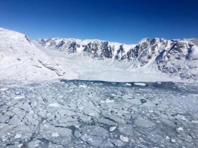
Stressing hands-on experiences is one of the things that I emphasize in my classroom. Students learn by doing and so do teachers. Science and technology are constantly changing and teachers have to keep learning and must familiarize themselves with new scientific ideas and theories. Before my experience with PolarTREC, I did not know what being a field scientist was like. I knew that field research existed but I never knew how complex and multifaceted the process is. Being a researcher is not comfortable; it is hard, and takes spirit and determination. Having experienced this expedition, I can talk with my students from a knowledge base that I never had before. I now know what it means to be cold in the Arctic and to see an ice cap and explain how vast it is. I can relate how the cold sinks into your core when the temperature drops below zero and the absolute quiet of being surrounded by nothing, or the noise of a glacier with its cracking and popping sounds as it moves slowly over the earth. I can share my personal experiences with my students. Anyone can look up pictures on Google but being able to show my students pictures that I took and pictures of me helps them to buy into what I am teaching them. My students were extremely happy that I was given a chance to participate in this program. I am not just teaching my students science but I am also teaching them about hard work, perseverance, and what they too, can accomplish.
The Science
Operation IceBridge is an aerial survey of both the Arctic and the Antarctic ice sheets. I was part of the Spring 2017 mission taking place in the Arctic. Satellites are used to monitor the Earth and provide scientists with data collected from the entire Earth sphere. 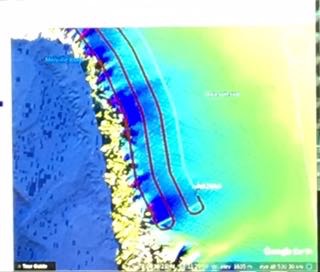
During my time on the plane, one of the missions that I flew was written about in the Washington Post. A new rift opened near the center of the Peterman Glacier and I was part of the team that flew over the rift on several occasions to assess the severity of the event and if there were going to be immediate dire consequences. 
I participated in Operation IceBridge while they were stationed at Greenland’s Thule Air Force Base and Kangerlussuaq, the commercial airport in Greenland. While on the plane, I was integrated into the crew and I was a viable member working with the 360 Camera, which was a new instrument on the plane this year that takes 360 degree pictures of the areas we flew over. I was excited to learn how to operate the camera and I also helped download some of the images collected by the DMS onto an external hard drive. The crew was extremely helpful and answered all of my questions. While on the P-3 Orion, I also participated in X-Chats talking in real-time sessions with classrooms all over the United States.
Connecting to the Classroom
Once I heard that I was accepted as a part of PolarTREC and Operation IceBridge, I started thinking about what this meant for me as a teacher and for my students. Connecting my experiences to my classroom started before I left for the expedition by teaching my students about the cryosphere in both the Arctic and Antarctic. The students could see how excited I was about having this opportunity. 
Before I left, the students and I participated in an X-Chat with some of the crew I would soon be working with on NASA’s P-3. As a class, we generated questions to ask the team which were answered live. When I was flying missions in Greenland, I was the one on the plane answering the questions. Along with the rest of the crew, I chatted with my class and others from all over the United States. While in the field, I also conducted a PolarConnect event, via a video conference link, where I discussed my experiences and explained the purpose of the research and how that research was conducted. The video link enabled me to reach out to my classrooms and many other classrooms within my school district plus other schools located throughout the United States. This coming school year, I intend to continue listening to PolarConnect in my classroom with my students. We will also discuss the logistics that go into scientific research and I will show my students that science is not an isolated subject but also encompasses technology, math, and economics. It’s truly a STEM world.
Living in Florida, some of my students have never seen or experienced real snow or felt truly cold weather. 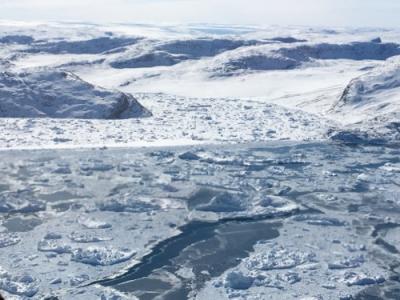
Reflecting Back
Before I left for my trip, I wrote several papers about my expectations--what I would be doing while on the expedition and what I would be learning. I had not really considered personal hardships, only anticipating physical hardships. I was surprised to learn that some of the biggest difficulties were not logistical nor technical issues, but rather many of the hardships with remote research are more personal. The biggest hardship was missing family and friends. It was hard for many members of the crew being away from home for long periods of time, which can be months not just weeks. Another difficulty was planning around the weather. The weather is unpredictable and it is hard to conduct research when one cannot control all of the parameters. There were a few technical problems and maintenance issues with the equipment and the plane but the crew was outstanding and professional. Problems such as these were handled quickly and efficiently.
Weather was a factor that was present in every decision made during operation IceBridge. The crew talked about it at every meeting and it was checked multiple times a day. Many decisions concerning the missions were based on the weather conditions which could change quickly for the better or the worse. The night before a mission was flown, the crew would select one primary mission to run the following day along with several backups, in case the weather changed. Every morning members of the crew would go to the weather office to review the different weather models for that day, looking at cloud cover, precipitation, and winds. These models would help them to decide which missions were possible that day. The crew never wanted to cancel a flight and would only do so as a last resort. If a mission could be modified and still flown, then that was the first choice and was preferred to no mission at all.

Being at both Thule and Kangerlussuaq, I was able to see the operation from two different base stations. I was given the opportunity to see a small sample of how the operation is moved from one location to another and all of the logistics that go with it. At the mission briefing each day, I heard the discussions about how missions were chosen and I learned that the decision is complex. It is not just about science but safety, weather, and cost all have to be assessed before a mission can be flown. I had no idea all of the complexities of flying the daily missions before I left for Operation IceBridge. During my stay, I saw the rotation of several of the crew where some people left and new crew members arrived. The new crew members quickly integrated themselves to the projects at hand. The crew works ten hour days and either five or six days a week trying to maximize the number of missions they fly.
The entire crew was supportive and helpful. While I was on the expedition, I was given a chance to talk to all of the engineers and see the work that they did. During the flights, we did not have to remain seated the entire time and I could walk around the plane and see how all of the instruments worked. The engineers took the time to explain what they were doing and why their data was important for polar science. I was also shown the website for the National Snow and Ice Data Center where the Operation IceBridge data is stored. I learned about the radar and the DMS system on the plane. I could see the DMS images as they were collected and how the Airborn Topographic Mapper (ATM) creates topographic maps.
Using What I have Learned in My Classroom
Before leaving on the trip, I set several criteria for myself regarding how I would use what I learned in my classroom and how this experience would help me to become a better teacher. One of the goals I set, was to integrate the data collected by NASA into my classroom lessons. I want to be able to use the DMS data collected by Operation IceBridge to encourage my students to compare how the Arctic changes from year to year; to inspire them to see where and how the Arctic Ice Sheet has changed and to facilitate critical thinking so that they can draw conclusions about what they have observed. I want them to use the data to draw conclusions about how the Arctic will continue to change over time.
Sitting and listening to a teacher talk can be interesting but there is only so much information a student can take in at one time. It is far better to learn by doing, and by encouraging my students to analyze data in a group, I will give them a chance to be part of an active learning experience. They will work in groups and discuss what they are studying. Talking about concepts is very helpful for a student. Being able to explain an idea to others, shows that the student understood it. I want to help my students to pick the topics that they want to study which will draw them into the lesson and make it easier for them take an active role in the lesson. They will get to explore a topic about the cryosphere that they feel vested in. This will increase their interest and their understanding.
Public Outreach
One of the most important aspects of participating in Operation IceBridge, is sharing what I have learned with the public. I contacted several local news stations and it was very exciting to be interviewed by Madeleine Wright from the local Miami affiliate of ABC along with a press release that was posted to the Internet. Another exciting local news opportunity, was an article that appeared in the Parklander, a monthly news magazine from Parkland, Florida which detailed my trip. Quite unexpectedly, I was honored with a proclamation of “Adeena Teres Day in Broward County” from the Commissioner of Broward County. The Commissioner, and several officials from Parkland, came to my classroom to give me the proclamation. My students were thrilled for me and I was very happy that the ceremony could take place in my classroom so I could share the honor with my students.
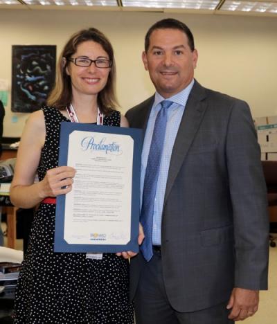
Although it was close to the end of the school year, I had the opportunity to present my PolarTREC experience to the teachers at my high school and my own classes. Next school year, I will be participating in an in-school science field trip where I will conduct a presentation about my trip to several different science classes in the school auditorium.
Another exciting outreach opportunity is an invitation I received to speak to a group of teachers at NASA’s Goddard Space Flight Center in Maryland in July 2017. Later this year, I hope to present at several different conferences including The Florida Association of Science Teachers, The American Geophysical Union, and the National Science Teachers Association. In order to accomplish this, I have been working with several Operation IceBridge alumni and alumni from other expeditions. I intend to keep doing outreach and telling the public about Operation IceBridge and PolarTREC.
| Attachment | Size |
|---|---|
| Download Report (1.23 MB)1.23 MB | 1.23 MB |
This program is supported by the National Science Foundation. Any opinions, findings, and conclusions or recommendations expressed by this program are those of the PIs and coordinating team, and do not necessarily reflect the views of the National Science Foundation.
