3.31 Heading north to the ice camp!
Up at 5 am load the car and head to the university. It is a lovely spring morning in Fairbanks and the temperature is -5 F. At the university Cathy downloaded into her laptop the latest version of the data analysis and satellite maps that Mani Thomas, Cathy’s graduate student from the University of Delaware, had generated for transport to camp. 7:30 am we arrived at the Fairbanks airport, checked in the bags, and I got my first cup of coffee. We left Fairbanks at 9:00 am, crossed the Brooks Range, and arrived in Barrow at 10:25 am.
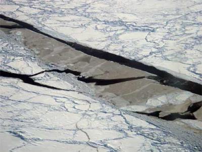
The sea ice near Barrow was showing stress and strain. There were many pressure ridges where different pieces of ice had pushed against each other. The process is much like how mountain ranges are made by plate tectonics. The area up here looks flat and white from the plane. This may be true on the land (tundra) and new ice, but there is drifting snow, rubble ice and pressure ridges on the older sea ice. Near the shore the ice is solid, but further out to sea, leads or breaks in the ice have started to open up. As the leads increase Bowhead whales will start to move into the area as they head to their summer feeding grounds. The whaling captains in Barrow will try to capture a couple of the whales. Bowhead whales are an important traditional food source for the village of Barrow.
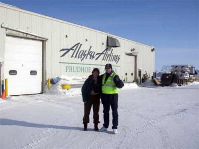
We had a short layover in Barrow and after a 30 min flight we reached Prudhoe Bay. We were expecting to stay in Prudhoe Bay for the night. But it turned out that the plane to the ice camp was leaving in 30 min and had room for two passengers. So we grabbed a quick snack, jumped into our Arctic gear, and climbed on the plane. After an hour and fifteen minutes in the air, we were touching down on a sea ice runway at the ice camp!
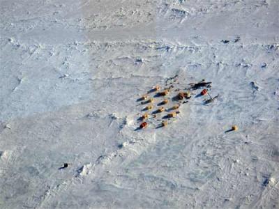
We gathered our bags and boxes of equipment and headed for the camp.
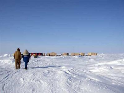
We are about 200 miles northeast of Prudhoe Bay, on top of a large piece of multiyear ice (12 feet thick) surrounded by first year ice (about four feet thick). We are floating on top of about 1400 ft of sea water. We are still a long way from the North Pole. How much is all of this using the metric system?
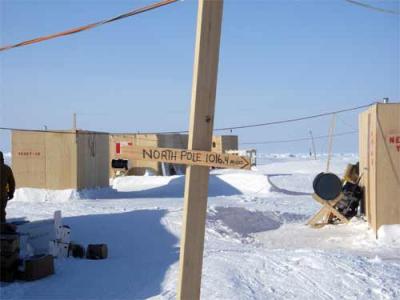
We met with the chief scientist Dr. Jennifer (Jenny) Hutchins –University of Alaska Fairbanks, and got our Bunk assignments. The huts are named after Los Vegas Casinos. My home for the next two weeks will be at the Luxor.
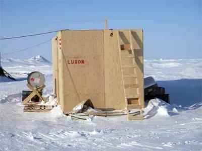
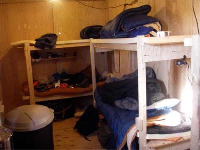
The huts are 8' x 20' and made of two layers of plywood with two inches of Styrofoam insulation in the middle. They are heated by a stove that burns Jet B fuel. There are 6 bunks made of plywood with a four inch foam pad and a sleeping bag on top.
After we had moved into our huts, and organized our personal gear, we started unpacking the scientific equipment and organizing the work space. That evening we ate dinner in the mess tent and received an orientation on the rules and customs of the camp. Tomorrow the work begins.

Comments