Don't Forget to register for next weeks polar connect event. See details at: www.polartrec.com
As mentioned before there are multiple parts to our research in studying the ocean floor. For two weeks we have used the multibeam, knudsen (chirp), and seismic. Today we attempt our first dredge.
Just to review, the multibeam is literally mapping the ocean floor. The chirp gets a bit more definition in its image, and actually penetrates the sediment and the seismic can "see" down up to a kilometer. All of these pictures are being taken through the use of energy and measurement of time, no photographic cameras. For the knudsen and multibeam, the source of the energy is an electrical charge. For the seismic, an air gun with approximately 2000 psi.
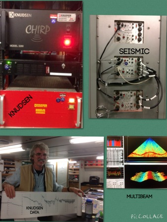
Each instrument releases energy in different frequencies and each frequency penetrates to different depths. It is the time measured between source and receiver that gives scientists their pictures of the ocean floor. Velocity comes in to play with salinity and temperature, but that will be a lesson for another day.
The scientists are using the dredge to collect physical samples. They want rocks in hand, they want to determine the chemical composition, they want to look for trace elements, and they want to look at the rocks' magnetic properties.
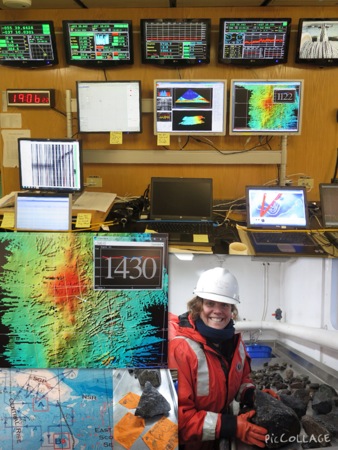
Once back at the lab, scientists will measure isotopes of radioactive elements to ascertain the age of each sample, and measure the chemical compositions of the rock samples.
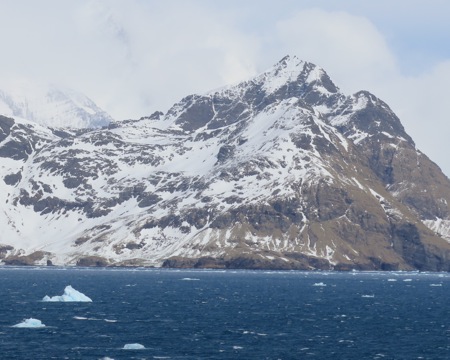
The scientists are specifically looking for a sea mount to dredge. They want a basement sample. Because sediments do not easily accumulate on steep slopes, the steeper the side of a sea mount, the more likely the sample will be from that sea mount and not be a drop stone from displaced glacial ice. Imagine all the rocks being moved around in the icebergs in this picture.
It is now 14 hours later, the sea floor has been mapped, the scientists have found a track about one nautical mile in distance with a slope of approximately 40 degrees -- perfect for a dredge. The ship is facing into the wind, let's sample.
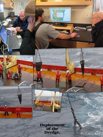
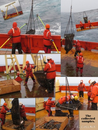
Once the dredge is on board, a two step process begins. Our resident ecologist will check the sample for any biological specimens that happened to get caught, and then the geochemist jumps in and starts sorting and separating rocks.
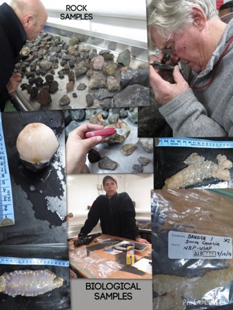
It is now 9:30 at night, and we started using the multibeam to scout out our location at 4:00 this morning. Our first dredge was a success and we have samples. The second dredge at one point experienced over 14.5 thousand pounds of pressure, too much. The equipment is designed so that there are fail-safes, and a weak link (literally) snapped on the dredge: the equipment was saved but the samples were lost. Fail-safes are in place to ensure that there is no danger to the ship during different sampling operations, and to hopefully not lose scientific equipment. We are off to re-dredge, I foresee a long evening.


Comments