For the first time since we left for the remote wilderness we experienced rain. It came down in the early morning before we were stirring from our tents and kept on as a steady drizzle until well into the afternoon. With the weather as a consideration, we decided that it would not keep us from doing fieldwork for the day. Two groups were selected, each with a specific task to complete and we headed up.
Our first stop was the three depressions we located yesterday. Jodi, Sasha, Rebecca and Ola were going to do controlled excavations of each depression to determine if there were any artifacts. Greg went over the directions of what needed to be done and left the work in the hands of a very capable team. I will admit that after being the first to spot the depressions yesterday, I was a tiny bit disappointed that I didn't get to break ceremonial ground there and sift through the contents of the test pits.
The second group left the first Stolbevaya site and headed down the ravine in order to follow the series of ridges and ravines along the coast. Our group included Greg, Sean-Paul, Alyesa, Lyosha and myself. These high terraces are about 40 meters high, some higher, and go almost vertically straight up from small streams that interrupt them. In the drizzle and mist they were even more slick than yesterday. However, for some reason I found them easier to climb today. Perhaps it was because I was better mentally prepared for what the job would entail. Perhaps it was because I had gotten my legs more accustomed to the actual act of climbing the steep ground. Whatever the case, with shovel in hand, I along with the group headed up. And down. And up again.
Feeling victorious about finding our three depressions yesterday paled in comparison to today's finds. Walking for hours through knee to chest high grasses and shrubs felt like being in a circular car wash. We were wet, getting slapped around and the wind was intermittently trying to dry us, only to have us cross a patch of wet chest high plants and start over again.
We were quickly successful in finding depressions and by the end of our day we had marked 31 depressions with a hand held GPSA Global Positioning System (GPS) is a satellite-based navigation system used to track the location or position of objects on the Earth’s surface.. The sites were arranged in six clusters, indicating that a group of inhabitants lived close together in the pit houses of long ago.
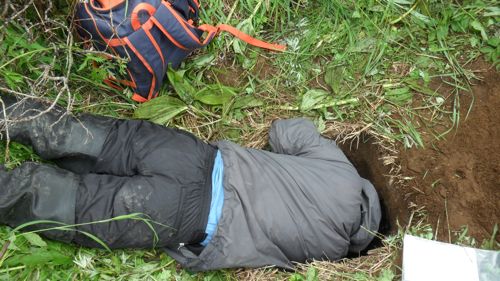
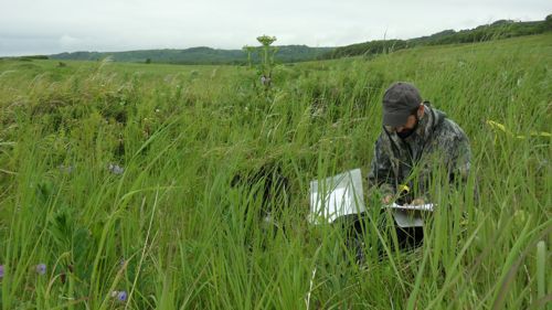
At one of the depressions Greg gave the order to dig a test pit. It was roughly 50 centimeters by 50 centimeters in size and went down well over a meter in depth. All of the soil that we removed we put through a screen to see if we could see collect any artifacts. We took turns digging and screening the site while Greg kept a watch over the screen for anything that would indicate human habitation.
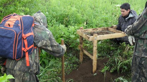
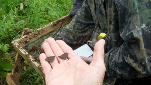
While digging Sean-Paul put his geology skills to work. With careful notes he had taken from yesterday's lessons with Jodi, he identified the tephra and we determined that our test hole was directly through a fire pit from long ago. There was charcoal in textbook formations and using the screen we found flakes. Flakes are small stone chips that are created when you strike one rock against another. The flakes have one flat surface and the other side has a small bulge that is caused by the strike. This rock shape does not occur naturally in nature so that is how you know humans made it. We also found some FCRs, fire cracked rocks. These are generally smooth stones that crack from the extreme heat of a fire pit. Archeologists note these rocks when they find them, but most of the time they are just left behind and not processed for a museum or university lab.
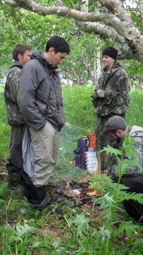
Along with GPSA Global Positioning System (GPS) is a satellite-based navigation system used to track the location or position of objects on the Earth’s surface. location, Greg makes some brief but descriptive field notes on each site. It is somewhat time consuming but, necessary for archeological records. Keeping an eye on the time and distance we are from camp, we head back around 6PM. The walk back seems long. We are tired from all of the climbing and walking for sure, but because the walking has lost its purpose it just seems like work instead of exploring.
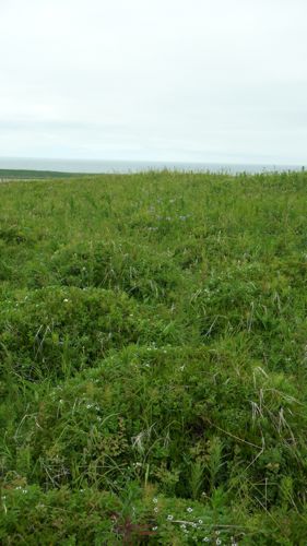
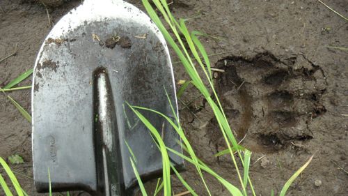
Sean-Paul and I compare one of the fields to a video game. We pretend we are Mario and Luigi in a Super Mario Brothers game hopping from one mound of soft tundra plants to another. Greg is providing the video game music. From there we start singing any song we know lyrics to and slowly we make our way back to home base. I think that anyone who did not know what we were doing out here would think we were looking for bears. The best way to keep away grizzlies is to make noise, so every 50 feet or so one of us yells "Hey Bear!" We generally do this throughout the entire day, but most especially when we are near a thicket of bushes. Bear trail often lead directly into these thickets and we have seen several bear sleeping areas near them as well. Although I am somewhat afraid of seeing a bear, I am grateful for the trails they leave behind on their well-traveled routes. It makes the walk a bit easier for us at times.
With the hum of the generator in the distance, I know it is time to get the satellite antenna set up for a phone call from the Paleo-GeologyThe science that deals with the dynamics and physical history of the earth, the rocks of which it is composed, and the physical, chemical, and biological changes that the earth has undergone or is undergoing. Team. There is starting to be a rhythm to the days here, now that field camp is officially and productively underway.


Comments