We are on our 4th out of 6 consecutive flight days this week! I am grateful for clear skies above our target areas which have allowed us to get in a smooth routine of flying every day. Once the weather is on our side the pace of work picks up. Power is supplied to the plane two hours before take-off and teams start to run instruments within the first hour. The GPSA Global Positioning System (GPS) is a satellite-based navigation system used to track the location or position of objects on the Earth’s surface. ground station is turned on one hour prior to take-off and will collect data until one hour after we land.
I wanted to share with you a little about both yesterday's and today's priority flights. On Wednesday, we covered the west coast of Greenland in a baseline mission called Umanaq B. Today's mission is called the South East Coastal Mission. It is a baseline flight covering a series of glaciers along the scenic southeastern coast of the Greenland Ice sheet. Baseline flights are priority missions typically run each year and determined by the Operation IceBridge Science Team. You can see the track of each of these missions below:
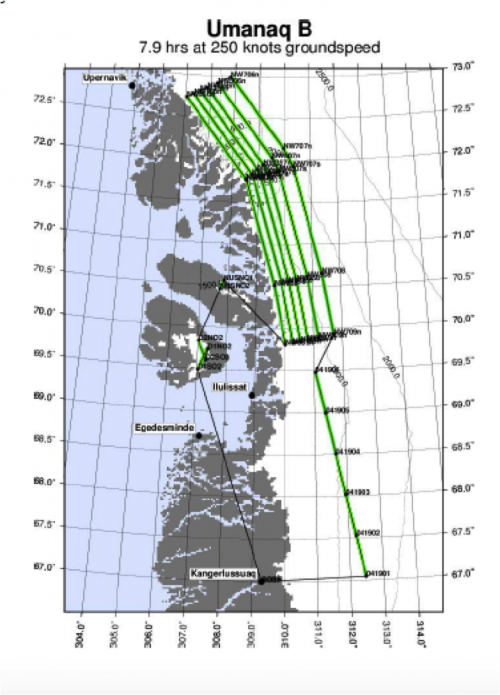
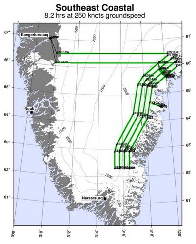
In both of these missions we were flying parallel paths along the coast which are perpendicular to the flow of ice into the ocean. Can you remember what these tracks are called (QOD)?
Both flights provided important data for the team and, as a bonus, the coastal terrain provided some beautiful views. The terrain on the East coast of Greenland is more rugged than that of the West, which makes for some spectacular scenery while monitoring instruments. In today's mission, we began and ended with transit lines across the ice sheet. The ice itself changes drastically throughout the course of this transit and the data collected reflects those changes. One of the most exciting things about the expedition has been hearing from scientists who work with the data provided by IceBridge missions in the lab and are able to connect the models to what we are actually seeing from the plane.
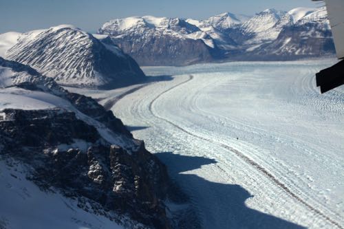

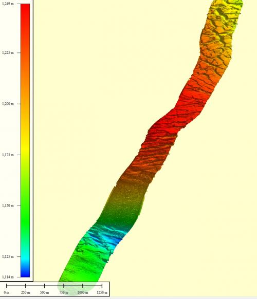
NASA Scientist Donghui Yi explained that it is common to assume that the interior of the Greenland Ice Sheet is relatively flat and smooth, but the data shows otherwise and we could see close up that smooth is far from the case. During our flights this week, we've seen large areas filled with crevasses, melt ponds and ridges, not to mention dynamic areas of calving as we flew near the coast. The movement of the ice sheet is extremely complex and we're still searching for the best models to understand exactly how it is changing over time. This is exemplified by a quick-look plot created by Rob Russel of the Airborne Topographic Mapper instrument team which shoes steep elevation changes and crevassing during the Southeast Coastal Mission.
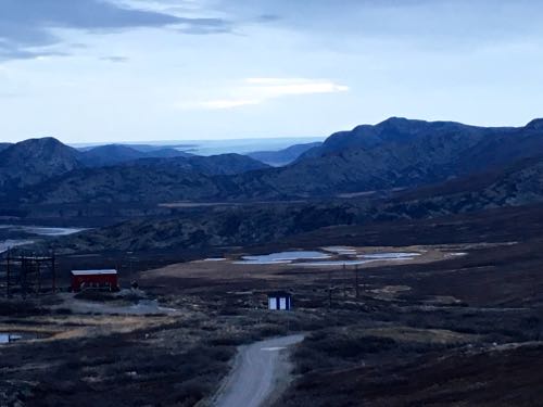
We shifted our schedule forward by about two hours, so our return at 7:30 p.m. was enough for our daily post-flight debrief, and for completing data collection on the ground before heading to a Thai Dinner at the only restaurant in town, Nordly's. After a Musk Ox Curry (yes, that was dinner), we went on to hike up to Raven's Cliff an overlook at the top of which is the Kangerlussuaq RadarA method of estimating the distance or travel speed of an object by bouncing high frequency signals off the object and measuring the reflected signal. Station.
What is the name for our flight paths that run perpendicular to the flow of water into the ocean?


Comments