A Little Bit About Science
Today we flew two historic flight lines. Flying over the same areas is very important because this is how scientists can see change over time. Ice sheets can contain valuable climate information from Earth's past. Part of the IceBridge mission is to disseminate the data to whomever can use it. This is a newer concept in science exploration. By doing this, IceBridge is allowing people in locations all over the world who are unable to afford or are incapable of doing their own polar research the ability to receive the data they need. There are too many questions about climate change for one group to research or explain. The data is crowd sourced, so questions about climate can be answered by anyone who is asking the questions. Historically, science has the habit of 'publish or perish'. The idea of sharing data is a newer one that allows for scientific exploration.
RadarA method of estimating the distance or travel speed of an object by bouncing high frequency signals off the object and measuring the reflected signal. is what the plane uses to measure depth, it can penetrate both snow and ice. RadarA method of estimating the distance or travel speed of an object by bouncing high frequency signals off the object and measuring the reflected signal. will bounce off the different textures of the layers and the different chemical make-up in the layers of snow and ice. Like the different strata in rocks, one can see the different layers of the ice. This data can be used for many different areas of studies. The layers of ice can contribute to the scientist's knowledge of temperature, precipitation, atmospheric composition, volcanic activity, and wind patterns that occurred in the past. In my Earth science class I talk about relative dating. This can be done in polar studies too. One way to do this is to use ice cores. Ice cores are circular long pieces of ice that are drilled and pulled out of the ice. Ice cores are a limited sampling method, but are used by many scientists to learn about the past climate of Earth. RadarA method of estimating the distance or travel speed of an object by bouncing high frequency signals off the object and measuring the reflected signal. can cover a much bigger area, and like ice cores, radar data can give scientists a look at Earth's climate history. Scientists can use the radar data to compare ice sheets in different locations all over the Earth. This is done by doing chemical analysis on one point of ice somewhere in the world and then using the radar, scientists can compare results to places all over the world. The radar will allow scientists to detect similarities in the layers. The layers that share the same chemical properties were created at the same time. This can help scientists date ice sheets in different areas and get a clearer picture of how climate is changing. It is exciting for me to see things at play in the field that I have talked about in my teaching career.
A Little Bit About Life
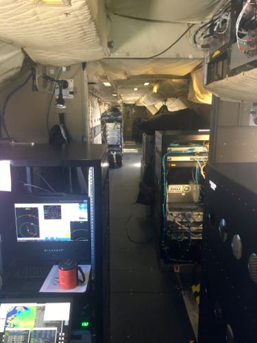
Life aboard the P-3 Orion is comfortable and this helps to pass the time quickly. The seats are nice and as soon as we are up in the air we can walk around and stretch our legs a little. All of the equipment is on the sides of the plane, leaving a long isle to walk through. The science equipment have two seats in front of them and there are areas with seats that are not in front of a station. There are several windows with good views on either side of the plane. The cockpit is large and roomy. There is no door separating the cockpit from the rest of the plane – this makes the area seem huge. At least to me it does. It is cool to be able to see inside the cockpit and to watch the pilots as they fly the plane.
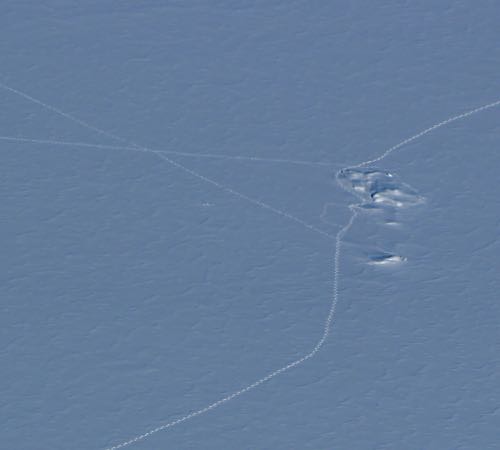
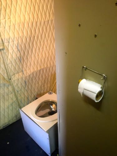
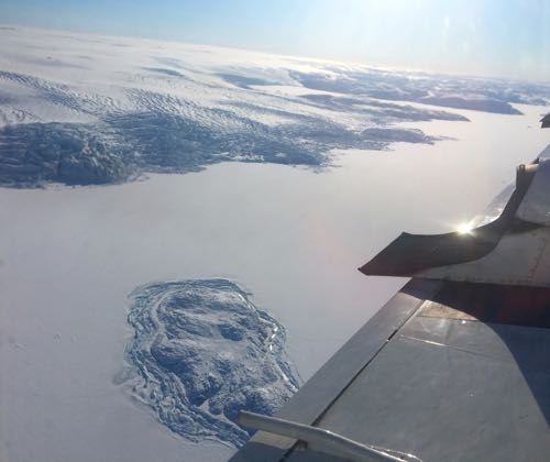
The P-3 has a refrigerator and a microwave. There is a small bathroom in the back of the plane. And the most important feature, a coffee pot! Most of the crew lives on easy mac, cup of noodles, and microwave popcorn. There is also plenty of cookies and candy available for the entire crew to share. Life in the P-3 is warm and cozy even if the days are long and on occasion monotonous. When flying land ice missions, there can be vast stretches where all you see is the flat white surface of the ice. It is so bright that I am constantly wearing my sun glasses inside the cabin. I tried to take pictures out of the window of the cockpit today but it was so bright my camera couldn't focus. Even the flat white surface of ice has its own beauty, but taking pictures of some of the other features here in Greenland is more fun. Every station has a headset and the flight crew is good about telling us when we are approaching an interesting feature. Today I could see paw prints made by polar bears in the snow. I tried to take a good picture, but we passed by so fast it was hard to do. Luckily, one of the other members of the crew got a good picture and I can add it to the journal. I am slow to spot features like paw prints when I am so high up in a plane and looking out of these tiny windows. I am still working on my reaction times. The flight crew gives us a heads up so we have a chance to run to a window get our pictures. Most of the crew members run to the windows when there is a potential picture to be taken, but they are also good about sharing window space.


A Little Piece of Perfection
The ice is very reflective and looking out the window I could see prisms of light being made on some of the rougher pieces of ice. It was like a painting. All white with just a little color.


Comments