Dec. 16, 2006
Journal from Mrs. Chippy - Update from the Convergence
As I look outside the ship – it sure looks the same as it has for the last 48 hours. The ocean is a deep blue, the skies are clear except for some soft cirrus clouds high over head, and the sun continues to shine very intensely although not in a way that generates much warmth. But according to Brent Stewart – the chief scientist on board and a marine biologist from the Sea World Research Institute in San Diego – we are currently passing through one of the most important features of the southern oceans – it is called the convergence zone. Take a look at our current data from the ships computer and see what you can notice:
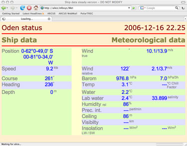
For those of you reading without the benefit of seeing the pictures here is the important data for this morning:
Latitude 61 degrees 46 minutesLongitude 78 degrees 36 minutesTemp 5.9 degrees celciusWater temp 4.3 degrees celciusSkies clear with a few cumulus cloudsSunrise 3:50 AMSunset 12:30 AM
The key according to Dr. Stewart is that the water temp has dropped almost a full 2 degrees in the past day – which signals we are at the point where the cold southern waters converge with the warm waters from the north Pacific. This signals that we are entering the area of the world that is clearly under the direct control and influence of Antarctic systems. Although not a wall – the convergence in many ways acts as a boundary – with vastly different organisms and food chains in existence on one side as compared to the other. Cold water has the ability to absorb high quantities of both oxygen and carbon dioxide – so that we should expect to see increases in zoo and phytoplankton, with increases in organisms such as krill that feed on the plankton, and increases in organisms that feed on the krill such as penguins, whales, fish, and so on. I have nothing visual to report yet – but we'll be on watch all day to see if his hypothesis holds true.
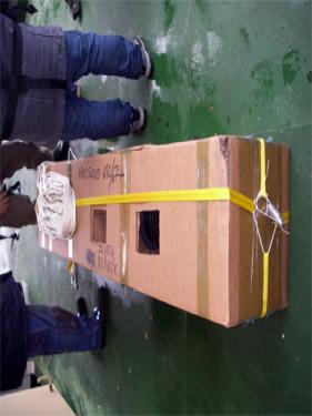
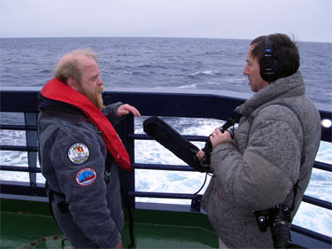
Here's a picture of Kevin – wearing a pfd just in case he were to end up overboard while launching the SOLO – being interviewed by multimedia science journalist Dan Grossman. The probe is contained in a biodegradeable cardboard box to protect is during shipping and launching – and the entire apparatus is sent over the side – in this case as close to the 59 degree latitude line as possible. Here the crew is putting the SOLO over the stern to launch
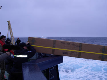
The SOLO is a very sophisticated piece of equipment that can remotely record information about the ocean environment and then relay it by satellite back Dr. Owens thousands of miles away in Massachusetts.
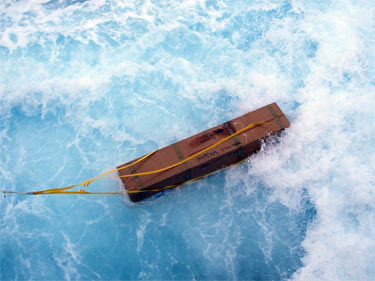
After it was launched, it immediately sank approximately 1800 meters (close to one mile) and collected information about pressure, temperature and salinity. It will then rise to the surface (using a system which alters its buoyancy using compressed gas, send back the data via satellite, and then descend to roughly 1000 meters in depth. It will then drift with the currents for about 9 days, descend to 1800 meters again, take a profile to the surface, and send the data back to shore. The float will repeat this latter cycle until the batteries fail, which is approximately 4-5 years.
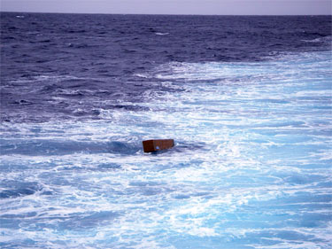
The data is then distributed to all the weather and climate prediction centers throughout the world. It is also sent to the Argo Global Data Acquisition Centers (GDACs). These centers provide data to scientists and the public, and the data is always available at the following websites: http://www.coriolis.eu.org//cdc/argo.htm which is in France, andhttp://www.usgodae.org/cgi-bin/argo_select.pl which is in Monterey, California.
Well going to head on up to the bridge in hopes of spotting my first southern hemisphere whale today! Don't forget you can ask us questions through this e-mail, or by going to the www.polartrec.com website. It's also where you'll find these pictures that go with the posts – unfortunately our system can't handle sending the pictures to everyone, so we post them once a day to Fairbanks where they are added to our journals.
Have a great weekend.


Comments