The Core of It All
Ice coring. There is a LOT of sea ice coring happening through MOSAiC. To do this, scientists use a tube-like tool with teeth on the end to drill from the top to the bottom of the sea ice. After the drilling is done, the tool holds a cylinder of ice. Then they carefully pull the tube from the surrounding ice and the ice core out of the tube.
The sea ice team hopes to take dozens of ice cores each week as part of MOSAiC. By the end, they hope to have collected over 1000 sea ice cores! Most will be over a meter (3 feet) deep, and some will be much deeper when the ice is at its thickest in late winter and earl spring.

These ice cores will be measured, weighed, cut, melted, filtered, and analyzed for all sorts of information. Scientists will take the temperature of the sea ice, from top to bottom. They will measure salinity of the ice and of brine channels of super salty water that form in pockets in the ice. They will look at how much light penetrates (goes through) different layers of the sea ice, and what wavelengths of light do get through. They will take photographs of the structure of the sea ice to measure brine channels and whether or not they are connected to each other.

They will determine nutrient levels and amount of carbon. They will measure specific gases, like methane. They will determine how much of an oxygen isotope (O18) is present to figure out how much of the ice is formed by sea water and how much is actually melted and then re-frozen snow.
Others are interested in the biological side of things. They will do DNA and RNA analysis for bacteria and ice algae. They will melt the sea ice and filter out meiofauna -- small animals that live in the sea ice. They will measure the concentrations of chlorophyll-a (a pigment used for photosynthesis) at different parts of the core.
Through all of this work, researchers are trying to answer a number of questions:
- Where did the sea ice form?
- Did all the ice in this area form in the same place at about the same time, or is there a lot of variety?
- How do air temperature and water temperature affect sea ice freeze, melt, and structure?
- Does the sea ice block or support transport of gases between the ocean and the atmosphere?
- Does the sea ice block or support transport of nutrients between the ocean and atmosphere?
- What lives in the sea ice?
- Does the community of organisms living in the sea ice (ice algae, meiofauna) match where the ice came from, where it is now, or some combination?
- How is the structure different in thick and thin sea ice? In multi-year ice? Where melt ponds have frozen over?
- How does the small-scale structure of sea ice (like ice crystal size and connectivity of brine channels) affect the way it interacts with the ocean, air, and living things?
And much more!

These questions are worthwhile on their own to deepen our scientific understanding of this very unique part of the world. But together, they help to fill in key holes related to climate models. Currently, most climate models treat sea ice as fairly straightforward. You input approximately how old the ice is, the thickness (in 5 broad ranges), snow cover, air temperature, and how much sunlight is reaching the ice. From this, the model predicts how the ice will freeze or melt, and how it interacts with the atmosphere, ocean, and living things. But sea ice is much more complex than that!
For example, the structure and permeability of the ice determines how easily heat, gases, nutrients, and water is transported back and forth between the atmosphere and ocean. Understanding this is key to building better climate models and forecasts of change in the Arctic. Better knowledge of how the climate is and will change is crucial for communities along the Arctic and around the world as they plan for the hazards headed their way. In the shorter term, improved models will also help to create better day-to-day weather forecasts. This is really important to people living and working along the Arctic coasts, and beyond.
So the sea ice team will be collecting, measuring and analyzing 30+ cores each week. This will continue throughout the MOSAiC year so long as the sea ice is stable enough for them to stand on and core. But that is a lot of holes in the ice! During the winter, this isn't a big problem. The holes quickly re-freeze with sea water. But during the summer months, the darker surface of water through the hole absorbs more sunlight. It wouldn't be as quick to refreeze. In the warmest, brightest months, the holes created by ice cores could actually generate melting in the surrounding ice. This could be a major problem.
But the scientists have a cool trick. In their lab on the Polarstern, they can freeze liquid sea water into cylinder of ice that matches the diameter of their ice cores. Then, when they are coring, they can just pop this substitute ice into the holes. It isn't an exact copy of the sea ice they've taken, but at least it will reflect much more of the sun's light and help the holes to refreeze.
During set up of the distributed network, a small team has been doing sea ice coring whenever they have the opportunity to get out on a floe from the ship or via helicopter. They are particularly interested in two things -- methane in the sea ice and sediments in the sea ice.
The methane is linked to another study looking at subsea permafrost (soil or sediment that stays frozen throughout the year). Yes, in some places there is permafrost under the ocean floor! More about this in a later journal; back to ice cores now. If they find large quantities of methane in the sea ice, it could be an indicator that the sea ice formed over areas with subsea permafrost that releases methane as it thaws. This helps them to confirm where the sea ice came from. But understanding the fate of this methane from subsea permafrost is also really important because methane is a powerful greenhouse gas and contributes to climate change. Having more information about where that methane ends up is really crucial to improving climate models in a changing Arctic. They especially are trying to figure out how long it stays in sea ice, and if more of it is released into the air or ocean.

They are also particularly interested in sediments in the sea ice. These sediments help them to track where the ice formed or the path it took to get here. If sea ice forms in really shallow waters, or grows thick enough to touch the sea bottom in slightly deeper waters, it can pick up sand, pebbles, or mud. This sediment is then often frozen into the bottom of the ice.
There are other reasons sediment is important. Presence of sediment also can impact the freezing and melting of the sea ice; for example, more sediment makes for some areas of darker ice, which can speed up melting. Sediments may also affect what can live in and around the ice. They may introduce important nutrients and minerals to areas that otherwise wouldn't have much nitrogen or silica or iron or other key nutrients. Other times, where there are thick sediment layers, it might block some light from reaching the bottom layers of the ice or the ocean below the ice; this can limit ice algae or phytoplankton growth. Can you think of other parts of the Arctic ocean-air-ice-biology system that might be affected by sediment in sea ice? There are lots of possibilities. However, the sediment is so sparse in these offshore ice floes that the impact is likely pretty small if anything. The real area of interest for these researchers is in using the sediment to track the origin of the sea ice.
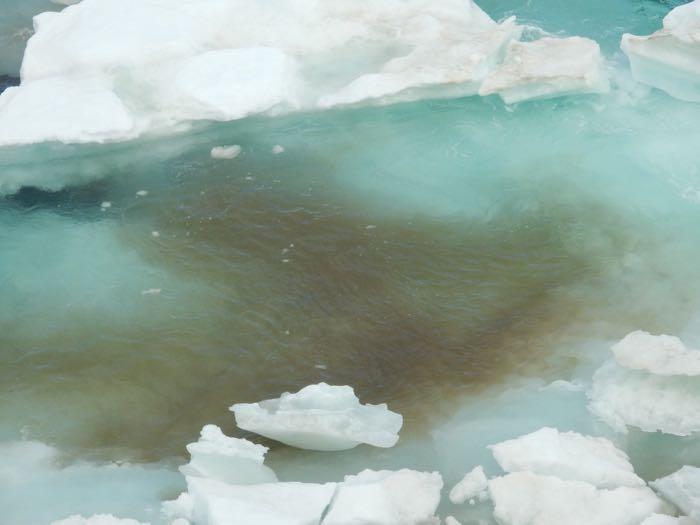
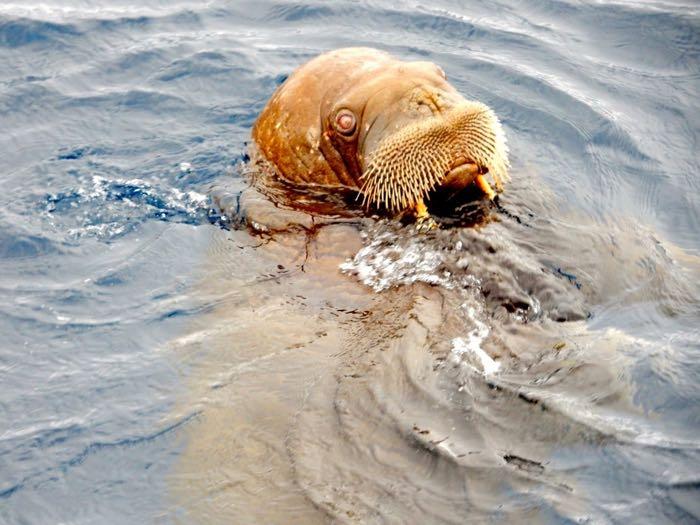
Yesterday, there was much excitement. The ice core team found a clear layer of dark material in one of the cores. It doesn't look like ice algae or frozen phytoplankton. They suspect it is sediment from shallower waters where the ice formed and grew thicker. Which would be an important clue about the history of this ice floe. But it turns out there is also a chance the dark layer in the ice is walrus scat! Now, people are working hard on the problem of how to figure out if this layer is mud or poop! And that’s the kind of science investigation that piques my interest, so I’ll be following it closely. I'll keep you posted.

Your Questions and Curiosities
Catherine wondered while reading PolarTREC journals whether any of the research in the Arctic involves ice and/or rock coring. This is an excellent question! The sea ice coring happening through MOSAiC is really different from sediment, rock, glacier, or ice sheet coring. These other types of coring are often used to understand the past history of an area or climate over long time-scales. Any particular piece of sea ice exists on a much shorter time scale, between one and about ten years. So sea ice coring is usually done for different reasons, as I described earlier. However, there are some people on board who typically study permafrost or Antarctic ice sheets. When we have some downtime, I'll be asking them about their work to try to better answer Catherine's question.
Education Extension
I must admit that I am very tempted to put together instructions for a lab related to identifying sediment versus animal scat - on its own, in water, and in ice. But, I'll refrain for now. Maybe one of you will be inspired to create it yourself!
If you'd prefer, you can build model sea ice cores (or ice sheet cores) with your learners using Pringles cans or similar tubes. The Create Classroom Ice Cores lesson is based around the idea of creating two different ice sheet core models to observe changes in past climates. However, you could easily adapt the instructions to build model cores more representative of sea ice. The most important thing to do here is to use saltwater, and to introduce sediments to one or more layer in one of the models. Then you could provide students with a (real or mock) map of different sediment types in a region, and ask them to identify areas the sea ice might have formed or grown.
Explore with your learners other samples that tell a story over time. These could be tree cores or tree cookies where growth rings capture the annual conditions for the tree. It could be soil cores, looking down at different layers of soil deposited and developed over time. It could be fish otoliths (ear bones) or clam shells, which have growth rings similar to tree cookies. If you live somewhere that accumulates lots of snow over the winter, you can dig a snow pit to look at the different layers of snow and any freeze thaw cycles. For the snow pit, look back at weather data to try to date each layer. After investigating one (or more) of these methods, have learners match their own life events to years on a tree cookie or clam shell or a drawing of layers in the snow pit.


Comments