The following is Part 2 of Matt Walsh’s edited and abridged Personal Journal for August 2-7, 2007, recounting his surveying exploits with James Taylor and Dima Chvagian in the North Central Kuril Islands. All photos, unless otherwise note, are courtesy of Matt Walsh.
August 4, 2007
Woke up this morning at 7:50am. The first thing I heard was that after breakfast the ship would steam to Ekarma Island and that in little more than an hour we would be heading to shore. James and I both grumbled as we got ready.
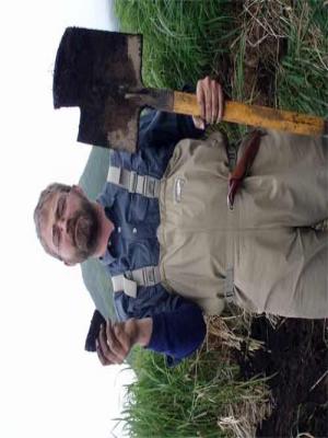
James does his best Norman Rockwell pose after breaking our only full-sized shovel. Afternoon, August 4th.
The day was relatively clear and bright, with mist only shrouding the volcanic tops of the island. When we got to shore we set out along the beach and then quickly found ourselves in waist-high grass, neck-high puchka and elephant rhubarb, strewn with patches of dwarf birch, massive volcanic boulders covered in moss, and beach grass. The going was strenuous. We moved through the brush at a good pace, but every step was won by stumbling, stomping, or cursing. Three times we traversed ravines filled with dwarf birch that grows low to the ground, reaching only maybe ten feet tall and spider-webs across the terrain, twisting and clawing at every turn. As you struggle through the branches they catch at everything. Ducking and crawling is the best way to get through it, but the low branches snatch at your backpack and legs. It made for a difficult few hours of hiking. When we reached the last creek bed, James and I followed the stream up a ways toward the mountains, while Dima made his way down the stream to the beach and then along the coast. When James and I finally emerged through the birch trees we were nearly atop the terrace. A quick climb up a steep grass-strewn ridge brought us to the top.
When we finally reached the terrace, it spread out before us, a sea of tall grass obscuring anything less than a meter or so tall. We found house pit features almost immediately and set about surveying the immediately surrounding area. We found a number of pits while we waited for Dima to struggle his way up a nearby cliff to reach us.
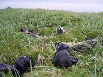
*Dima and James take a short breather while I prepare to survey further along the terrace. Afternoon, August 4th. *
We found more pit features just after noon, but their shape and depth seemed strange to both James and I, being nearly perfect rectangles and relatively deep. Stereotypical house pits in the area from the cultures that we are studying tend to be relatively shallow and not as defined largely due to erosion and ash deposits from volcanic eruptions. We both thought they might have been military features from World War II, but I explained to James that the house pit features that I mapped on Chirinkotan looked very similar. It was decided that we would excavate a one meter square test pit between a few of the house pits. While James and Dima began the pit, James gave me his radio and I was sent hiking across the terrace to see if there were any similar features further along. I continued along the expanse, wandering through the bush and I couldn’t help but imagine myself as some gallant explorer, traipsing fearlessly into the unknown. It’s easy to think like this when you don’t have to worry about bears or any other living thing except maybe the odd fox, seagull, or insect.
It took me just under an hour to make it to the far end of the terrace. The Japanese Volcanologists were working along a bit of cliff edge only a hundred meters or so away from the basalt cliffs that cut off the terrace and drop 80 meters to the sea. They invited me to examine the profile they had been working on and then began trekking away in the direction that I had come. I scraped around where they said they found a stone flake but after a while I had found nothing archaeological. I took some pictures for good measure and walked to the far extent of the terrace.
There were no obvious features in the vicinity that I could see, so I decided to get a better look from higher up. I hiked up a steep incline of beach grass and head-high brambles just below a ridgeline of birch trees and began struggling my way back toward James and Dima. From my elevation I had a good view of the entire expanse, as well as the Iskatel a kilometer or so off in the glassy distance.
When I got back, James and Dima had cut away the turf and sod from the patch of earth that would be Ekarma 1, Test Pit 1. I ate a Cliffbar, then set to work excavating. We troweled into the cultural layer but found little besides charcoal, many fire-cracked rocks, a few small stone points and many lithic flakes. We started running out of time and James broke the shovel trying to loosen a large rock from the pit. As the afternoon stretched toward 6pm and our pickup time we divided our efforts. I kept digging while James mapped the surrounding house pits on the GPSA Global Positioning System (GPS) is a satellite-based navigation system used to track the location or position of objects on the Earth’s surface.. Dima made a small local area site map. We took photos of the test pit once I’d reached the sterile depth at ~80cm below the surface. I made a drawing of the stratigraphy of the south wall of the pit and then set about backfilling the only proof of our hard day’s work. After the pit was filled, we returned the original sod back on top of it and climbed down from the terrace, down through the creek and out onto the beach. I couldn’t reach James on the radio because, as I would soon learn, the batteries on his had died shortly after he started mapping.
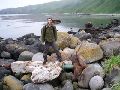
*Me, during the walk back to our zodiac rendezvous point, standing on the rusted ruins of an old ship’s propeller that was washed up on the Ekarma coast. Afternoon, August 4th. (Photo taken by Dima Chvagian) *
When Dima and I got back to the pickup spot there was already a fire burning and James and most of the others were all sitting around it eating rolls and bits of cold chicken from a bag that the ship’s cooks had sent to shore with us. Less than an hour later we were back on the ship. James and I sat in the sauna burning away the soreness from the day’s exertion. Walking through the undergrowth that envelops most of the islands is a full-body workout - with ticks! Not to mention that despite how the shorelines look from the safety and distance of the ship, there is not a single genuinely flat span of ground to be found anywhere.
We’ve been told by the captain that the next few days should be consumed by storms that have been steadily moving into the region, but that is the same story we’ve heard every day for the last three days, and each day is a little more clear and sunny than the next. So, with absolutely no idea where we will be going tomorrow or what we will be doing when we get there, beyond the fact that we will try to find archaeological sites using the time-honored method of acting on hunches and educated guesses, we settled in for the evening. I think after today’s workout, tomorrow will come too early and find my body aching.
August 5, 2007
I awoke this morning to wind and rain spread across a cold grey background. The captain says we cannot go to shore. The weather seems more like simple common foulness than full-blown storm, but that may be due to our location. Sasha Belusov told me this morning that many ship’s captains that sail in the area prefer to anchor here during storms because this particular patch of sea is protected by Shiashkotan to the east and Ekarma to the northwest.
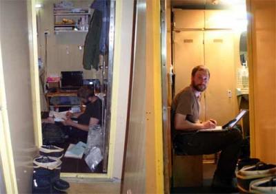
James and I took the opportunity to catch up on paperwork - labeling and cataloging samples and completing forms. I created a database with all the GPSA Global Positioning System (GPS) is a satellite-based navigation system used to track the location or position of objects on the Earth’s surface. locations of the house pits from Chirinkotan, and cleaned the few ceramic sherds that we collected there. I washed the flakes and lithic tools we discovered yesterday at Ekarma. Every half hour or so, Dima pitter-pattered down the stairs to ask for a pen, paper, or to look at one of our maps.
The realities of archaeological field work. James Taylor and I working across the hall from one another as we catch up on the myriads of paperwork that accompany good archaeology.
Afternoon, Aug. 5th. By afternoon we had completed most of the work and there was little to do but drink coffee and either nap or wander around the ship aimlessly. James took a nap and I lay in my bunk listening to music, letting my mind wander to home. The weather was still nasty outside and I spent a moment wondering how everyone was fairing on shore.
We started moving again just before 3pm and I went up to the bridge to ask the captain where we were going. He told me we were heading south around Shiashkotan to the Pacific side to avoid the next set of winds that will be coming from the northwest. I thanked him and he told me Nyeh zah-shto, "Don’t mention it.” We’re not sure if we will be going to shore when we arrive on the other side, but for now we have little to do but sit and wait.
The storm finally moved in on us as night fell. As I lay in my bunk thinking of home the ship creaked and moaned as it hunched and rose awkwardly in the swell. Every inch shuttered as it struggled to maintain equilibrium in the wake of the angry waves. We spent the night tipping this way and that as waves battered the hull, reverberating like the dull cry of far away thunder.
At least we’re not stuck on shore, I thought.
Matt Walsh


Comments