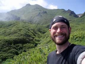
The following is Part 1 of Matt Walsh’s edited and abridged Personal Journal for August 2-7, 2007, recounting his surveying exploits with James Taylor and Dima Chvagian in the North Central Kuril Islands. All photos, unless otherwise note, are courtesy of Matt Walsh.
August 2, 2007
Woke this morning at 6am and got everything packed and checked in preparation for heading to shore and surveying today. I went with Mike and Shelby into the hold in the foredeck and gathered up some sample bags of various sizes and one of the expedition tents for James and me. It’s looking as though we won’t need a tent, since the plan so far sounds like we will be returning to the ship each night to eat dinner, sleep, and steam to another smaller island each day. It sounds pretty cushy, but in a way I’d rather avoid making the zodiac trips back and forth, especially if the weather gets nasty.
By late morning we had loaded everyone up and sent all the Americans to shore except James and me. After getting everyone ashore James spoke to Rybin, the Japanese VolcanologyThe scientific study of volcanoes and related processes. team and Dima Chvagian, and everyone emphatically told him that we would head northwest to Chirinkotan, but that we would not embark for the island until tomorrow. We ate lunch in the galley and spent the rest of the early afternoon puttering below deck, making short forays to the surface to look for islands in the distance and watch the fulmars and seagulls swoop over the waves. We busied ourselves with writing and basking in the idea that we had been granted an impromptu day off.
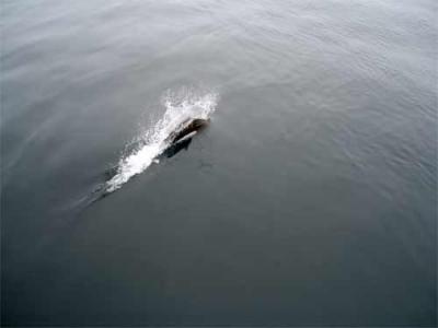
In the early afternoon, as we approached Chirinkotan, we spotted a pair of Dahl’s porpoises careening through the water alongside the ship. Everyone came out to see them, including the cooks and a number of the ship’s other crew.

A Dahl’s porpoise keeping pace with the ship. Morning, August 2nd.
As we got closer to Chirinkotan, word came down that we would be disembarking to the island in one hour. Now feeling unprepared, we both panicked. We both downed a few cups of coffee and tea and gathered our gear, laughing at the ridiculousness of the situation. With so little time to survey the chances of finding anything worthwhile were slim at best.
By the time we climbed into the zodiac we were looking forward to landing on the tiny island. Chirinkotan means "Bird Island” in Ainu, and it lived up to its name. Surrounding the island are literally thousands of birds, and when we reached the rocky beach they became as thick as smoke. The sky seemed clogged with them.
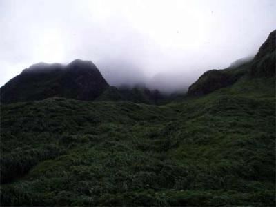
The island disturbingly resembles a tiny version of Skull Island from King Kong. Looking up into the mist-shrouded volcanic peaks and stepping into the dense foliage that covers every inch between the beach and the rocky mountainsides feels like walking into a different world. Given the isolated location of the island, it is quite possibly one of the remotest places in this area of the world. And it feels like it.
The mist-shrouded, densely foliated and isolated island of Chirinkotan. Afternoon, August 2nd.
Surprisingly, we stumbled upon archaeology almost immediately as we made our way up the steep, slippery cliff side to the terrace. Bird nests were everywhere, and puffins and fulmars were constantly dashing out of nests and holes dug into the hillsides.
James started excavating a profile in the cliff side where we found Okhotsk ceramic sherds, charcoal, and a few large sea mammal bones. Dima and I made our way further up the cliff side in search of house pits. We didn’t have to look for long. The entire terrace was dotted with house pit features. It was the single most amazing site I’ve ever seen. The entire expanse of the terrace is a patchwork of deep pits mingling in the tall grass. Bird nests and broken eggs litter the ground beneath every step.
By the end of the day I had mapped over 50 cultural features across the terrace and up along the ridge, and had probably missed more than half of what was there due to our time constraints. Dima was so excited that it was difficult to keep him in check. He wandered out of sight for a few minutes at a time, only to pop up from the grass smiling and yelling something in Russian and giving me a thumbs-up. At times I swear he appeared to be skipping ecstatically through the tall grass, emerging from the underbrush halfway across the terrace like a prairie dog when I would call for him to make sure he was alright. The cliffs that separate the terrace and site from the Okhotsk Sea could easily provide a fall of a hundred or more meters to the rocky beach below if one is not careful when nearing the grass-obfuscated edge. Within only a few hours we had discovered something that none of us had dreamed of finding earlier in the day.
I wandered through the expanse of pits and mounds, doing my best to map them and get GPSA Global Positioning System (GPS) is a satellite-based navigation system used to track the location or position of objects on the Earth’s surface. points at each feature. The sky seemed almost black at times with swooping birds that tear through the air diving close enough that you could hear the wind on their wings as if they were bottle rockets flying just above your head. A number of times I came upon fulmar nests with chicks or eggs, the frightened parent immediately feigning injury to defend the nest from the predator. I tried my best to quietly pass or avoid the nests but it was difficult given the overwhelming number of them.
By 7pm it was time to return to shore. James was already on the beach as Dima and I scrambled down the slick cliff side, holding on to beach grass and weeds to avoid sliding the hundred or so meters down into the creek bed below.
When we returned to the ship we were all ecstatic. James had gotten a number of samples from the profile he had cut into the hillside, and although I hadn’t found any charcoal in any of the probes that I made, I had managed to map a good deal of the new site. The three of us shared a toast to our success and went to the galley for dinner.
After dinner James and I worked on organizing the materials we had gathered from the site. I re-drew the map I had hastily scribbled into my field journal while surveying. After our work was completed we lay in our bunks, exhausted, and listened to music on James’ iPod.
Today has been far more eventful than I could have ever imagined. We watched as our friends departed to their respective sites, disappearing into the mist atop calm glassy water like ghosts in a very recent memory. We saw more wildlife today than I think I have during the entire rest of the expedition. And we discovered and mapped an entirely unknown and unexplored archaeological site on one of the remotest islands in the chain.
August 3, 2007
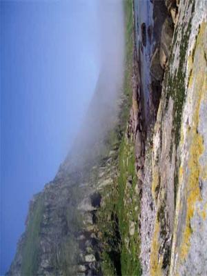
When I woke up at 7am this morning we were on the Pacific side of southern Shiashkotan.
Mist crawling across the cliff side terraces of southern Shiashkotan, Pacific side. Morning, August 3rd.
James and I stood on the mid-ship deck just off the bridge peering teary-eyed into the wind at the mist shrouded cliffs, trying to determine where would be the best location to survey if we were to go to shore. After breakfast we spoke with the captain and he informed us that we had crossed over to the Pacific during in the night because the weather was expected to get steadily worse and he felt it would be safer at our current location.
Eventually, a decision was made that we would steam north off the coast of Shiashkotan and attempt to find a reasonable place to land in the afternoon before the weather deteriorated too much to allow us to go to shore.
Shortly after breakfast we learned that we were leaving in 15-20 minutes. We scrambled to get everything together and stood on deck watching the massive cliffs and volcanic peaks of Shiashkotan appear and disappear in the morning mist. We tried to determine where sites might be by scanning the only two visible terraces near our prospective landing spot.
We walked along the boulder strewn beach and up onto the first visible terrace, which, as could be seen from the ship, had a large shack and some other dilapidated buildings. Apparently, it was an old military building, but from the looks of it, it was little more than an oversized cabin with a few smaller buildings randomly propped up nearby.
We continued walking to the top of the terrace, with a clear view of the volcano every time the mist dissipated. Strangely, the area looked recently used, as evidenced by a trail through the grass that wove its way between the dwarf spruces and the monolithic volcanic boulders that populate all of the surrounding area. I joked that we had found a crop circle. Following the path I found an expired Russian cigarette stomped into the pathway and it was later revealed to us by Sasha Belusov that the path was probably made by Russian tourists that pay large sums of money to visit the volcano.
We found no signs of archaeology anywhere, so we hiked down from the terrace by way of a gently sloping cliff infested with dwarf birch. Once on the beach we continued along the coast for a few hundred meters until we ran into the Japanese Volcanologists that had been trying to find a way further along the coast but had been promptly stopped by a landslide of basalt columns and other massive stone debris. We could go no further.
BasaltBasalt is a common volcanic rock. It is usually gray to black and fine-grained due to rapid cooling of lava at the surface of a planet. cliff sides block our passage to the next terrace, but make for a dramatic photo opportunity. Afternoon, August 3rd.
We returned to our original drop-off point to await the zodiac. It was a bright sunny day once the fog burned off, and to everyone’s surprise there were few bugs beyond the odd mosquito when we were on the terrace.
We waited on the beach for a few hours and finally built a fire when Igor came wandering down the beach with one of the ship’s cooks, Tanya, and the nurse that serves as doctor. With the fire built we waited in the afternoon chill for Sasha Belusov to return from climbing the volcano, and for Sasha Rybin to return from his own adventures. The day wore on as it tends to do.
Hours later, Belusov returned, followed by Rybin a half hour later, but no one made any effort to load the zodiac and we were soon told that the Iskatel had steamed south back to where we had anchored last night, and was only now making the return voyage. Another few hours passed. James drank tea by doubling a couple sample bags together as a cup, and for a moment I honestly thought we would be spending the night on the beach, desperately huddled by the dwindling fire, awaiting Iskatel’s arrival.
Around 6:30pm the ship came into view from around the corner of a series of towering basalt cliffs that blocked the shore a kilometer or so beyond where we sat. We piled onto the zodiac and returned to the ship.
When we got back I changed my shirt and went back above deck to help unload the next zodiac. Once everyone was back on the ship I joined James in the sauna and we sat, sweating in the tiny burnt-cedar room for a while. After the sauna it was time for dinner.
After dinner, Sasha Belusov came below deck and showed us video footage of his hike up the volcano. James and I both felt bad for not having taken the time to go up the volcano.
Although the day was regrettably devoid of archaeological finds, it ended well, and I will go to sleep happily wondering what tomorrow brings. The captain has told us unequivocally, that tomorrow we will not go to shore because he expects the typhoon to hit around mid-afternoon. If this is true, we get to sleep in, but if things go the way they have for the last few consecutive days we will be frantically collecting our gear by early morning. At this point I’m of the opinion that whatever happens, happens. And I prepare myself before going to bed to deal with any possibility in the morning. That, and I’ve begun counting the hours before I get to see my girlfriend, Marnie, again. Home seems like a dream that I just want to wake up to. But instead, tomorrow we are slated to be hit by a typhoon.
Matt Walsh


Comments