Action on the Sea Ice Over Past Couple Days
Our team watches the development and movement of sea ice regularly. While the IABP's mission is to deploy environmental sensors on the Arctic Ocean to collect real-time weather condition data, the team is deeply connected to the sea ice as it is often the vehicle that carries the buoys far out into the ocean current. Setting buoys out as far on the ice as we can helps to ensure that the buoys will get caught in the current instead of just getting washed up to shore... that is the hope at least. This is why during our upcoming spring expedition we will also be flying helicopters out onto icebergs further from shore (up to 50 miles north of Utqiaġvik); to set the buoys out for their maiden (and only) voyage into the ocean currents to collect data.
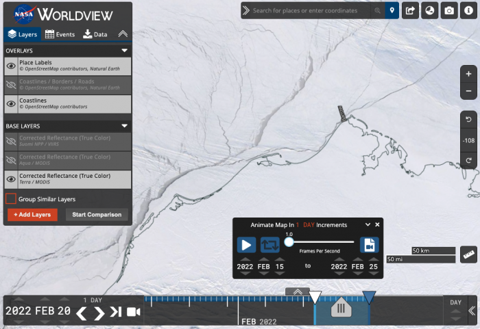
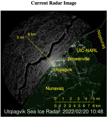
Planning where to go on the sea ice with the snowmobiles or where to land with helicopters involves a lot of satellite and radar technology. During the past few days some pretty big action has been happening on the ice. Watch these two animations (Worldview and radar links below) carefully for happened on February 20th...

Push play to see animation of NASA Worldview imagery. You'll notice in the Terra/MODIS satellite that the clouds sometimes get in the way of being able to see the sea ice.
Utqiaġvik (Barrow) Sea Ice RadarA method of estimating the distance or travel speed of an object by bouncing high frequency signals off the object and measuring the reflected signal.
So, to see the sea ice under the clouds in addition to the satellite imagery, we also rely on Utqiaġvik Sea Ice RadarA method of estimating the distance or travel speed of an object by bouncing high frequency signals off the object and measuring the reflected signal. from the University of Alaska Fairbanks.
Watch it all the way through to at least :27 on February 20th to see what happened.

Utqiaġvik (Barrow) Sea Ice Webcam
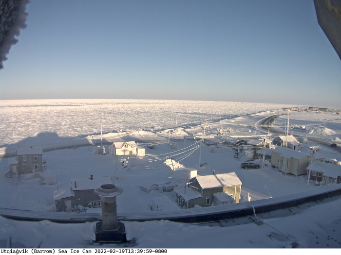
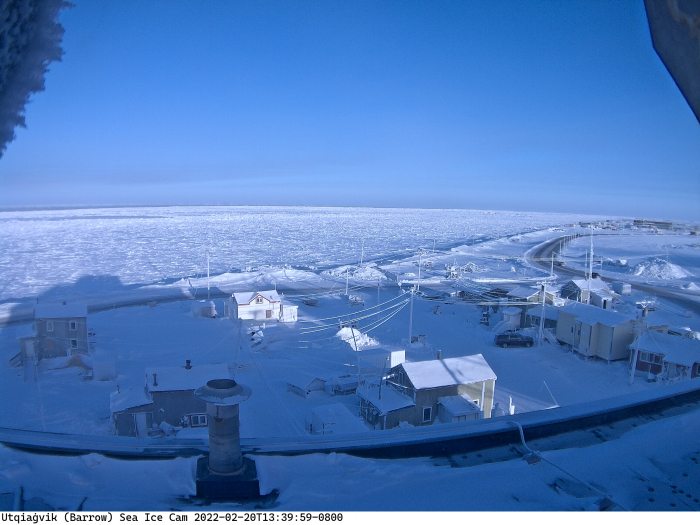
The University of Alaska Fairbanks also operates a webcam from Utqiaġvik. After looking at the satellite and radar it looks like the big crack was pretty close to land. So I have found webcam images from the same time of day on February 19 and 20 so see if it is possible to observe the crack (open water) from town. Check out these two photos and see if also can see what possibly could be open water in the far distance of the left hand side of the the second photo from February 20th.


What happens next?
Our team will be watching the sea ice behavior closely before we head out on snowmobiles and helicopters to ensure we are safe and able to get to the places we hope to deploy buoys. Also, the local native people are paying very close attention as now is the beginning of their preparations for whaling season where they completely depend on sea ice.
Your Turn - Your Observations and Curiosities
After looking at these observations, what types of questions do you have? What are you curious to know more about? Please share your thoughts in the comments below. Perhaps our team will be able to answer some of your questions from their expertise and experience.


Comments