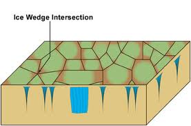
The answer to yesterday’s photo…
The “mud crack” look on the surface of the earth is a classic surface feature formed by permafrost. The lines are ice wedges that have formed from surface water seeping into the ground.
Today’s events
So it was a work day today – paperwork, that is. We worked on preparing documents so we can get out and gather Local and Traditional Knowledge (LTK) and use it the legal/ethical way. It turns out you can’t just ask people questions and use their information in a formal manner ☺ It has to be OKed with paperwork and release forms.
We made it to the Community Planning Division to speak with the GIS personnel. They have many maps that we will have access to, though we are trying to locate maps dating before the 1940’s – we are yet to find any maps that old. They don’t have any maps that old that have been sorted in their archives so we will search through a stack of their older maps that have not yet been sorted.
How our work is different
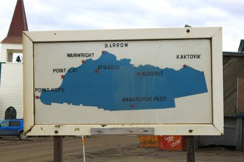
Many research projects, especially featured here on PolarTREC, are excellent projects that feature hands-on research and exploration with a very specific focus. Whether it’s the biology of a specific animal, or the structure of a specific formation, they tend to be very specific. This project will be taking many research projects that have already been done and have already produced results and combine them to understand the big picture of the ecology on the North Slope. How does every element of the environment combine to make the North Slope what it is and what potential risks can come from this? When I say the “North Slope” it refers to the northern-most region of Alaska, located north of the Brooks Range, shown below:
Once we sort through the history of the people, oceanography, atmosphere, erosion, geology, cryosphere, etc., etc., etc., then we can truly assess the environmental risks here in Barrow and understand the primary threats to the community. When we accomplish that (not an easy task) then we can create a model for risk management on the North Slope.
Polarisms
Because of the location and climate, all polar regions have unique polarisms, for lack of a better word.
For example, the photo below was taken tonight at 11:45pm. Notice any thing strange about the picture?
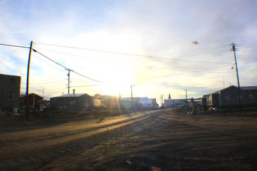
Barrow, Alaska, receives continuous daylight for 85 days in the Summer. Tonight, the sun will not be setting, nor will it tomorrow, or the next day, or the next. All polar regions experience continual daylight in the Summer – the areas of higher latitude just receive more hours of daylight. On the flip-side, the Winter days see continual darkness. Hence the movie, 30 days of night – if you’re into horror films, you’ve probably seen it already. If not, you ought to ☺
I mentioned this movie in a previous post – according to my internet research, the movie was actually filmed in New Zealand, though it’ Barrow in the storyline.
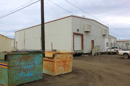
The community is actually built on top of permafrost. No big deal, right? Just frozen ground underneath the houses, buildings, and roads. This is actually a very big deal. All of these structures conduct heat into the ground, which thaws the permafrost, and makes the ground very unstable. This will collapse any structure. So, the roads are dirt, and the houses and building are built up off of the ground -- Basically hovering over the surface of the ground.
A view of the coast
Below is a short video I filmed and edited today. It’s the coastline of Barrow – the Arctic Ocean (locally the Chukchi Sea).
http://


Comments