Note: Much of today's journal information is referenced at the end. There are also several links to more information about Ny Alesund, Svalbard, and Arctic science throughout the journal. Feel free to wander off on any of this info and come back later. You might just become a "polar junkie" yourself.
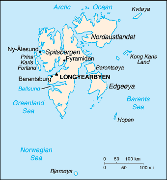
WHERE IS NY ÅLESUND? Ny Ålesund (New Ålesund) is a small settlement located halfway up the western coast of Spitzbergen, the largest island of the Svalbard archipelago*. Its geographic location is at latitude 78° 55' 48" North of the Equator and longitude 11° 56' 59" East of the Prime Meridian on a map of the world. (The North Pole is 90° north of the Equator.) Decimal coordinates: +78.9245, +11.9286

Have Google Earth? Just type in Ny Alesund, Svalbard. And go right there.
NY ÅLESUND HISTORY:
There is some fascinating history here. And it's all tied to "GeoscienceStudy of the Earth."!
Coal was discovered here as far back as the 1600's by whale hunters. It was coal that brought people here in the early 1900's. The Kings Bay Kull Company was established. In the late 1920's coal prices dropped and mining ceased until after World War II. In 1962, 21 people lost their lives in a mine explosion. All mining activity in Ny Ålesund stopped after this accident.
(Who remembers from Earth Science class . . . what does coal come from? What kind of climate does coal originate from? What kind of climate is at 79N now? Hmmmm. Any ideas on how coal got here?)
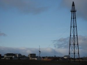
Polar exploration has roots in Ny Ålesund. In 1925, Roald Amundsen attempted to reach the North Pole by sea plane from here. He was unsuccessful. "In 1926 Amundsen came back to Ny Ålesund, accompanied by the American Lincoln Ellsworth and the Italian Umberto Nobile, to set out on a joint expedition with the airship "Norge". This expedition was a success. The airship flew over the North Pole as planned and landed in Teller, Alaska." The original launch tower is still here, on the east side of the village.

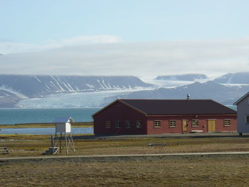
After mining stopped, Ny Ålesund evolved into a premier center for international arctic scientific research and environmental monitoring. The village is a mix of old and new. There are still old buildings from as far back as the mining era being used. (One of the labs we are working in is the "Vaskerilabben", or laundry lab. It was once used as a laundry, but is now a modern lab facility.)

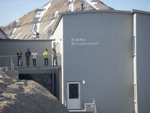
And there are high-tech modern facilities too. We are also working out of the brand new Marine Lab.

A great website about what's going on in Ny Ålesund today is done by the Dutch station here. www.arcticstation.nl Try the link called "Street View". It will walk you right through town. Way cool!
Another great link is one of the webcams. Check it out at:
http://sverdrup.npolar.no/ Look close. Maybe you'll see me waving at you.
National Geographic has done a great article on Svalbard http://ngm.nationalgeographic.com/2009/04/svalbard/barcott-text . If you go there, look at the Svalbard Map [http://ngm.nationalgeographic.com/2009/04/svalbard/svalbard-map. We are working at the base of the "small" glaciers on the east end of the fjord, "Kongsfjorden", that Ny Ålesund is located on.
Coming up . . . "GlacierA mass of ice that persists for many years and notably deforms and flows under the influence of gravity. Tramping" !
References & Citations for this journal from , Kings Bay AS www.arcticstation.nl, http://ngm.nationalgeographic.com/2009/04/svalbard/barcott-text
see *Project Vocabulary under Overview tab


Comments