News Update
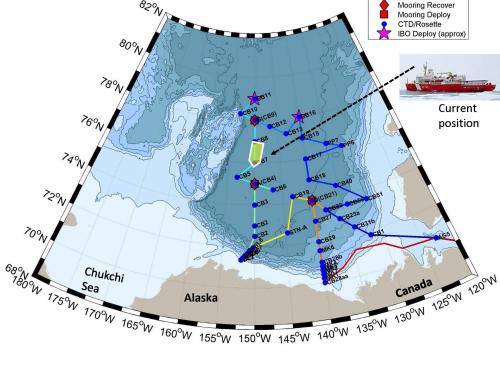
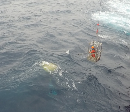
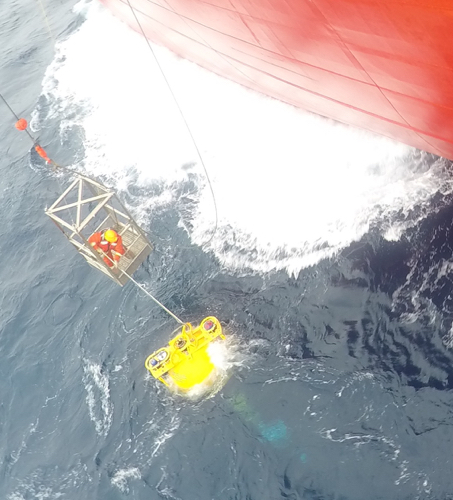
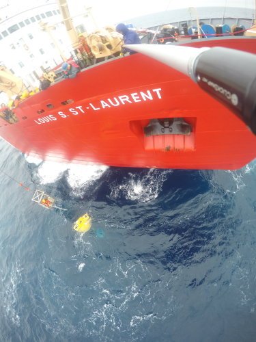
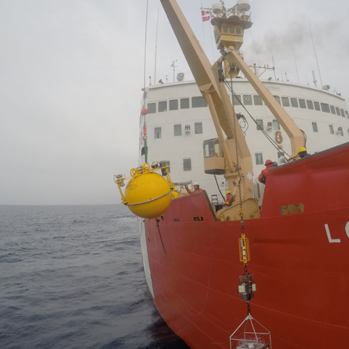
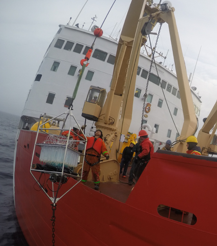
Yesterday after the successful deployment of MooringAn anchor or weight attached to the sea floor used to hold a scientific instrument in place. B, we started heading south on the 150˚ W line, stopping along the way at two CTDA research tool that is submerged in the water to measure conductivity (salinity), temperature, and depth. stations CB8 and CB7 and arriving at CB4 mid-morning. Station CB4 is also known as the BGOS-A station that is the second mooring station: MooringAn anchor or weight attached to the sea floor used to hold a scientific instrument in place. A. The mooring recovery work went fairly smoothly, although the rougher seas made things a little tricky. A twenty-five hundred pound mooring float hanging on the end of a cable from the arm of a crane has a mind of its own as the ship rocks and rolls in the swells. But when the dust settled all was where it was supposed to be and in one place. I took some GoPro shots from the end of an 18-foot pole that offered a little different perspective.
The man with the plan Chief Scientist Bill Williams announced a change in plans. Turns out there are some batteries missing for a piece of equipment required for MooringAn anchor or weight attached to the sea floor used to hold a scientific instrument in place. Station A. Rather than just scrapping the mooring redeployment, we are going to bomb down the 150˚ W line, hit some stations on the BL line, and then take a right turn and head for Barrow, Alaska for a battery pickup and maybe some groceries. Then we will make our way back to MooringAn anchor or weight attached to the sea floor used to hold a scientific instrument in place. Station A and redeploy a fully charged mooring.
Chemistry Timeout
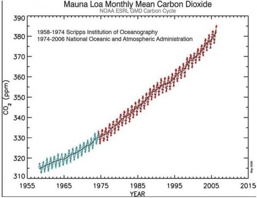
One of the driving forces behind all chemical systems is this idea of equilibrium or balance. Anytime there is a change in a chemical system, the system will shift to reestablish the equilibrium. The earth’s oceans and atmosphere can be thought of as a huge chemical system that is in equilibrium. It has been well established that the oceans pH has been locked in at 8.1 which remember is a H3O+ concentration of 10^-8.1 mol/L or.0000000079 mol/L. We also know that historically (think Pre-IndustrialBefore the industrial revolution when technological changes led to greater burning of fossil fuels. Age) the earth's atmosphere has had a CO2concentration hovering right around 280 parts per million (ppm). Beginning in the late 1950's consistent records of the concentration of CO2 have been kept and there has been a steady consistent increase (see the Mauna Loa Mean CO2 figure below). Today we are at 400 ppm. That increase in CO2 in the atmosphere has caused a shift in the equilibrium state and resulted in a change in the ocean's pH. That change ranges from .1 to .2 pH units all in the downward direction so that today most oceans pH range from 8.0 to 7.9. The explanation for this goes something like this: the increase in CO2 causes more CO2 to be dissolved in the oceans water which causes more carbonic acid to form which results in an increase in the amount of H3O+ which causes a change in pH in the downward direction. And the result: Ocean Acidification. So when you open a bottle of club soda what do you think happens to the pH as the club soda goes flat??
Crewmember Focus
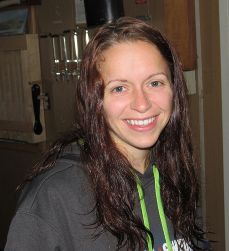
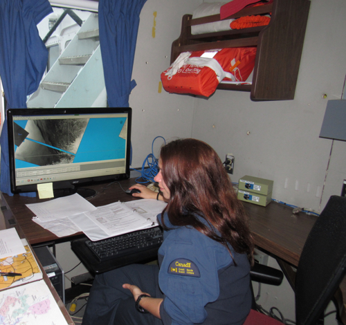
Jess Downey is the ships First Officer also know as the First Mate. She is third in the line of command and is one of two female bridge officers. Jess has been with the Coast Guard for 9 years including 4 years attending the Coast Guard College in Sydney, Nova Scotia. This 6 week trip is her first ice breaker experience and she is enjoying the challenges of learning the capabilities of the CCGS Louis S. St. Laurent. Jess is the oldest of six siblings and grew up in the small town of Codroy Valley, Newfoundland. Codroy Valley survives on farming, fishing, timber, a bit of fishing and lots of tourism in the summer months. Jess says she chose to go to the Coast Guard College because it offered her a free college education, something she needed growing up the oldest of six siblings. She says she has no regrets about making that choice and sees herself being in the Coast Guard for the long-term.
As the First Officer, Jess has quite a list of responsibilities. She is in charge of the fire fighting equipment, inspections and evacuation drills. When she is on watch she is literally driving the boat keeping the vessel within about a mile on either side of the plotted course. She says when it comes to ice "you go around the big stuff and through the small stuff" to keep from having costly breakdowns.
Beaufort GyreA spiral oceanic surface current driven by the wind. Observing System (BGOS): Ice-based Observatories
In our previous dispatches we have discussed mostly deployments of Ice-Tethered Profilers, Ice Mass BalanceThe difference between the mass gained by new ice growth and the amount lost by melting. buoys and moorings which collect data about the Beaufort GyreA spiral oceanic surface current driven by the wind. region year round. Other observations include measurements which we conduct once per year from the board of our icebreaker, Louis St. Laurent. These are observations of ocean physical parameters such as ocean water conductivity (“C” which allows us to calculate water salinity), ocean water temperature (“T”) and pressure/depth (“D”) to provide us with the level or depth of observations. To measure these parameters, we use the “CTDA research tool that is submerged in the water to measure conductivity (salinity), temperature, and depth.” instrument (or CTDA research tool that is submerged in the water to measure conductivity (salinity), temperature, and depth. rosette) mentioned earlier in many of our dispatches. The CTDA research tool that is submerged in the water to measure conductivity (salinity), temperature, and depth. rosette also collects water samples at different depths for geo-chemical analysis and we will discuss this later in more details.
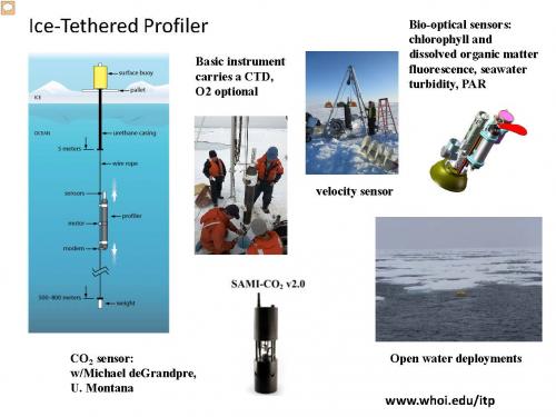
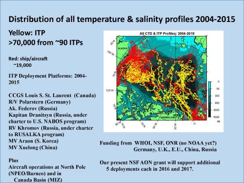
Today we introduce some details about Ice-Tethered Profilers (ITPs). This instrument (see images below) measures water temperature, salinity and depth from 7m to 760 meters. The instrument drifts with sea ice and is supported by surface buoy. While drifting horizontally with ice, the ITP moves in vertical direction along a cable from 7 meters to 760 meters and collects data every 25 cm. The data are transmitted to the surface buoy that sends the data via satellite to our laboratory in Woods Hole. Then all the data collected are made available to the public in real time (go to www.whoi.edu/itp for more details). The ITP data are assimilated into weather predicting models to make predictions more correct and reliable. Scientifically, the data are used to analyze changes of the Arctic Ocean in space and time and for better understanding of different ocean processes.


Comments