
Jack’s Weather Report:
Today is a beautiful day in Barrow. It is sunny with light to moderate winds.
Temperature: 49 °F
Winds: Out of the east 9 kts (10 mph)
There could be no better day than today to take a plane ride. We filed out of BASC at 9:00 a.m. and headed over to the airport, just a 5 minute drive. Nothing in Barrow is very far. We came to the charter building at the airport and immediately headed out to the plane. It was nice not to have to go through security. We boarded the plane and, without delay, we were in the air.
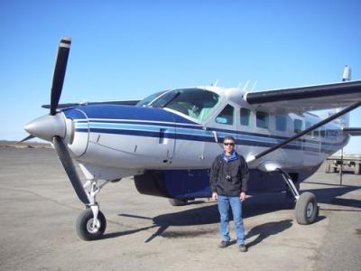
Here is our eight-seater plane for the short flight
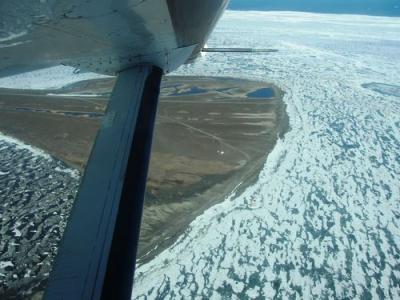
It was a very short flight over to the biocomplexity site. We circled the site taking pictures and trying to get a better feel for how the site looked in terms of water levels. The project is designed to move water from the central area to the northern end to create a: 1) drier than normal basin and 2) a wetter than normal basin. The southern end serves as the control and will maintain its normal water level.
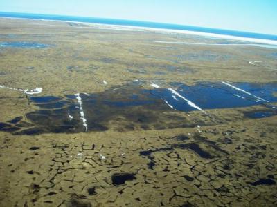
Biocomplexity Site
You are looking west and north is to your right.
There are two dikes separating the three manipulation areas. They are made of black plastic and are dug into the permafrost. See if you can find them.
The central basin's water will be pumped into the northern basin to make it wetter.
If this is all confusing, feel free to "Ask the team a question". The snow lines represent the boardwalks that allow us entrance to the middle of each manipulated area. The boradwalks have acted as snow fences and captured too much snow and this has been a problem getting started.
Here is a real snow fence viewed from the plane
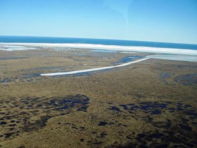
After numerous passes around the site, we headed out towards Point Barrow for a few minutes of site seeing. The road out to point barrow is very narrow as you can see by these photos.
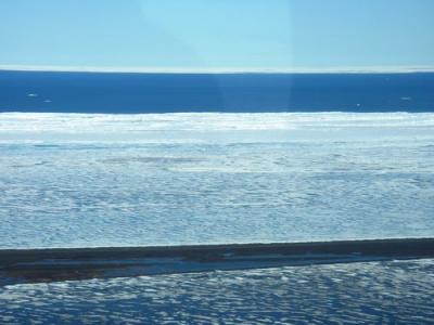
Top to Bottom: sky, floating sea ice, open ocean, shore ice, Point Barrow Rd., Elson Lagoon
Point Barrow itself is wider. This is where the archeological site is. You can barely see the two tents that serve as base camp. The point is eroding 30 to 40 feet per year, which is why the excavation of the burial ground is going on at a rapid pace.
Look closely....the white speck in the middle of the photo is the archaeology base camp.
Any polar bears down there?
We were only in the air for about 30 minutes and then it was back the BASC. We all took a bunch of pictures. With that comes picture management. You’ve heard this story before if you have read my other journals, which photos to keep, which to delete, which to edit, what to name them and which ones to put on my gallery. You can really work up an appetite doing all that. Okay, it’s time for lunch……salad, soft-shell taco, tamale, and rice. It was very tasty. Sorry….no lunch pictures today.
Oh No...the internet...just blew a gasket.
Comments