An aerial overview of Southwestern Alaska reveals a concentration of natural lakes. For these to exist there need to be depressions in the landscape below the water table that allow ground water to accumulate. These topographic lows were created by the scouring action of glaciers which also form moraines that dam the glacial valleys to trap water.The attraction of a lake is that it is in the bottom of a drainage basin so it receives water, sediments and organic matter carried by precipitation and melting glaciers. These reflect the environmental changes within the watershed.
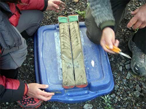
Scientists use lake sediments as a proxy* to help them understand the history of those watersheds. For example, the "proxies" mean patterns established by the way big rain events carry larger amounts of sediments into lakes. Because of this weather information is critical to understanding when these big events occurred so patterns can be accurately interpreted and dated. (For instance a proxy for precipitation would be the thickness and grain size patterns forming layers in cores of lake sediments.) Long cores from the bottoms of some lakes in Southwestern Alaska have been used to reconstruct climate change from as long as 10,000 years ago and more.
These lake sediment cores actually give scientists opportunities to use multiple proxies for each one: Heidi Roop is doing her research based upon grain size of sediment layers; Scott Anderson is looking at pollen grains that indicate shifts in vegetation communities in lake ecosystems in response to wet and dry cycles (i.e. different plants are dominant in arid versus moist conditions); Caleb Schiff is working with isotopes (another journal entry on this later); other scientists are engaged in research that use volcanic ash, species composition of midges (tiny insects); and the percentages of diatoms related to growing seasons. As you can see, lake sediments provide many opportunities for scientists to investigate climate history.

Now, back to "Why are we in Southwestern Alaska?" The Aleutian Low is a weather phenomenon, a huge low pressure system that creates certain winter weather conditions in the Gulf of Alaska. When the Aleutian Low is strong it creates warmer, wetter winter weather in Southwestern Alaska and the Pacific Northwest.
Through paleoclimatology scientists are trying to learn about past changes in climate and make it relevant to future climate change. In the future we want to understand how climate variability will translate to weather patterns on the local scale. In winter, in the Pacific Northwest, the most prominent feature is the Aleutian Low. By studying lake sediments to understand historic behavior of the Aleutian Low we can begin to project how this will behave as climate changes.
SHANNTAE asked: Are you going to be studying wildlife? We are not here as wildlife biologists, but you know me kids, I can't resist learning all I can about the wild plants and animals.


Comments