Tomorrow, if everything was going as it was only 3 weeks ago, I would be embarking on an adventure of a lifetime with a science expedition team to place real-time weather buoys on the sea ice of the Arctic Ocean. We would be making it possible for satellites to transmit observation data through the atmosphere at incredibly high speeds to then tell a master computer what the current conditions of the Arctic Ocean are every few minutes. These observations of the natural world, in such a far remote locations, are critical to crafting weather forecasts, informing marine ship captains, understanding climate change, and helping native people who live within the Arctic Circle with daily weather forecasts that ultimately influence their livelihoods of whaling and living on and from the sea.
Instead, I'm working to submit this week's natural world observation data here from my neighborhood through a citizen science observation program, NASA's Globe Observer app. Also, in light of the April expedition not happening, a couple weeks ago I took on the weekly maintenance and operation of the IMPROVE air quality monitoring station on top of Aspen Mountain in. IMPROVE stands for Interagency Monitoring of Protected Visual Environments. And with Colorado's Stay-at-Home public health order, I can still do all this important science. Science is essential! I'd like to tell you a bit about each of the projects.
Due to my wide reaching broadcast of announcements regarding my (then) upcoming Arctic expedition, the lead scientist for NASA's Globe Observer Land Cover project reached out to me a couple months ago. Dr. Peder Nelson had read my post on the Earth-To-Sky list-serve. He was very interested in my planned trip to Utqiaġvik, Alaska and asked if I would make numerous observations for GLOBE's Land Cover program. And as to be expected, we had a couple really great phone call conversations and quickly learned that we have many common interests and philosophies on teaching the process of science, teaching people 'how to see', and then how to do something useful with those observations. And as my expedition plan evolved, it became clear that I was invited to teach something during our planned outreach events in two rural Alaskan communities. After reading about culturally responsive teaching in rural Alaska (great resource from ARCUS) and learning more from my expedition team, I offered to teach the local communities to share their unique perspectives of the land cover they know best through the GLOBE Observer app as well as teach them how to access and use the data themselves. And as we all know this is not going to happen this week in Whittier at the Community School or in Utqiaġvik next week.
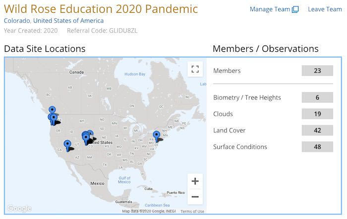
Instead, I decided to offer a virtual two-part science class from my home via google hangouts meet not only once, but twice during the past two weeks. I didn't want my preparations and enthusiasm to go to waste, so instead I shared it with 38 households from 10 different states (none from Alaska though). It as really meaningful to have Dr. Peder Nelson join us in both classes and interact with the families, teens, and older adults throughout the virtual class. And so far, our GLOBE team "Wild Rose Education 2020 Pandemic" has 23 members and over 130 observations!

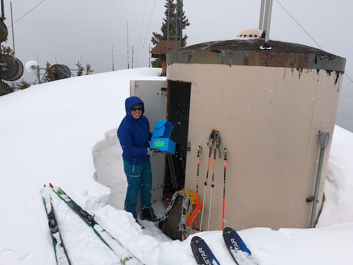
Weekly, on Tuesdays I'm charged with getting myself to the top of Aspen Mountain. (11,200ft) to the high tech air quality monitoring station. It is the only sampling station of its kind in this region of the country that was designed and installed by UC Davis Air Quality Research Center (AQRC) researchers and staff. The stations are programmed to automatically collect samples of haze-forming particles from the air on an ongoing basis. My job is to change the station’s particle-laden filter cassettes weekly and ship them back to AQRC, where most of the analyses to characterize the captured particles are performed. The IMPROVE project addresses visibility degradation issues at Class 1 areas throughout the United States: national parks, wilderness areas, wildlife refuges, and indigenous lands that have been designated by Congress as places to be afforded the highest level of air quality protection under the law. And the top of Aspen Mountain is not only a world class ski resort, but also sits high in the West Elk Mountains much of which is designated Wilderness.

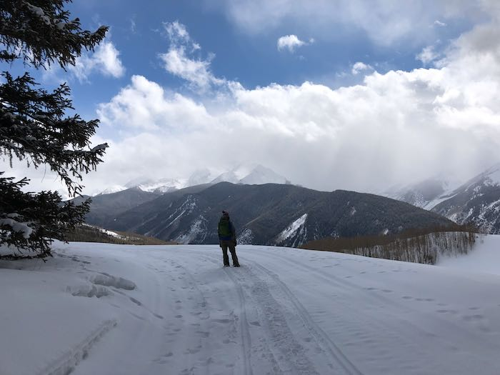
To get to the top of Aspen Mountain is typically very easy in late March, one simply rides the Silver Queen Gondola and enjoys the stunning 20 minute ride gaining ~3,000 feet to the top from the base in Aspen, Colorado. Yet, with our state on strict stay-at-home orders, our ski area operations are closed. So instead, one must drive up a county gravel road as far as the snow plow trucks plow and then begin the 3.4 mile journey gaining 1,492 feet to the top at 11,200 feet. Last week's trek on the snow mobile route was an icy sun-baked refrozen packed down slog up on backcountry cross country skis with climbing skins. Coming back down was so terrible, I took my skis off and just walked after falling three times on the hard ice. After learning from that experience, week I just wore my heavy hiking boots, yet there was new snow and skiing might just have worked well. Curious what next week will bring; keeps it an adventure for sure.

While on this 'essential' science mission out of the house and up Aspen Mountain during this time of Covid-19, I thought I would collect as much observation data as possible. So I found the details and downloaded the app for the Community Snow Observations project to submit snow depth data from microclimates that do not currently have any other snow or precipitation measuring stations. I also have been collecting GLOBE Observer Land Cover and Clouds data at the same sites I collect snow measurements. Multiple parameters at one location is much more useful data in the long term.
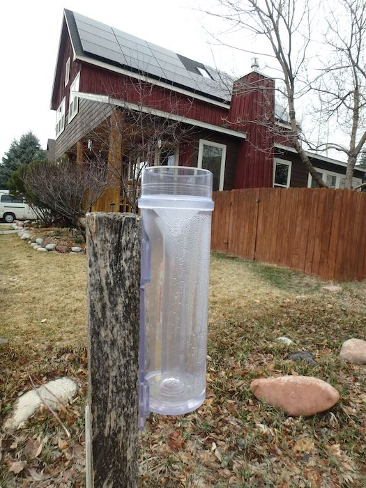
Finally, I've also renewed my momentum and participation with CoCoRHS (Community Collaborative, Rain, Hail & Snow Network) and registered my protocol savvy precipitation gauge in my front yard and am reporting water content each time we receive precipitation.

In a truly difficult time, when it seems tough to find outward purpose and ways to contribute from home, it feels really good to be able to contribute to nationally recognized science research and data collecting. And it give me an 'essential' reason to get out of the house.
Until next time, Sarah
PS - I also have been teaching myself to use iMovie. And of course I needed some footage to play with. So, it's not the Arctic, but thought you may enjoy it anyway.


Comments