Measurements in the Field
There is a lot of time between field tasks while the drone is flying, so everyone took advantage of this to trek through the forefield to take some measurements. Not only is the data collected by the drone tied in with measured GPSA Global Positioning System (GPS) is a satellite-based navigation system used to track the location or position of objects on the Earth’s surface. points, but it is also “grounded” with field measurements. In this case the field measurements in question are striation directions.
Striations are a series of ridges, furrows or linear marks that are made when a glacier advances and scratches the underlying bedrock when it pushes and/or drags rocks and debris in front or underneath the ice. Glaciers act as huge bulldozers pushing everything it meets along the way in the direction the ice is flowing.
When I teach about striations in my courses, I tell my students to imagine a scenario when you were little and you accidentally dropped something behind a big heavy piece of furniture and you decided to get it yourself. You drag said heavy piece of furniture some distance to retrieve your lost item. In come your parents and they freak out because their nice hardwood floor, etc. is now sporting some not so nice gouges on it. And those floor gouges would be made in the direction you dragged the furniture. Well in nature glaciers are the heavy furniture, and the bedrock is the wood floor.
Don’t ask my parents about the time I did this with the refrigerator. I’m not sure they are over it.
So striations are super important to glacial geologists because they not only tell you that ice once covered the area, but they can also be used to reconstruct the direction of glacial flow.

Anna Thompson, a graduate student at Iowa State University, is working on one aspect to try to reconstruct the speed of flow in ancient glaciers. While in the forefields of Tsanflueron, I helped her take some field measurements that she will use to understand how ice flows over steps, or steep walled drops in the bedrock.
Finding the perfect steps to measure was not easy because nature rarely cooperates with our ideal parameters. We wandered around looking for steps that were perpendicular (or near to) the direction of flow. To determine this we would need to examine the direction of the striations and determine if they were meeting the edge of the step at a near 90-degree angle.
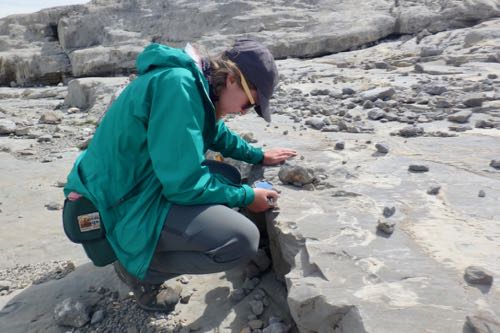
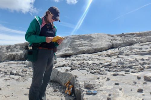
When ice flows over a step it will be separated from the rock for a short distance before it flows down back to the bedrock. Anna was trying to get measurements from a range of different step sizes to see how the gap between the ice and the rock reflects the speed of the ice.
So how on Earth can she determine how far the front edge of the glacier was “airborne” before it touched back down? There are many indicators of this preserved in the rocks. First of all, where the ice is not in contact with the bedrock, there will not be any striations present. Secondly, Anna can tell where the ice came in contact with the bedrock again through the presence of striations and through the presence of a calcite precipitate on the rocks.
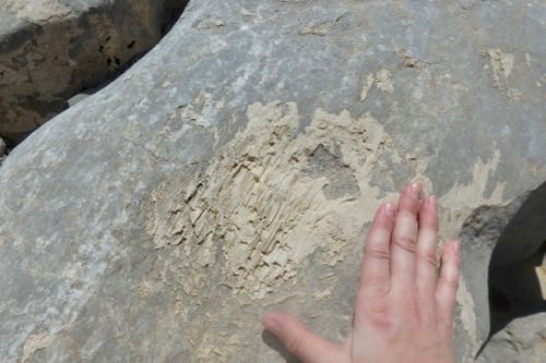
There is always some amount of water flowing underneath the glacier, and when a glacier forms above a limestone base, this water will dissolve some of the minerals in the rocks and deposit them through precipitation elsewhere. This is the same exact process that forms sinkholes and karst topography (i.e. caves) in limestone around the world. This calcite mineral was present all over the glacial forefield and we were able to measure the distance from the edge of the step to the start of the striations and calcite to determine the where the ice came back in contact with the bedrock.
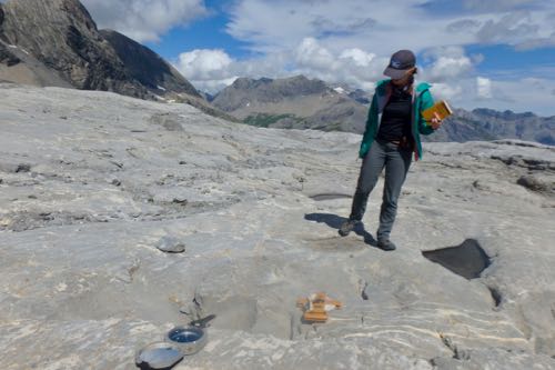
Anna and Dr. Neal Iverson will then use these measurements back in the laboratory to help them with their work determining the flow speed of glaciers in the past.
Field Location
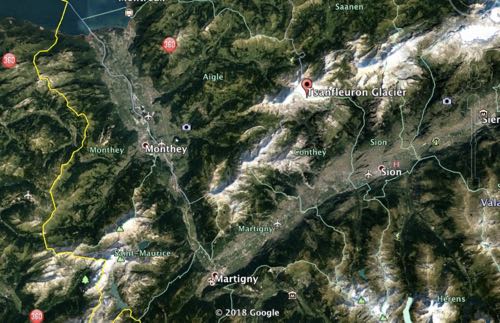
I have gotten some questions about where in Switzerland we are working. Here are two maps that show you the town we are staying in and the site of the Tsanflueron GlacierA mass of ice that persists for many years and notably deforms and flows under the influence of gravity..

PolarTREC Poppy
Sometimes it is nice to just sit back with a nice cup of tea and enjoy the view.

Daily Haiku
Tiny scratches tell
stories of past glacier flow
Powerful old ice


Comments