Kanger First Full Day

    So far things are going well. The morning got off to a slow start. Getting your footing at a new airport takes some time. There are many procedures that need to be followed and it takes awhile for people to get accustomed to the new schedule. The official time in Kangerlussuaq is an hour later than it was in Thule. Also, we start our missions a half hour later here in Kanger. Even though I didn't actually sleep in. One would think this would make everyone move faster, getting some extra time in the morning but it was the opposite. I was feeling a little lazy this morning, but I did not let that get in my way too much.

    Before even reaching the plane this morning I went to the weather office. There I met Anna who is a weather genius. To predict weather one not only needs to know the maps and readouts but they need to know the features of an area. As we all know weather is hard to predict and varies throughout the day. Missions are decided by the weather and how much clear data the instruments will receive. The weather in Kanger is much touchier than in Thule. The night before a mission, several flight plans are discussed. Once at the wether station, John Sontagg (Nasa Engineer and Scientist) and Scott Farley (pilot) decide the mission for the day based on optimizing time spent on mission and how much clear usable data can be collected. Today we are flying the Southeast Coastal Mission because the weather for that area was clear and data collection would be high. Weather permitting, the team will fly all of the required flights out of Kanger. There is no set schedule, just set missions. The missions can be shuffled like a deck of cards, stacking the deck with the mission that has the best results going to the top of the deck. Weather is the temporary atmospheric conditions of an area in a specific place and time. It is always changing and only somewhat predictable. There are many factors that go into weather prediction and getting the entire picture takes an expert. Weather is all about forming a hypothesis of what you think may occur and then waiting to see if your hypothesis is accepted or rejected.

    Today's flight was extremely bumpy. I was not a happy camper at first. But I didn't get sick! That is the first thing most people think as soon as they hear the words bumpy flight! No, I'm upset because like in all planes, the passengers safety comes first so when it's bumpy we are not allowed to stand up. During the first half of the day, we were flying over canyons and looking at terrain both inside and at the top of the canyon, and I missed it! I had to sit in my seat. I could watch it from my computer because the plane's camera was taking photographs but I couldn't see with my own eyes or take my own pictures. Now it is much calmer but we are flying over flat white ice. There are snow covered mountains off in the distance and it's pretty but it is not as exciting as this morning's terrain. On the bright side I did get to experience something new. I wore my crew headset the entire time and listened as the crew talked about all of the readings they were taking and the glitches that occur mid-flight. One of the radar systems was not working correctly during the flight so the crew had to wait until it was safe. Then they opened up a board in the floor of the plane to see if they could fix the problem. I am always shocked how quickly the scientists and engineers handle problems aboard the plane. They all work as a team. Even if the problem is with another person's system, the team pulls together to help out.

    Today's Science Lesson

    Looking at the weather is essential to a successful IceBridge Mission. As I mentioned before, every night there is a meeting to discuss the next day's mission. Several plans are considered. One mission is decided upon as the main goal for the day but backups are always needed. The next morning the weather is checked. The amount of clouds and where they appear in the sky is taken into account. Today there were cirrus clouds in the area we were surveying. Cirrus Clouds are high altitude clouds made of ice crystals. The plane flies low and slow so it was no problem to fly under the clouds. Wind speed and direction are also taken into account along with the pressure systems. Winds always travel from high to low areas of pressure. High pressure is usually associated with good weather, while low pressure system is usually associated with bad weather.

    Air cools as it rises, which can cause water vapor in the air to condense into liquid water droplets, sometimes forming clouds and precipitation. Rising air is moist air and descending air is dry air. Low pressure air is forced up while high pressure air is forced down. This air movement allows scientists to look at the different pressure systems and predict whether it will be a clear day or a day with precipitation.

    Leaving Thule Video and Our New Lodgings

    I didn't get great pictures on the plane today it was very bumpy but here is a video about us leaving for Kanger and some pictures of our new lodgings. Tomorrow I will post some awesome ice pictures.
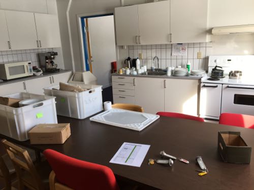
    Kitchen 664 Building Danger Greenland
    This is the kitchen in Kanger Greenland where the OIB team eats. Most nights the team have a family dinner. Everyone contributes. It is nice to have a kitchen and people who can cook.
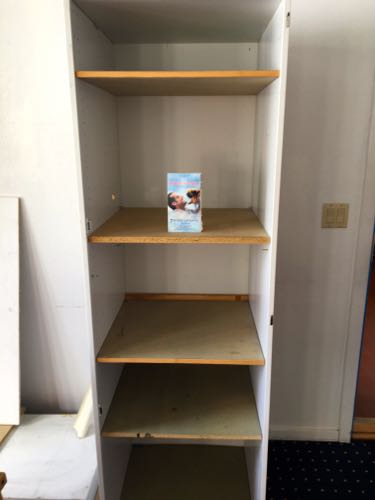
    The TV Building 664 Kanger Greenland
    This is where the TV should go, but instead the team is going to set up a monitor for our briefings. The movie box (VHS) is empty.
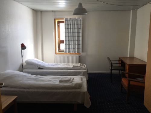
    Bedroom Danger Greenland
    This is Adeena Teres' bedroom for two weeks in building 664 Kanger Greenland. It is comfortable and the heater works well.

    Author
    Date
    Location
    Southeast coast
    Weather Summary
    Slightly cloudy
    Temperature
    20F

    Comments

    Adeena Teres

    The research that Operation IceBridge does is all from airplanes but there are other surveys that take place on boats or on land. The data that we are collecting has not been analyzed yet. The program studies climate change, global warning is not the correct term. This is because some areas will get colder while others will get warmer. Climate change is a natural occurrence but scientists are trying to figure out if humans are speeding up the process. Scientists have to look at the data over a period of years to see if there is a trend indicating if the climate change is natural or if it is being affected by humans. I do not take ice samples, for operation IceBridge all of the data we collect is taken by the instruments on the plane.

    Adeena Teres

    The plane has been bumpy several times. The plane flies at different altitudes depending on the mission for the day. The radar wasn't working because the flight was so bumpy. Once it calmed down the radars were restarted and were functioning properly again. After the flight, I was told that this has happened before. It doesn't happen every time the flight is bumpy, it just depends on how much turbulence there is and how long it lasts for. The data for this year still has to be analyzed. Operation looks at climate change, global warming is a misnomer. Some areas of the world will get warmer while some will get colder. The scientists have to look at the change over many years to see if there is any trend in the data. They are looking to see if it is a natural change or if humans are influencing the change in climate. I like both Thule and Kanger. Thule had more creature comforts, like great desserts and movies, but Kanger has great places to hike and more to do outside. The weather in Kanger is also nicer. I don't know which one is my favorite yet. Right now they are a close tie with Kanger being slightly more fun because of the hiking and the weather.

    Adeena Teres

    The Kanger meetings take longer because when we were at Thule the weather was much better and it was easy to analyze all the factors and to make decisions. In Kanger the weather is trickier. It seems like many of the areas that Operation IceBridge wants to fly has clouds or high winds. Trying to find areas that are clear and that will allow the maximum amount of data to be collected is hard.

    Adeena Teres

    There is not hanger in Kanger. The procedures for both airports are the same, the difference is the time. The missions will dictate how long the crew stays at a certain area. The reason for IceBride is to bridge the gap between the two satellites. I do not know what will happen with Operation IceBridge after the satellite goes into space. There will probably be some kind of arial survey but it might not be called IceBridge and it may be different from the current operation.

    emerson elsemiller

    Is all the research that you will be doing all from a plane? or do you also use ships and boats to colect data? In the data you have collected, is everything in the news about global warming supported in your research findings so far? Or do you think this is a natural progression over the years that the earths temperatures and climates change naturally? Do you take ice samples and work hands on with the ice or let the instruments collect all the data for you? glad to hear youre having fun on your trip. stay warm!

    Josh Rosenthal

    Is this the first time that your plane ride has been bumpy? How did they fix the plane so that the radar started to work again? Did you have to land so that they could fix the plane or did they do it while up in the air? Does that data that you have collected support the theory of global warming? How high up do you go once you are in the plane for the day? Which place do you like better Kanger or Thule? Glad that you are having a blast on your trip!

    Mariana

    It's great that you are getting to experience bith places. At the beggining of your post you mentioned that there are more procedures to follow than Thule. Are these procedures related to planning the flight missions? Is there a hanger like in Thule to guard the plane or does it stay out in the cold? Is weather one of the main reasons why you stay longer in Kanger than in Thule..just in case you can't fly everyday? Or is it more in terms of the number of missions to cover?I read on OIB web page that a new satellite will be launched to gather data over the two poles. Once this satellite is in place will that help get more accurate information? Will they still do flight missions or just monitor it thru the satellite?

    Keep having an amazing time

    Kelly McCarthy

    Love the video and explanation of the C-130 and Adeena, your video of the coastal trip to Kanger at the end of your video is AMAZING!! Sorry to hear about the bumpy road seat restrictions but we're looking forward to seeing the incredible views yet to come from your Kanger missions (this is only day 1)! Are there any differences you noticed between the weather meetings in Thule and those in Kanger?