Today I woke up to clear sunny skies, the sound of melting ice and snow from our rooftop, and a good feeling about today's flight. After a quick breakfast and a muddy, icy walk to the hangar, I was reassured that the weather was in our favor today. Most of the science team was already plane-side by 7 and we were officially on for the North Pole Transect! This is a high priority sea ice mission that takes us up the northern coast of Greenland, past the Canadian Station Alert (the northernmost settlement above Nord), and over the Arctic Ocean to the North Pole and back. My first science flight would be over the pole!! We would start our transit at about 12,000 feet in altitude and once we reached the sea ice we dropped to our 1500 feet line.
While we waited for a pre-flight briefing and eventually take-off I was a combination of excitement and nerves. I have listened to others' OIB flight experiences, watched their videos and read their stories, but I couldn't shake the nerves until I really experienced it for myself. I learned quickly that there was nothing to worry about – we are in the best of hands with both the NOAA crew and NASA team and I am grateful that I had the chance to experience this flight with them.
I spent take-off near a window seat, getting tips from the ATM team's Craig Swenson. We donned headphones that allowed us to hear information being passed along by the pilots and it was exciting to hear the lead-up to take-off and the point when we were in flight. The view during this flight was like none I'd ever seen and I'll warn you that while the photos below are beautiful, they are nothing compared to actually being there.
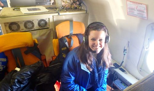
I spent most of the flight rotating through different science team members, asking questions, observing their work, or finding window spaces in both the cabin and the cockpit to document the beauty of the landscape we were covering. We also had a chance to talk with a classroom using Mission Tools Suite for Education, so a huge thank you goes out to Mrs. Bloom's 2nd Grade Class from Southern Columbia School District in Catawissa, PA. While we were flying near the northern coast of Greenland at 12,000 feet we were hit with majestic views of mountains and glacial valleys and one of the largest glaciers in the north, Peterman GlacierA mass of ice that persists for many years and notably deforms and flows under the influence of gravity..
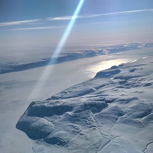
Then we dropped down to 1500 feet at the edge of the ice sheet to begin collecting data over sea ice. The radar had been collecting measurements since take-off and the ATM had been collecting data since we reached 12,000 feet so I think it will be interesting to look at the data from the point at which we changed from land to sea ice.
In the first few hundred miles of our trip, we traveled over thick, old sea ice covered in snow and filled with pressure ridges. Pressure ridges are peaks which are formed as a result of stress from moving ice masses over the Arctic ocean. The concept is similar to plate tectonics mountain building or volcano formation. Rarely in this early part of the flight did we see that glassy newer ice, or any open water leads or pools.
Eventually we moved into a completely different type of sea ice. the ice was not old and layered, but thin, dark, glassy, and broken. This is likely single, rather than multi-layer ice, which is an indicator that the type of ice near the pole has been changing.
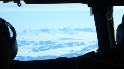
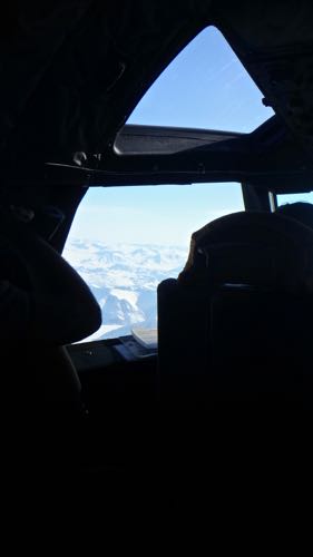
I have been focusing on the breathtaking beauty of the view outside our plane, but the pace of life inside the plane was something else. John Sonntag and Craig Swenson were monitoring navigation systems, communicating with the flight crew, and chatting with students during the entire flight. Aaron Wells was processing rada data from the time the plane began running until well after the flight was over.
Eric Fraim was running the DMS camera which is exciting to watch in real time, checking for leads in the sea ice and monitoring the instrument as it snapped 11 images per second. Each image the DMS camera takes has 70% overlap with the image before it in order to piece together an accurate mosaic of frames for the big picture. The swath of the DMS is comparable to that of the ATM. When you place them side-by-side you can compare the topography measured by the ATM with the human eye perception of a region.
Matt Linkswiler and Alexey Chibisov monitored the ATM and the FLIR Infrared camera. The FLIR camera snaps 15 images per second (storing just one for further use), but it is interesting to watch this instrument scan surface temperature in real time as you are passing over pressure ridges, leads, and other features of the sea ice visible outside the window.
[Stay tuned for FLIR video clip]
Our Kansas state team has also been working on the snow radar and MCoRDS from CReSIS which are amazing tools, one of which helped map a hidden canyon beneath the Greenland Ice Sheet a few years ago. We'll hear more about them soon!
After visiting the instrument teams to gain some perspective on each component of the IceBridge mission, taking many photos from the cockpit window, and chatting with students, the excitement started to build as we neared the North Pole. It happened in a blink of an eye but soon we had crossed it, clear as day beneath us, full of magic as one would expect.
[image]
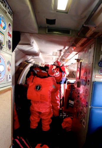
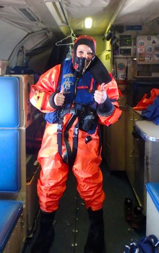
The views on the return transit were just as spectacular as the way out and I have more video and photos than I'm sure I know what to do with. Moving back toward Thule, we were prepared for a 'ditching' drill. This is a cold water survival drill initiated by our NOAA crew to ensure we know the procedures in place if we would need to land in the water and abandon our aircraft. The rules of the ditch drill are as follows:
- Find ditching station (assigned seat)
- Remove shoes
- Unroll Exposure ("Gumby") Suit
- Put on Gumby Suit, sealing gloves and cap
- Place Switlik Life Vest on top of Gumby Suit
- Buckle into ditching station, seatbelt tight
- Pilot simulates 'impact with water'
- Passengers head toward nearest exit (at which we would slide off into a life raft if this was a real event).
The drill was difficult for many of us who had never tried on a suit like this before. I am thankful that we worked through the drill on our first flight out because there are so many pieces to complete in a short amount of time.
We ended the work day with a science meeting and a potential plan for tomorrow's sea ice flight. As always our plans are subject to Arctic Weather dynamics, so the final call will happen at 6:30 a.m. tomorrow!


Comments