The tagging has begun!
What an exciting time this is - we have tagged our first seal!
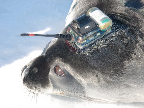
But before I tell you about the process, let's talk tags. We will be putting three different tags on the seals - an ID tag (if the seal doesn't already have one), a VHF tag and a satellite tag. Let me introduce you to them:
ID tags
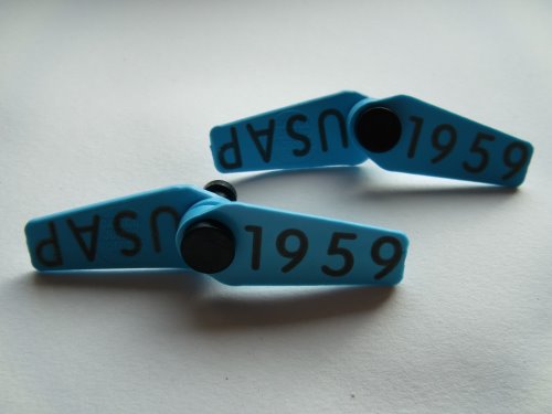
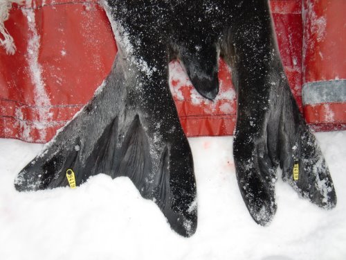
The ID (identification) tags are used to identify the seal. They are generally yellow, blue or red in color. There are 4 pieces (2 pair) to each tag set - all with the same numbering system. For example, the tags in this picture all have the number 1959 on one side and USAP(abbreviation) United States Antarctic Program (United States Antarctic Program) on the other. One pair gets clipped onto each hind flipper. Most of the seals we've seen already have flipper tags, but we'll bring some just in case.
VHF tag
VHF (Very High Frequency) tags are glued on the backs of the seals and are used to find the seals when the team returns next Oct./Nov to retrieve the larger satellite tags. How will they do it?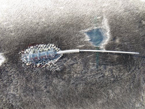
SatelliteAn object placed in orbit around the earth to collect or transmit information. Tags
SatelliteAn object placed in orbit around the earth to collect or transmit information. tags will be glued to the heads of the Weddell seals and will stay on throughout the Antarctic winter. The team is interested in learning more about Weddell seals by studying how they dive and forage for food during the winter. So in a very real sense these seals will become the 'scientists' by helping to collect a variety of scientific information. Among the equipment on this tag will be a CTDA research tool that is submerged in the water to measure conductivity (salinity), temperature, and depth.. This will measure ocean water characteristics such as salinity, temperature and depth.
- The 'C' in CTDA research tool that is submerged in the water to measure conductivity (salinity), temperature, and depth. stands for Conductivity which measures the salinity (how salty) of the ocean water.
- The 'T' in CTDA research tool that is submerged in the water to measure conductivity (salinity), temperature, and depth. stands for Temperaturewhich measures the temperature of the water.
- The 'D' in CTDA research tool that is submerged in the water to measure conductivity (salinity), temperature, and depth. stands for Depth which measures how deep the seal dives.
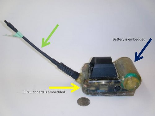
Let's take a closer look at the parts of the satellite tag:
Battery - - indicated by the blue arrow - simply provides power
Circuit board - indicated by the yellow arrow - is powered by the battery and tells the sensors what and when to sense. It also codes the information in a way that it can be easily received by the satellite network.
The battery and circuit board are encased in a strong, waterproof epoxy.
- Antenna - indicated by the green arrow - transmits the collected data via satellite. The satellite tags transmit data only when the seals are above water - so while the seals are under water data is being collected. Not all scientists retrieve the tags - meaning some scientists collect only the data that is transmitted via satellite. However, for the past two years our team has returned to Antarctica during the October/November field season to collect and analyze the satellite tags. And after analyzing the data from these tags, they found the amount of data collected increases 4 times - a very encouraging finding.
Let's get a little closer to the tag...
Now, you are able to see the many sensors on the tag:
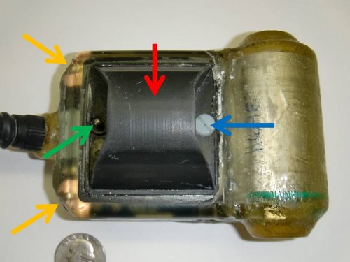
- Temperature sensor - indicated by the green arrow - simply measures the temperature of the water.
- Conductivity sensor - indicated by the red arrow - measures the salinity (how much salt) is in the water. As water flows through the small opening, the sensor measures the salinity of the water by using the measurements of both the temperature and conductivity.
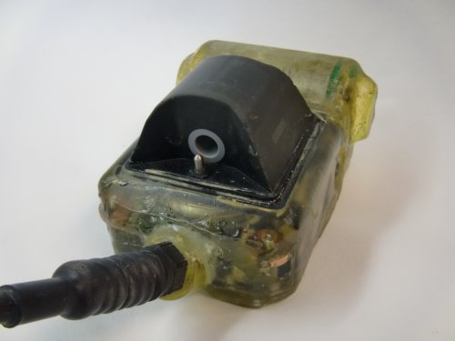
- Pressure sensor - indicated by the blue arrow. If you look closely, you can see a small hole in the plastic screw. This hole measures the water's pressure. Pressure and depth are directly related and are measured in decibars - which are equal to meters of depth. So if a seal dives 200 meters below the surface, the pressure is about 200 decibars
- Salt water switch - indicated by the orange arrows - tell the tag when to collect or send data. When the circuit is closed (the tag is under water) the tag's focus is on collecting data. But when the circuit is open (the tag is above water) the focus is on sending/transmitting data.
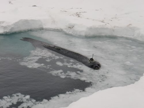
The seal made it to the water. Can you see both the VHF and Satellite tags?


Comments