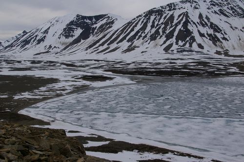
The process of science can be used to figure out the mechanisms behind a phenomenon, event, or observation, or it can be used to determine if a new tool can be used for analysis of an event or phenomenon. One of the Svalbard REU students from UNIS, Leo Sold from Germany, has chosen to test the adaptability of an image analysis tool to the study of glacial ablation. Leo was intrigued by the plume cam photos and used his Photoshop skills to analyze the amount of snow in an image. No one has done this before with the plume cam photos and therefore Al and Mike were excited at the prospects of Leo's ideas.Every couple of days during our field season Leo visited a snow patch that existed in the plume cam photos, and during this time, the plume cam was still taking pictures of the snow patch. He took measurements on the dimensions, snow depth, and water equivalence of the snow. These measurements are considered the "ground truth" measurements for his analysis. The next step will be to compare these measurements with the images acquired from the plume cam in order to "train" the image analysis program to recognize what is considered snow and what is not.

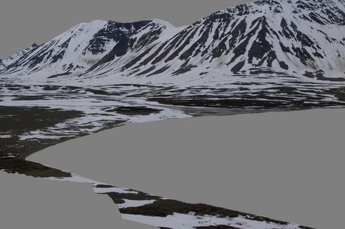
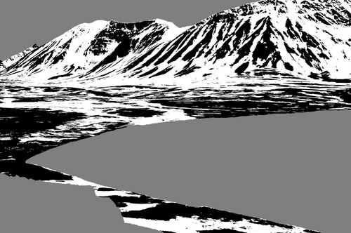
Instead of using Photoshop for his analysis, Leo decided to use a freeware program called "Image J" (http://rsbweb.nih.gov/ij/) which can be applied to numerous studies besides his work. The first step in the analysis of the plume cam photos is to remove all the portions of the image that will not be analyzed, and in this case it was the sky, Lake Linne, and foreground. The next step is to count the number of back versus white pixels in what was converted to a black and white image. Fortunately the software will do this for Leo! These final values are then used to assess snow cover in the Linne Valley. Leo will use these values from the images taken during our field season to compare changes in snow cover over time as related to the weather conditions.


The latest from Kapp Linne is that Jesse and Al had a successful day yesterday coring a number of ice core moraines around the Linne Valley. They plan on returning to Longyearbyen later today.
Challenge of the day: Image J is user friendly and has many applications. If you visit the Earth Exploration Toolbook (http://serc.carleton.edu/eet/index.html) you will find numerous applications of the software for the Earth Sciences as well as tutorials for using the software in the chapters of the toolbook. Try it out on some of your images!


Comments