....not quite a catcher's mitt, but you'll get what I mean!There are a number of instruments placed around the Linne Valley continuously gathering data. For instance, the cameras placed above Lake Linne and closer to the Linne GlacierA mass of ice that persists for many years and notably deforms and flows under the influence of gravity. take 2 pictures per day throughout the year, the data loggers in the stream and in the various weather stations gather data multiple times per hour, and sediment traps in the lake gather falling sediments non-stop until they are removed from the lake approximately one year later. Here's a little more about the sediment traps.
The sediment traps appear simplistic, although to someone studying the sedimentation of the lake floor, they are quite ingenious. They are comprised of a funnel attached to a clear tube that collects the sediments that fall into the lake. On top of the funnel a piece of plastic grating is attached to prevent the turbulence of the flowing water from stirring up the sediments that have been caught in the funnel. The funnel/tube system is attached to a mooring (heavy boulder, roping, and buoy) that allows the sediment trap to remain in position for the duration of the study period. Also attached to the mooring near the sediment trap is a data logger used to collect temperature data, and water flow data. The moorings have anywhere from two to four sediments traps attached in order to trap sediments throughout the entire water column.
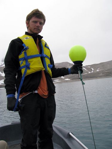
The next step is to place the moorings in the lake. The PI's have been collecting sediment data at Lake Linne for the past five years and Lake Kongress the past two years, and so it is very important that the moorings are placed in the same locations from year to year. If they are placed in random locations without any documentation as to where they are, then they are extremely difficult to find the following year, and the data cannot be compared to data from previous years. Look at the topographic map of the Linne Valley and Lake Linne in the Photo Gallery to see if you can come up with places to place the sediment traps. Think about where the sediments would be coming from, and why a scientist may be interested in studying them. The sediments flow into the lake from the glacier meltwater streams, and the scientists would be interested in how they flow in the lake within the water column and where they flow in the lake. What this all means is that the moorings and sediment traps are placed all around the south end of the lake and one is placed towards the north.
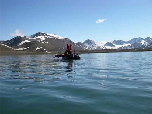
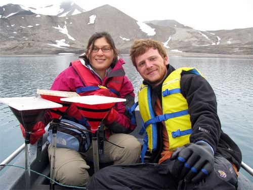
Today we pulled out 3 of the moorings leaving us with one or two more to go. Even though we had GPSA Global Positioning System (GPS) is a satellite-based navigation system used to track the location or position of objects on the Earth’s surface. waypoints (exact positions) and a fish finder, it was still quite a challenge to find the moorings. The moorings are set about approximately 1 to 2 meters below the surface so the movement of the ice does not move the mooring, and over the year sediment covers the bright green buoy. Once a buoy was located we wrapped a chain around the buoy, and used this to haul the mooring and sediment traps onboard. Keep in mind that this is an Arctic lake and is very cold and even colder when the wind blows giving the scientists challenges in their chosen methods. Bates College student Megan Arnold is using the sediments from all these moorings in her study that compares the yearly changes in sedimentation of Lake Linne, and so she has been storing, sketching, and preparing to take these cores home. Smith College student Maya Wei-Haas is studying the geochemistry of the sediments of Lake Kongress and will be using the sediments from there. Before this field season ends, the moorings will be redeployed with fresh instrumentation ready to collect data for the next REU student who comes to Lake Linne. If we have any preliminary results they will be reported in a later journal entry.
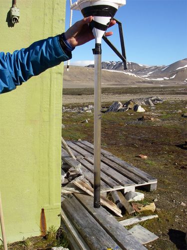
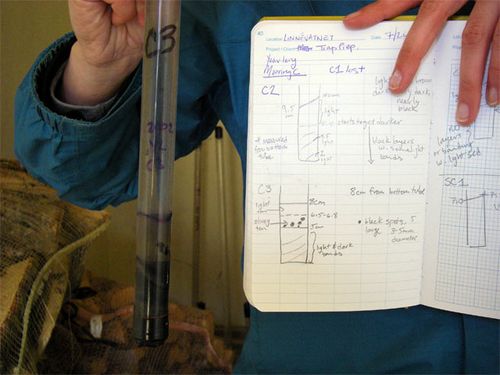
Challenge question of the day: There are usually layers of sediments in the tubes of the sediment traps. What would cause differences in the sediments during the course of a year?


Comments